Trail Walking Marchastel - Aubrac 13 :Rieutort - Prinsuéjols - Photo

Aubrac 13 :Rieutort - Prinsuéjols

 SERUS
SERUS

User

© OpenStreetMap contributors
Length
Length
7 km
Max alt
Max alt
1257 m
Uphill gradient
Uphill gradient
177 m
Km-Effort
Km-Effort  
9.3 km
Min alt
Min alt
1180 m
Downhill gradient
Downhill gradient
162 m
Boucle
Boucle
No
Creation date :
2019-05-19 20:38:26.108
Updated on :
2019-05-19 23:27:44.572

(0 Reviews)

Walking
Walking
1h59
Difficulty : Medium

Scan this QR Code to open this trail in the SityTrail application

FREE GPS app for hiking

Logo SityTrail SityTrail

IGN / Geographical institutes

Download SityTrail from the App Store Download SityTrail from Google Play

Logo SityTrail SityTrail World

The world is yours!

Download SityTrail from the App Store Download SityTrail from Google Play Download SityTrail on Huawei AppGallery

About

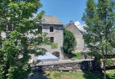
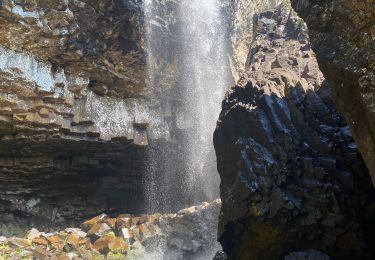
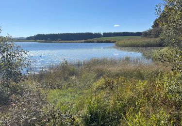
Trail Walking of 7 km to be discovered at Occitania, Lozère, Marchastel. This trail is proposed by SERUS.

Description

Rieutort d'Aubrac-Finyèrols-Ferme des Gentianes-Le Py-Prinsuéjols


Elevation profile

Positioning

Country:
France
Region :
Occitania
Department/Province :
Lozère
Municipality :
Marchastel
Location:
Unknown
Start:(UTM)
508349 ; 4946372 (31T) N.

Trails nearby

Trail Walking Prinsuéjols-Malbouzon - Prinsuejouls GR 65 - Photo
Walking
GUIDE
antignacs

Walking

Very easy
(1)
Prinsuéjols-Malbouzon, Occitania, Lozère, France
15.3 km | 18.4 km-effort
3h 42min
Yes
Trail Walking Marchastel - Rieutort lac san andeol cascade deroc  - Photo
Walking
GUIDE
antignacs

Walking

Easy
(1)
Marchastel, Occitania, Lozère, France
17.5 km | 20 km-effort
4h 52min
Yes
Trail Walking Prinsuéjols-Malbouzon - Malbauzon  - Photo
Walking
GUIDE
antignacs

Walking

Easy
Prinsuéjols-Malbouzon, Occitania, Lozère, France
18.3 km | 22 km-effort
4h 18min
Yes
Trail Walking Marchastel - Phot’Aubrac 2023 - Photo
Walking
GUIDE
antignacs

Walking

Very easy
Marchastel, Occitania, Lozère, France
12.6 km | 14.6 km-effort
4h 0min
Yes
Trail Walking Marchastel - Le Bes Rieutord Montgros variante  - Photo
Walking
GUIDE
antignacs

Walking

Very easy
Marchastel, Occitania, Lozère, France
11.6 km | 14.2 km-effort
2h 55min
Yes
Trail Walking Nasbinals - Nasbinals col d’Aubrac Montorzier - Photo
Walking
GUIDE
antignacs

Walking

Medium
Nasbinals, Occitania, Lozère, France
23 km | 28 km-effort
5h 51min
Yes
Trail Walking Nasbinals - Cascade De Roc depuis Nasbinals - Photo
Walking
GUIDE
nadinebondoux

Walking

Easy
Nasbinals, Occitania, Lozère, France
13.4 km | 16.3 km-effort
4h 52min
Yes
Trail Walking Nasbinals - Nasbinal Cascade du Deroc - Photo
Walking
GUIDE
Roger Philippe Wallez

Walking

Difficult
Nasbinals, Occitania, Lozère, France
12.6 km | 15.8 km-effort
4h 56min
Yes
Trail Walking Nasbinals - Nasbinals les Cascade du Deroc - Photo
Walking
boudpn

Walking

Difficult
Nasbinals, Occitania, Lozère, France
11.3 km | 14.3 km-effort
5h 23min
Yes


Close
My subscriptions