




Promenade de la Truite

SityTrail - Marked Routes
Quality hikes shared by tourist offices. GUIDE+





54m
Difficulty : Easy

FREE GPS app for hiking
 SityTrail
IGN / Geographical institutes


SityTrail Plus
The world is yours!

About
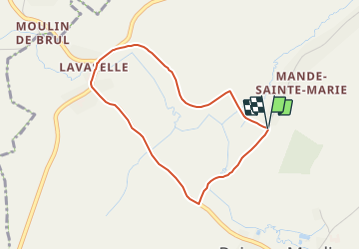
Trail On foot of 3.2 km to be discovered at Wallonia, Luxembourg, Vaux-sur-Sûre. This trail is proposed by SityTrail - Marked Routes.
Description
Trail created by Cap-Sûre Anlier 32 61 21 80 05.
Symbol: Losange rouge sur fond blanc
Website: https://61453aac-6ed1-4e33-a6f6-37c5b3ea227c.filesusr.com/ugd/a35561_6180de17aff0447f83ac3d8be9360a56.pdf
Photos


Positioning
Comments