Trail Walking Nendaz - Bisse de Salins 03.06.14 - Photo

Bisse de Salins 03.06.14

 duamerg
duamerg

User

© OpenStreetMap contributors
Length
Length
8.5 km
Max alt
Max alt
1153 m
Uphill gradient
Uphill gradient
340 m
Km-Effort
Km-Effort  
13.1 km
Min alt
Min alt
885 m
Downhill gradient
Downhill gradient
350 m
Boucle
Boucle
Yes
Creation date :
2014-12-10 00:00:00.0
Updated on :
2020-01-30 13:57:03.991

(0 Reviews)

Walking
Walking
3h06
Difficulty : Easy

Scan this QR Code to open this trail in the SityTrail application

FREE GPS app for hiking

Logo SityTrail SityTrail

IGN / Geographical institutes

Download SityTrail from the App Store Download SityTrail from Google Play

Logo SityTrail SityTrail World

The world is yours!

Download SityTrail from the App Store Download SityTrail from Google Play Download SityTrail on Huawei AppGallery

About

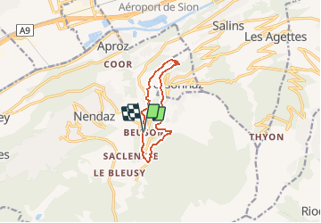
Trail Walking of 8.5 km to be discovered at Valais/Wallis, Conthey, Nendaz. This trail is proposed by duamerg.

Description

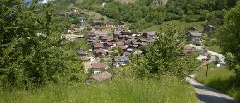
Sur la route de Nendaz, laisser la voiture en contre bas du petit village de Beuson ou alors y venir en autobus postal.
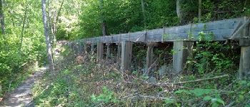
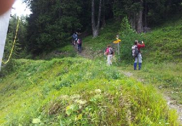
Après une montée raide de 30 minutes sur le goudron on arrive au début du bisse qui est bien indiqué. Charmant chemin que l'on suit jusqu'à un indicateur mentionnant Baar / Aproz, Prendre ce chemin. Après 5 virages, suivre le chemin sur la gauche (pas d'indication) qui traverse un torrent et l'on arrive au hameau du Bioley. Suivre la route ou l'on trouve 2 bancs pour le pic-nic et la vue. Arrivé au village de Brignon traverser la route principale et descendre dans le village oû l'on retrouve les indicateurs pédestres pour nous ramener à Beuson.
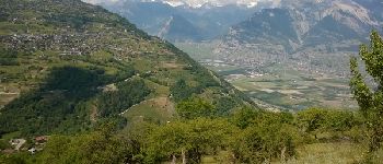
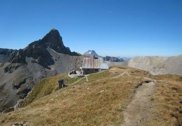
Course facile avec de belles vues sur la vallée du Rhône et le coteau de Nendaz,
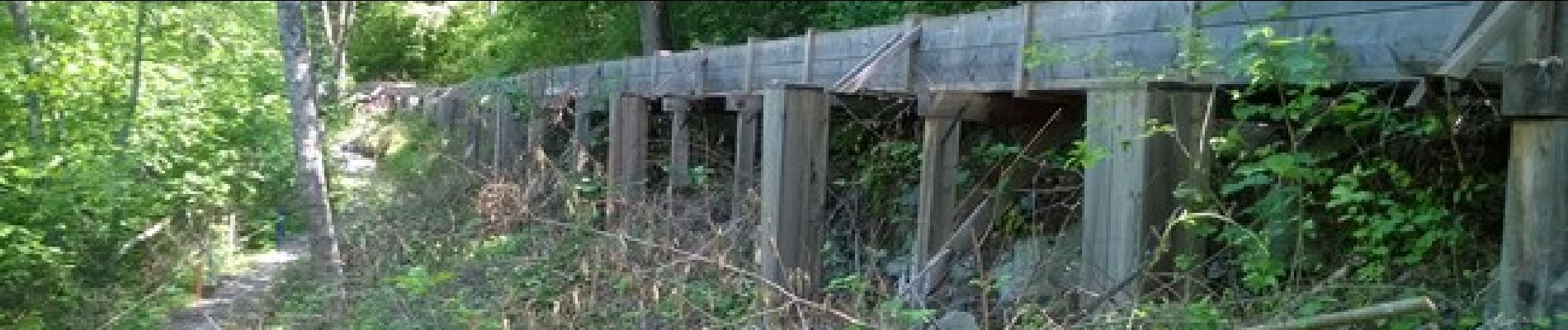
Un peu plus haut se trouve l'ancien bisse de Vex.

Elevation profile

Photos

Points of interest

Point of interest Nendaz - joli bisse - Photo
duamerg
NENDAZ 
Point of interest Nendaz - banc et vue - Photo
duamerg
NENDAZ 
Point of interest Nendaz - Brignon - Photo
duamerg
NENDAZ 
Point of interest Nendaz - parking - Photo
duamerg
NENDAZ 

Positioning

Country:
Switzerland
Region :
Valais/Wallis
Department/Province :
Conthey
Municipality :
Nendaz
Location:
Unknown
Start:(UTM)
370690 ; 5115705 (32T) N.

Trails nearby

Trail Walking Nendaz - w10_03_nendaz - Photo
Walking
GUIDE+

Walking

Very easy
(1)
Nendaz, Valais/Wallis, Conthey, Switzerland
12.8 km | 18 km-effort
4h 8min
Yes
Trail On foot Isérables - Balavaux - fixme - Photo
On foot
PRO

On foot

Easy
Isérables, Valais/Wallis, Martigny, Switzerland
3.9 km | 6.8 km-effort
1h 33min
No
Trail On foot Nendaz - Mayens-de-Sion ouest - Planchouet - Photo
On foot
PRO

On foot

Easy
Nendaz, Valais/Wallis, Conthey, Switzerland
10.1 km | 13.2 km-effort
2h 59min
No
Trail On foot Ardon - Chemin des berges du Rhône - Photo
On foot
PRO

On foot

Easy
Ardon, Valais/Wallis, Conthey, Switzerland
4.4 km | 4.9 km-effort
1h 6min
No
Trail Walking Sion - Tour du Massif des Muverans - Photo
Walking
illustre

Walking

Very easy
Sion, Valais/Wallis, Sion, Switzerland
6.2 km | 14.1 km-effort
22h 11min
No
Trail Walking Vex - Les Collons - Photo
Walking
cmike39

Walking

Medium
Vex, Valais/Wallis, Hérens, Switzerland
12.1 km | 18.8 km-effort
4h 9min
Yes
Trail Mountain bike Veysonnaz - Mayens de l''ours - Photo
Mountain bike
GUIDE+

Mountain bike

Very easy
Veysonnaz, Valais/Wallis, Sion, Switzerland
22 km | 34 km-effort
8h 8min
Yes
Trail Walking Nendaz - vs_hike666c - Photo
Walking
GUIDE+

Walking

Very easy
Nendaz, Valais/Wallis, Conthey, Switzerland
13.4 km | 18.6 km-effort
3h 27min
No
Trail Walking Nendaz - vs_hike666b - Photo
Walking
GUIDE+

Walking

Very easy
Nendaz, Valais/Wallis, Conthey, Switzerland
10.6 km | 15.4 km-effort
2h 53min
No


Close
My subscriptions