Trail Walking Blancafort - Le Canal de la Sauldre - Blancafort - Photo

Le Canal de la Sauldre - Blancafort

 tracegps
tracegps

User

© OpenStreetMap contributors
Length
Length
16.2 km
Max alt
Max alt
222 m
Uphill gradient
Uphill gradient
124 m
Km-Effort
Km-Effort  
17.9 km
Min alt
Min alt
163 m
Downhill gradient
Downhill gradient
124 m
Boucle
Boucle
Yes
Creation date :
2014-12-10 00:00:00.0
Updated on :
2014-12-10 00:00:00.0

(1 Reviews)

Walking
Walking
4h00
Difficulty : Medium

Scan this QR Code to open this trail in the SityTrail application

FREE GPS app for hiking

Logo SityTrail SityTrail

IGN / Geographical institutes

Download SityTrail from the App Store Download SityTrail from Google Play

Logo SityTrail SityTrail World

The world is yours!

Download SityTrail from the App Store Download SityTrail from Google Play Download SityTrail on Huawei AppGallery

About

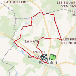
Trail Walking of 16.2 km to be discovered at Centre-Loire Valley, Cher, Blancafort. This trail is proposed by tracegps.

Description

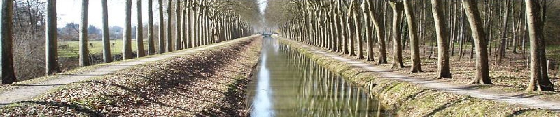
Ce tronçon isolé de 45km conserve le charme suranné des projets démesurés d’aménagements fonciers du XIXè siècle, et offre la découverte d’une Sologne sauvage et secrète, que Maurice Genevoix a si joliment contée.

Elevation profile

Photos

Positioning

Country:
France
Region :
Centre-Loire Valley
Department/Province :
Cher
Municipality :
Blancafort
Location:
Unknown
Start:(UTM)
464620 ; 5264419 (31T) N.

Comments

Please log in to post a review or rate the element


très belle randonnée avec beaucoup de chemin bordé de haies


Trails nearby

Trail Equestrian Blancafort - Le Canal de la Sauldre - Blancafort - Photo
Equestrian
tracegps

Equestrian

Difficult
Blancafort, Centre-Loire Valley, Cher, France
16.2 km | 17.9 km-effort
3h 0min
Yes
Trail Mountain bike Blancafort - Le Canal de la Sauldre - Blancafort - Photo
Mountain bike
tracegps

Mountain bike

Medium
Blancafort, Centre-Loire Valley, Cher, France
16.2 km | 17.9 km-effort
2h 0min
Yes
Trail Walking Blancafort - Blancafort - Photo
Walking
Ordijamo45

Walking

Very easy
Blancafort, Centre-Loire Valley, Cher, France
9.7 km | 10.6 km-effort
2h 22min
Yes
Trail Walking Concressault - Ballade dans la campagne du Cher - Photo
Walking
Ordijamo45

Walking

Very easy
Concressault, Centre-Loire Valley, Cher, France
8.9 km | 10.5 km-effort
2h 33min
Yes
Trail Walking Blancafort - BMF-160903.2 - Aubigny-Blancafort - Photo
Walking
randodan

Walking

Very easy
Blancafort, Centre-Loire Valley, Cher, France
2.6 km | 2.9 km-effort
50min
Yes
Trail Walking Blancafort - Blancafort 25 04 2021 - Photo
Walking
jean.marie.litzler@gmail.com

Walking

Easy
Blancafort, Centre-Loire Valley, Cher, France
10.8 km | 12 km-effort
2h 25min
Yes
Trail Walking Blancafort - aubigny - Photo
Walking
murph

Walking

Very easy
Blancafort, Centre-Loire Valley, Cher, France
28 km | 32 km-effort
7h 4min
No


Close
My subscriptions