Trail Walking Moirax - Moirax, dans les coteaux de Marescot - Photo

Moirax, dans les coteaux de Marescot

 tracegps
tracegps

User

© OpenStreetMap contributors
Length
Length
13.2 km
Max alt
Max alt
162 m
Uphill gradient
Uphill gradient
341 m
Km-Effort
Km-Effort  
17.7 km
Min alt
Min alt
64 m
Downhill gradient
Downhill gradient
337 m
Boucle
Boucle
Yes
Creation date :
2014-12-10 00:00:00.0
Updated on :
2014-12-10 00:00:00.0

(1 Reviews)

Walking
Walking
3h25
Difficulty : Difficult

Scan this QR Code to open this trail in the SityTrail application

FREE GPS app for hiking

Logo SityTrail SityTrail

IGN / Geographical institutes

Download SityTrail from the App Store Download SityTrail from Google Play

Logo SityTrail SityTrail World

The world is yours!

Download SityTrail from the App Store Download SityTrail from Google Play Download SityTrail on Huawei AppGallery

About

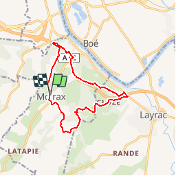
Trail Walking of 13.2 km to be discovered at New Aquitaine, Lot-et-Garonne, Moirax. This trail is proposed by tracegps.

Description

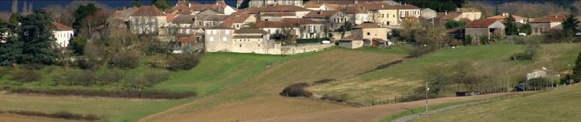
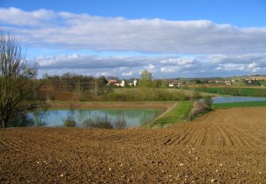
Ce circuit passe, sous et au dessus de l’autoroute A 62. Le bruit de la circulation n’est gênant que sur la partie nord de la boucle. Sinon très beaux paysages sur la vallée de la Garonne, proche d’Agen. Vous stationnez sur le parking, à gauche en venant d’Agen, au nord de Moirax sur la D 268, 100 m avant l'église. Téléchargez la fiche de cette randonnée sur le site du Tourisme du Lot et Garonne.

Elevation profile

Photos

Positioning

Country:
France
Region :
New Aquitaine
Department/Province :
Lot-et-Garonne
Municipality :
Moirax
Location:
Unknown
Start:(UTM)
308788 ; 4890383 (31T) N.

Comments

Please log in to post a review or rate the element


Trails nearby

Trail Walking Moirax - Du Prieuré de Moirax à l'église de Sainte-Marie d'Aubiac - Pays de l'Agenais - Photo
Walking
tracegps

Walking

Difficult
(1)
Moirax, New Aquitaine, Lot-et-Garonne, France
15.2 km | 22 km-effort
4h 10min
Yes
Trail Mountain bike Moirax - Moirax, dans les coteaux de Marescot - Photo
Mountain bike
tracegps

Mountain bike

Medium
Moirax, New Aquitaine, Lot-et-Garonne, France
13.2 km | 17.7 km-effort
1h 40min
Yes
Trail Walking Boé - Passeligne pélissier - Photo
Walking
gege47

Walking

Very easy
Boé, New Aquitaine, Lot-et-Garonne, France
5 km | 5.5 km-effort
1h 10min
Yes
Trail Mountain bike Estillac - Moirax - Photo
Mountain bike
tracegps

Mountain bike

Very difficult
(1)
Estillac, New Aquitaine, Lot-et-Garonne, France
42 km | 53 km-effort
3h 0min
Yes
Trail Equestrian Laplume - Randonnée dans les coteaux du Bruilhois- Laplume - Photo
Equestrian
tracegps

Equestrian

Medium
Laplume, New Aquitaine, Lot-et-Garonne, France
16 km | 20 km-effort
2h 45min
Yes
Trail Mountain bike Laplume - Randonnée dans les coteaux du Bruilhois- Laplume - Photo
Mountain bike
tracegps

Mountain bike

Medium
Laplume, New Aquitaine, Lot-et-Garonne, France
16 km | 20 km-effort
2h 0min
Yes
Trail Walking Laplume - Randonnée dans les coteaux du Bruilhois- Laplume - Photo
Walking
tracegps

Walking

Difficult
Laplume, New Aquitaine, Lot-et-Garonne, France
16 km | 20 km-effort
4h 15min
Yes
Trail Equestrian Moirax - Du Prieuré de Moirax à l'église de Sainte-Marie d'Aubiac - Pays de l'Agenais - Photo
Equestrian
tracegps

Equestrian

Difficult
Moirax, New Aquitaine, Lot-et-Garonne, France
15.2 km | 22 km-effort
2h 40min
Yes
Trail Mountain bike Moirax - Du Prieuré de Moirax à l'église de Sainte-Marie d'Aubiac - Pays de l'Agenais - Photo
Mountain bike
tracegps

Mountain bike

Difficult
Moirax, New Aquitaine, Lot-et-Garonne, France
15.2 km | 22 km-effort
2h 0min
Yes


Close
My subscriptions