Trail Walking Laruns - Pic de la Gentiane depuis Goust - Photo

Pic de la Gentiane depuis Goust

 tracegps
tracegps

User

© OpenStreetMap contributors
Length
Length
13.4 km
Max alt
Max alt
1742 m
Uphill gradient
Uphill gradient
972 m
Km-Effort
Km-Effort  
26 km
Min alt
Min alt
854 m
Downhill gradient
Downhill gradient
972 m
Boucle
Boucle
Yes
Creation date :
2014-12-10 00:00:00.0
Updated on :
2014-12-10 00:00:00.0

(0 Reviews)

Walking
Walking
6h00
Difficulty : Difficult

Scan this QR Code to open this trail in the SityTrail application

FREE GPS app for hiking

Logo SityTrail SityTrail

IGN / Geographical institutes

Download SityTrail from the App Store Download SityTrail from Google Play

Logo SityTrail SityTrail World

The world is yours!

Download SityTrail from the App Store Download SityTrail from Google Play Download SityTrail on Huawei AppGallery

About

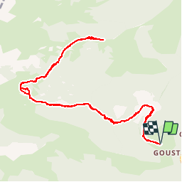
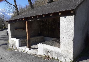
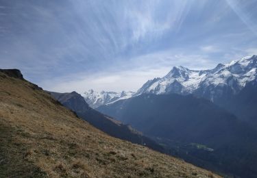
Trail Walking of 13.4 km to be discovered at New Aquitaine, Pyrénées-Atlantiques, Laruns. This trail is proposed by tracegps.

Description

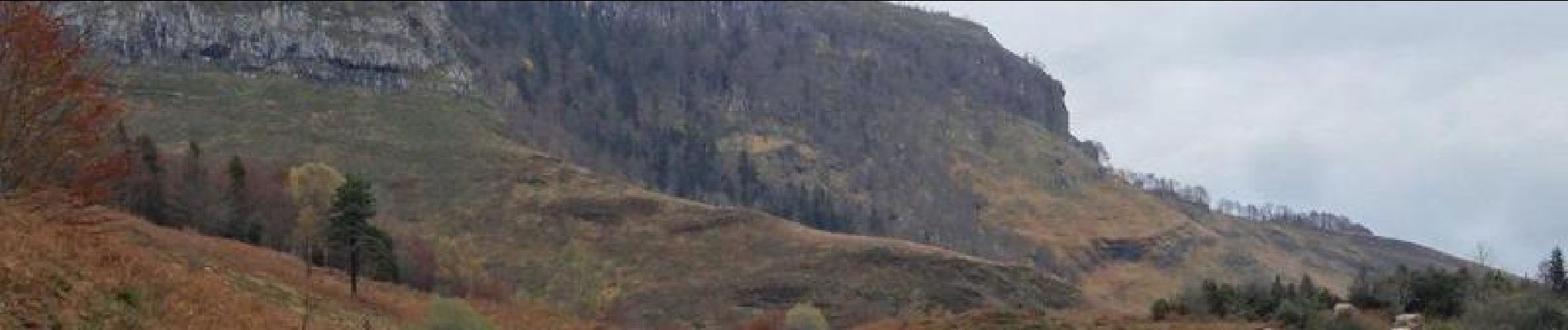
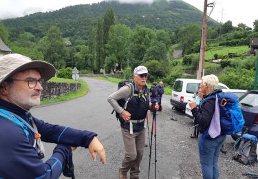
Départ depuis le Hameau de Goust au-dessus des Eaux-Chaudes en vallée d'Ossau. On suit le GRP Ossau jusqu'au col de Besse. Deux rudes montées pour arriver dans un premier temps au plateau de Besse, pour passer ensuite à la cabane de Besse et aboutir au col du même nom. On quitte le GRP au col pour grimper au Pic de la Gentiane qui domine la Basse vallée d'Ossau. Retour par le même chemin.

Elevation profile

Photos

Positioning

Country:
France
Region :
New Aquitaine
Department/Province :
Pyrénées-Atlantiques
Municipality :
Laruns
Location:
Unknown
Start:(UTM)
708170 ; 4758599 (30T) N.

Trails nearby

Trail Walking Béost - Behost - Photo
Walking
swp648

Walking

Easy
(1)
Béost, New Aquitaine, Pyrénées-Atlantiques, France
6 km | 9.9 km-effort
2h 59min
Yes
Trail Walking Laruns - LARUNS le tour du valentin G3
Walking
GUIDE
marmotte65

Walking

Difficult
Laruns, New Aquitaine, Pyrénées-Atlantiques, France
8.2 km | 12.9 km-effort
2h 56min
Yes
Trail On foot Eaux-Bonnes - La promenade horizontale - Photo
On foot
PRO

On foot

Easy
Eaux-Bonnes, New Aquitaine, Pyrénées-Atlantiques, France
3.5 km | 5.3 km-effort
1h 12min
Yes
Trail On foot Eaux-Bonnes - Les thermes - Photo
On foot
PRO

On foot

Easy
Eaux-Bonnes, New Aquitaine, Pyrénées-Atlantiques, France
3.6 km | 5.9 km-effort
1h 20min
Yes
Trail On foot Laruns - L'eau - Photo
On foot
PRO

On foot

Easy
Laruns, New Aquitaine, Pyrénées-Atlantiques, France
4.8 km | 5.9 km-effort
1h 20min
Yes
Trail On foot Eaux-Bonnes - La montagne verte - Photo
On foot
PRO

On foot

Easy
Eaux-Bonnes, New Aquitaine, Pyrénées-Atlantiques, France
10.4 km | 17.8 km-effort
4h 2min
Yes
Trail On foot Béost - La promenade des trois villages - Photo
On foot
PRO

On foot

Easy
Béost, New Aquitaine, Pyrénées-Atlantiques, France
5.1 km | 8.6 km-effort
1h 56min
Yes
Trail Walking Béost - La montagne verte - Photo
Walking
herve.feurprier

Walking

Easy
(1)
Béost, New Aquitaine, Pyrénées-Atlantiques, France
12.9 km | 22 km-effort
4h 40min
Yes
Trail Walking Laruns - chemin des fenetres - Photo
Walking
mongo

Walking

Easy
(1)
Laruns, New Aquitaine, Pyrénées-Atlantiques, France
8 km | 14.1 km-effort
3h 0min
No


Close
My subscriptions