Trail Mountain bike Bourgvallées - La Samsonnaise 2014 - Photo

La Samsonnaise 2014

 tracegps
tracegps

User

© OpenStreetMap contributors
Length
Length
47 km
Max alt
Max alt
170 m
Uphill gradient
Uphill gradient
735 m
Km-Effort
Km-Effort  
57 km
Min alt
Min alt
45 m
Downhill gradient
Downhill gradient
734 m
Boucle
Boucle
Yes
Creation date :
2014-12-10 00:00:00.0
Updated on :
2014-12-10 00:00:00.0

(0 Reviews)

Mountain bike
Mountain bike
3h25
Difficulty : Difficult

Scan this QR Code to open this trail in the SityTrail application

FREE GPS app for hiking

Logo SityTrail SityTrail

IGN / Geographical institutes

Download SityTrail from the App Store Download SityTrail from Google Play

Logo SityTrail SityTrail World

The world is yours!

Download SityTrail from the App Store Download SityTrail from Google Play Download SityTrail on Huawei AppGallery

About

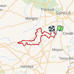
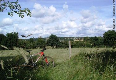
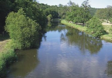
Trail Mountain bike of 47 km to be discovered at Normandy, Manche, Bourgvallées. This trail is proposed by tracegps.

Description

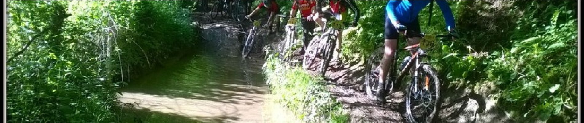
C'est un circuit très technique par ses différents dénivelés... Il reste accessible aux vététistes confirmés. Vous découvrirez ses beaux paysages dans toute leur splendeur... Attention circuit à ne pas faire lors de grosses pluies précédent votre rando... à moins que vous n'aimiez la boue. À bon entendeur.

Elevation profile

Photos

Positioning

Country:
France
Region :
Normandy
Department/Province :
Manche
Municipality :
Bourgvallées
Location:
Saint-Samson-de-Bonfossé
Start:(UTM)
636992 ; 5434292 (30U) N.

Trails nearby

Trail Walking Condé-sur-Vire - Le rocher de Ham - Photo
Walking
prv

Walking

Easy
(1)
Condé-sur-Vire, Normandy, Manche, France
10.9 km | 13.4 km-effort
2h 24min
Yes
Trail Walking Condé-sur-Vire - Roches de ham - Photo
Walking
phi14

Walking

Easy
(1)
Condé-sur-Vire, Normandy, Manche, France
11.1 km | 13.5 km-effort
2h 58min
Yes
Trail Mountain bike Domjean - Au coeur de la vallée de la Vire - Photo
Mountain bike
tracegps

Mountain bike

Difficult
(2)
Domjean, Normandy, Manche, France
32 km | 39 km-effort
4h 0min
Yes
Trail Walking Canisy - Le circuit Jean Follain - Canisy - Photo
Walking
tracegps

Walking

Medium
Canisy, Normandy, Manche, France
9.2 km | 10.9 km-effort
2h 19min
Yes
Trail Mountain bike Moyon-Villages - Le Mesnil-Opac C12-II  - Photo
Mountain bike
tracegps

Mountain bike

Easy
Moyon-Villages, Normandy, Manche, France
7.2 km | 8.4 km-effort
45min
Yes
Trail Walking Moyon-Villages - Le Mesnil-Opac C12-II  - Photo
Walking
tracegps

Walking

Easy
Moyon-Villages, Normandy, Manche, France
7.2 km | 8.4 km-effort
1h 49min
Yes
Trail Mountain bike Moyon-Villages - Le Mesnil-Opac C12-I - Photo
Mountain bike
tracegps

Mountain bike

Easy
Moyon-Villages, Normandy, Manche, France
7.9 km | 9.2 km-effort
45min
Yes
Trail Walking Moyon-Villages - Le Mesnil-Opac C12-I - Photo
Walking
tracegps

Walking

Easy
Moyon-Villages, Normandy, Manche, France
7.9 km | 9.2 km-effort
2h 0min
Yes
Trail Mountain bike Condé-sur-Vire - Boucle de Troisgots - C5 I           - Photo
Mountain bike
tracegps

Mountain bike

Easy
Condé-sur-Vire, Normandy, Manche, France
10.6 km | 12.8 km-effort
1h 10min
Yes


Close
My subscriptions