Trail Cycle Axat - Col de Pailhères - variante - Photo

Col de Pailhères - variante

 bosses21
bosses21

User

© OpenStreetMap contributors
Length
Length
79 km
Max alt
Max alt
2003 m
Uphill gradient
Uphill gradient
2668 m
Km-Effort
Km-Effort  
115 km
Min alt
Min alt
402 m
Downhill gradient
Downhill gradient
2667 m
Boucle
Boucle
Yes
Creation date :
2015-05-03 00:00:00.0
Updated on :
2015-05-03 00:00:00.0

(0 Reviews)

Cycle
Cycle
6h11
Difficulty : Difficult

Scan this QR Code to open this trail in the SityTrail application

FREE GPS app for hiking

Logo SityTrail SityTrail

IGN / Geographical institutes

Download SityTrail from the App Store Download SityTrail from Google Play

Logo SityTrail SityTrail World

The world is yours!

Download SityTrail from the App Store Download SityTrail from Google Play Download SityTrail on Huawei AppGallery

About

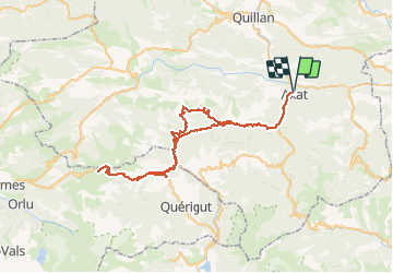
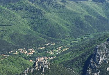
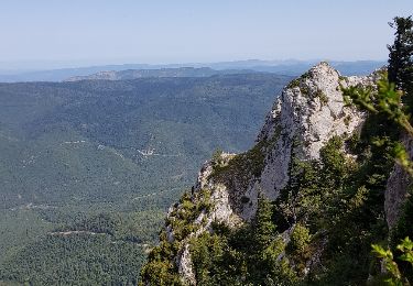
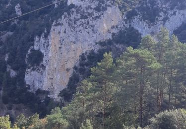
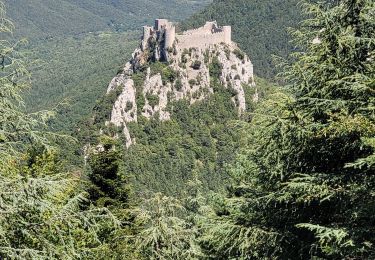
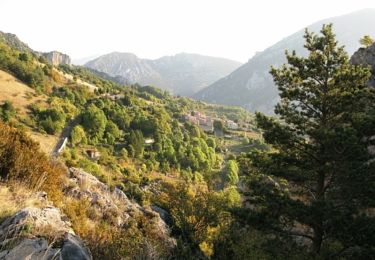
Trail Cycle of 79 km to be discovered at Occitania, Aude, Axat. This trail is proposed by bosses21.

Description

Col du Castel - 658m
Col Notre Dame - 950m
Col des Aychides - 1007m
Col des Clausels - 977m
Col des Trabesses - 1973m
Col de Pailhères - 2001m
Port de Pailhères - 1963m

Elevation profile

Points of interest

Point of interest Bessède-de-Sault - Col du Castel - 658m - Photo
bosses21
BESSÈDE-DE-SAULT 
Point of interest Bessède-de-Sault - Col du Castel - 658m - Photo
bosses21
BESSÈDE-DE-SAULT 
Point of interest Bessède-de-Sault - Col Notre Dame - 950m - Photo
bosses21
BESSÈDE-DE-SAULT 
Point of interest Bessède-de-Sault - Col Notre Dame - 950m - Photo
bosses21
BESSÈDE-DE-SAULT 
Point of interest Fontanès-de-Sault - Col des Clausels - 977m - Photo
bosses21
FONTANÈS-DE-SAULT 
Point of interest Fontanès-de-Sault - Col des Clausels - 977m - Photo
bosses21
FONTANÈS-DE-SAULT 
Point of interest Mijanès - Col de Pailhères - 2001m - Photo
bosses21
Point of interest Mijanès - Col de Pailhères - 2001m - Photo
bosses21

Positioning

Country:
France
Region :
Occitania
Department/Province :
Aude
Municipality :
Axat
Location:
Unknown
Start:(Dec)
Start:(UTM)
437463 ; 4739455 (31T) N.

Trails nearby

Trail Walking Salvezines - Forêt d’enmalo - Photo
Walking
ezola

Walking

Difficult
Salvezines, Occitania, Aude, France
10.1 km | 16.9 km-effort
3h 24min
Yes
Trail Walking Salvezines - Le Caunil. Maison forestière par Puylaurens  - Photo
Walking
robertperello

Walking

Difficult
Salvezines, Occitania, Aude, France
10 km | 16.2 km-effort
2h 45min
Yes
Trail Walking Salvezines - La forêt d  en Malo depuis le Caunil (11) - Photo
Walking
MarieFrancoise

Walking

Medium
(1)
Salvezines, Occitania, Aude, France
13.2 km | 22 km-effort
5h 22min
Yes
Trail Walking Axat - Sénayeurs à Axat et bois de la fage - Photo
Walking
geli.henri

Walking

Difficult
Axat, Occitania, Aude, France
8.9 km | 13 km-effort
4h 52min
No
Trail Walking Axat - axat château de puylaurens - Photo
Walking
marcagif

Walking

Easy
Axat, Occitania, Aude, France
22 km | 33 km-effort
6h 27min
Yes
Trail Walking Salvezines - Autour du Pic d'Estable - Salvezine - Photo
Walking
tracegps

Walking

Difficult
Salvezines, Occitania, Aude, France
16.1 km | 27 km-effort
5h 30min
Yes
Trail Walking Quirbajou - Balade GPS autour de Quirbajou - Photo
Walking
tracegps

Walking

Medium
Quirbajou, Occitania, Aude, France
12.2 km | 19.9 km-effort
3h 0min
Yes
Trail Walking Puilaurens - château de Puilaurens  - Photo
Walking
batut

Walking

Very easy
Puilaurens, Occitania, Aude, France
13.7 km | 21 km-effort
4h 40min
Yes
Trail Running Saint-Martin-Lys - enchaînement vélo / course à pied au d'Axat - Photo
Running
JohandePertuis

Running

Difficult
Saint-Martin-Lys, Occitania, Aude, France
59 km | 89 km-effort
55min
Yes


Close
My subscriptions