Trail Walking Faverges-Seythenex - Cret des Mouches - Photo
© OpenStreetMap contributors
Length
Length
9.3 km
Max alt
Max alt
2023 m
Uphill gradient
Uphill gradient
1025 m
Km-Effort
Km-Effort  
22 km
Min alt
Min alt
1139 m
Downhill gradient
Downhill gradient
705 m
Boucle
Boucle
No
Creation date :
2014-12-10 00:00:00.0
Updated on :
2014-12-10 00:00:00.0

(1 Reviews)

Walking
Walking
4h40
Difficulty : Medium

Scan this QR Code to open this trail in the SityTrail application

FREE GPS app for hiking

Logo SityTrail SityTrail

IGN / Geographical institutes

Download SityTrail from the App Store Download SityTrail from Google Play

Logo SityTrail SityTrail World

The world is yours!

Download SityTrail from the App Store Download SityTrail from Google Play Download SityTrail on Huawei AppGallery

About

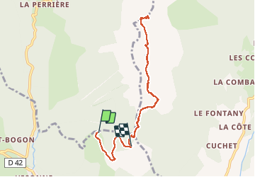
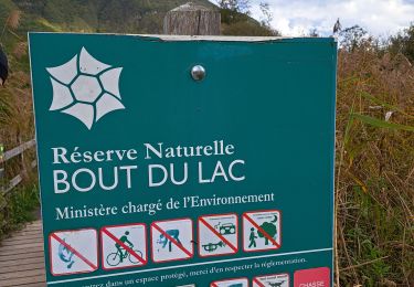
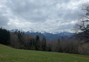
Trail Walking of 9.3 km to be discovered at Auvergne-Rhône-Alpes, Upper Savoy, Faverges-Seythenex. This trail is proposed by brichard38.

Elevation profile

Photos

Positioning

Country:
France
Region :
Auvergne-Rhône-Alpes
Department/Province :
Upper Savoy
Municipality :
Faverges-Seythenex
Location:
Faverges
Start:(UTM)
288218 ; 5072753 (32T) N.

Comments

Please log in to post a review or rate the element


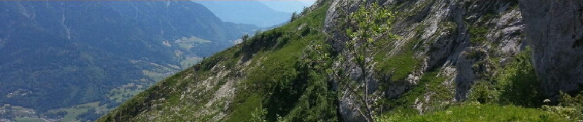
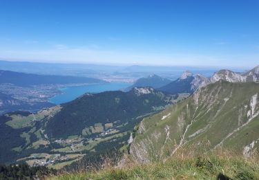
Vue panoramique magnifique depuis le sommet.Pas de difficultés particulières hormis le dénivelée et des passages assez aériens.


Trails nearby

Trail Mountain bike Lathuile - VTT des sources du lac d'Annecy - Photo
Mountain bike
GUIDE
pascalou73

Mountain bike

Medium
(2)
Lathuile, Auvergne-Rhône-Alpes, Upper Savoy, France
27 km | 31 km-effort
2h 3min
Yes
Trail Walking Saint-Ferréol - Crêt des Mouches 08-2019 - Photo
Walking
GUIDE
Kargil

Walking

Difficult
Saint-Ferréol, Auvergne-Rhône-Alpes, Upper Savoy, France
12.3 km | 31 km-effort
6h 48min
Yes
Trail Cycle Lathuile - Le tour du lac d'Annecy - Photo
Cycle
GUIDE
pascalou73

Cycle

Easy
Lathuile, Auvergne-Rhône-Alpes, Upper Savoy, France
38 km | 45 km-effort
2h 28min
No
Trail Walking Faverges-Seythenex - la fosse a l'ours depuis Prafeu - Photo
Walking
COMAN

Walking

Easy
(1)
Faverges-Seythenex, Auvergne-Rhône-Alpes, Upper Savoy, France
4.7 km | 8.4 km-effort
1h 42min
Yes
Trail Walking Doussard - Réserve naturelle du bout du Lac - Photo
Walking
rmary

Walking

Very easy
(2)
Doussard, Auvergne-Rhône-Alpes, Upper Savoy, France
4.3 km | 4.8 km-effort
1h 17min
Yes
Trail Walking Talloires-Montmin - Chalet de l'Aups depuis la Côte par Col de la Forclaz - Photo
Walking
katiab

Walking

Medium
Talloires-Montmin, Auvergne-Rhône-Alpes, Upper Savoy, France
10.1 km | 17.1 km-effort
3h 41min
Yes
Trail Walking Doussard - Réserve du bout du lac - Photo
Walking
katiab

Walking

Very easy
Doussard, Auvergne-Rhône-Alpes, Upper Savoy, France
4.2 km | 4.7 km-effort
1h 26min
Yes
Trail Walking Talloires-Montmin - LANFONNET   N°2 depuis la Forclaz  - Photo
Walking
Jean-Paulchoux

Walking

Medium
Talloires-Montmin, Auvergne-Rhône-Alpes, Upper Savoy, France
14 km | 27 km-effort
6h 57min
Yes
Trail Walking Saint-Ferréol - Presque le château de Montaigu - Photo
Walking
pacal08

Walking

Difficult
Saint-Ferréol, Auvergne-Rhône-Alpes, Upper Savoy, France
10 km | 16.4 km-effort
2h 17min
Yes


Close
My subscriptions