Trail Walking Ceillac - Tête de la Cula - Photo
 amiral13
amiral13

User GUIDE

© OpenStreetMap contributors
Length
Length
15.8 km
Max alt
Max alt
3104 m
Uphill gradient
Uphill gradient
1129 m
Km-Effort
Km-Effort  
31 km
Min alt
Min alt
2025 m
Downhill gradient
Downhill gradient
1129 m
Boucle
Boucle
Yes
Creation date :
2015-01-03 00:00:00.0
Updated on :
2015-01-03 00:00:00.0

(0 Reviews)

Walking
Walking
6h48
Difficulty : Medium

Scan this QR Code to open this trail in the SityTrail application

FREE GPS app for hiking

Logo SityTrail SityTrail

IGN / Geographical institutes

Download SityTrail from the App Store Download SityTrail from Google Play

Logo SityTrail SityTrail World

The world is yours!

Download SityTrail from the App Store Download SityTrail from Google Play Download SityTrail on Huawei AppGallery

About

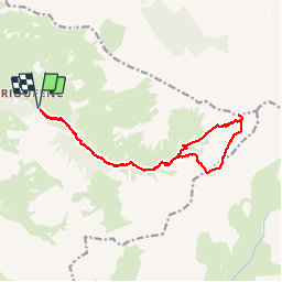
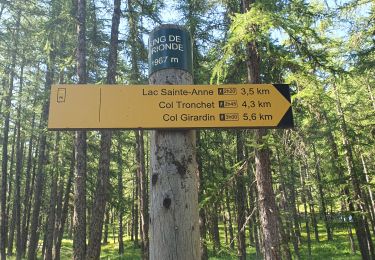
Trail Walking of 15.8 km to be discovered at Provence-Alpes-Côte d'Azur, Hautes-Alpes, Ceillac. This trail is proposed by amiral13.

Description

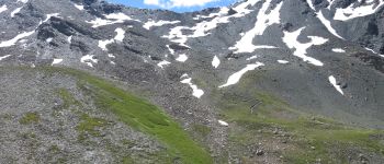
on commence à l'ombre d'un bois d'épicéas, puis l'on traverse les alpages ou paissent de nombreux mouton.
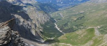
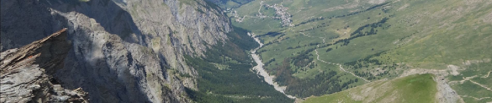
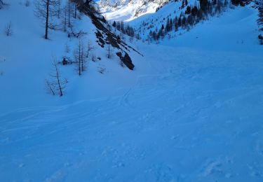
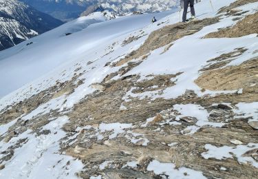
la fin de l'ascension que l'on pouvait penser plus difficile (pointillé rouge) se fait par un sentier bien tracé quelques dizaines de mètres plus au sud.
la traversée des crêtes du cristillan ne présente pas de difficulté mais demande une attention un peu plus soutenue . tôt en saison la présence de neige peut porter à réfléchir sur l'itinéraire de retour.

Elevation profile

Photos

Points of interest

Point of interest Saint-Véran - Sommet de la Tête de la Cula - Photo
amiral13
Point of interest Ceillac - itinéraire de descente - Photo
amiral13
Point of interest Ceillac - vue du col - Photo
amiral13
CEILLAC 

Positioning

Country:
France
Region :
Provence-Alpes-Côte d'Azur
Department/Province :
Hautes-Alpes
Municipality :
Ceillac
Location:
Unknown
Start:(UTM)
329120 ; 4947240 (32T) N.

Trails nearby

Trail Walking Saint-Véran - boucle St Veran - Refuge de la blanche - Photo
Walking
gildascb

Walking

Medium
(1)
Saint-Véran, Provence-Alpes-Côte d'Azur, Hautes-Alpes, France
19.3 km | 28 km-effort
5h 15min
Yes
Trail Walking Ceillac - Queyras_lac de Clausis - Photo
Walking
MartinBraudThierry

Walking

Very easy
(1)
Ceillac, Provence-Alpes-Côte d'Azur, Hautes-Alpes, France
13.1 km | 26 km-effort
2h 59min
Yes
Trail Walking Ceillac - le Longet ou tête du Rissace - Photo
Walking
GUIDE
amiral13

Walking

Medium
Ceillac, Provence-Alpes-Côte d'Azur, Hautes-Alpes, France
13 km | 25 km-effort
6h 26min
Yes
Trail Walking Ceillac - Lac Ste Anne et Tête de Girardin - Photo
Walking
GUIDE
amiral13

Walking

Medium
Ceillac, Provence-Alpes-Côte d'Azur, Hautes-Alpes, France
14.4 km | 27 km-effort
5h 48min
Yes
Trail Walking Ceillac - lac Sainte Anne - Photo
Walking
griffet

Walking

Easy
(2)
Ceillac, Provence-Alpes-Côte d'Azur, Hautes-Alpes, France
10.7 km | 17.9 km-effort
5h 16min
No
Trail Walking Ceillac - lac Saint Anne et Miroir - Photo
Walking
marchev

Walking

Medium
Ceillac, Provence-Alpes-Côte d'Azur, Hautes-Alpes, France
10.9 km | 18.5 km-effort
4h 14min
Yes
Trail Snowshoes Saint-Véran - Saint Véran - Col de Chamoussière - Pic de Caramantran - Refuge de la Blanche - Photo
Snowshoes
Pierre Lefèvre

Snowshoes

Difficult
Saint-Véran, Provence-Alpes-Côte d'Azur, Hautes-Alpes, France
22 km | 38 km-effort
5h 30min
Yes
Trail Touring skiing Saint-Véran - tête de la Cula - Photo
Touring skiing
tchoua

Touring skiing

Difficult
Saint-Véran, Provence-Alpes-Côte d'Azur, Hautes-Alpes, France
14.2 km | 31 km-effort
3h 31min
Yes
Trail Touring skiing Saint-Véran - pointe des marcelettes  - Photo
Touring skiing
tchoua

Touring skiing

Difficult
Saint-Véran, Provence-Alpes-Côte d'Azur, Hautes-Alpes, France
9.3 km | 23 km-effort
2h 41min
No


Close
My subscriptions