Trail Walking Availles-Limouzine - Au bord de la Vienne - Photo
© OpenStreetMap contributors
Length
Length
12.9 km
Max alt
Max alt
213 m
Uphill gradient
Uphill gradient
175 m
Km-Effort
Km-Effort  
15.2 km
Min alt
Min alt
121 m
Downhill gradient
Downhill gradient
174 m
Boucle
Boucle
Yes
Creation date :
2014-12-10 00:00:00.0
Updated on :
2014-12-10 00:00:00.0

(0 Reviews)

Walking
Walking
1h42
Difficulty : Difficult

Scan this QR Code to open this trail in the SityTrail application

FREE GPS app for hiking

Logo SityTrail SityTrail

IGN / Geographical institutes

Download SityTrail from the App Store Download SityTrail from Google Play

Logo SityTrail SityTrail World

The world is yours!

Download SityTrail from the App Store Download SityTrail from Google Play Download SityTrail on Huawei AppGallery

About

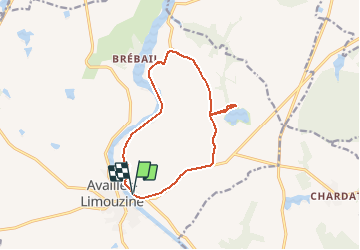
Trail Walking of 12.9 km to be discovered at New Aquitaine, Vienne, Availles-Limouzine. This trail is proposed by Geronimo2010.

Description

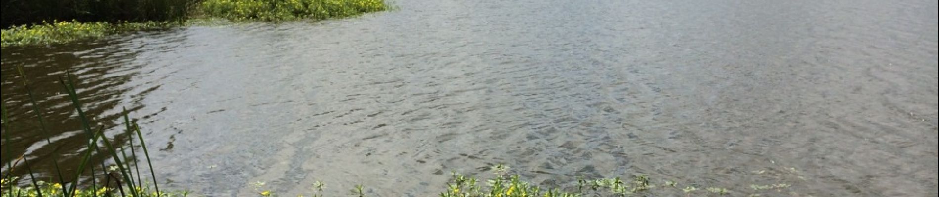
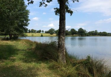
Au bord de la Vienne près de la camping Le Parc.

Elevation profile

Photos

Positioning

Country:
France
Region :
New Aquitaine
Department/Province :
Vienne
Municipality :
Availles-Limouzine
Location:
Unknown
Start:(UTM)
319255 ; 5110372 (31T) N.

Trails nearby

Trail Walking Availles-Limouzine - Chemin d'oc et oil nr10 - Photo
Walking
Geronimo2010

Walking

Very easy
Availles-Limouzine, New Aquitaine, Vienne, France
10.3 km | 12.1 km-effort
2h 19min
Yes
Trail Walking Availles-Limouzine - l'oc et d'oil nr9 - Photo
Walking
Geronimo2010

Walking

Easy
Availles-Limouzine, New Aquitaine, Vienne, France
3.9 km | 5 km-effort
54min
Yes
Trail Cycle Availles-Limouzine - Le circuit - Photo
Cycle
Geronimo2010

Cycle

Easy
Availles-Limouzine, New Aquitaine, Vienne, France
23 km | 26 km-effort
2h 22min
Yes
Trail Cycle Availles-Limouzine - Etang de Verrières - Photo
Cycle
Geronimo2010

Cycle

Medium
Availles-Limouzine, New Aquitaine, Vienne, France
9.5 km | 11.3 km-effort
38min
Yes
Trail Bicycle tourism Availles-Limouzine -  Availles Limouzinz/Civeaux - Photo
Bicycle tourism
dporcher

Bicycle tourism

Very easy
Availles-Limouzine, New Aquitaine, Vienne, France
45 km | 52 km-effort
Unknown
No
Trail Walking Availles-Limouzine - Étang de fondeube.gpx - Photo
Walking
sipsoun

Walking

Very easy
Availles-Limouzine, New Aquitaine, Vienne, France
9.1 km | 10.4 km-effort
1h 31min
No


Close
My subscriptions