


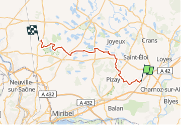
CHA - J16 - 25/09 - Pérouges > St Jean de Thurigneux V2

aeldin
User

Length
36 km

Max alt
301 m

Uphill gradient
320 m
Km-Effort
40 km

Min alt
212 m

Downhill gradient
245 m
Boucle
No
Creation date :
2022-08-06 14:34:27.238
Updated on :
2022-09-06 20:19:49.594
39m
Difficulty : Easy

FREE GPS app for hiking
 SityTrail
IGN / Geographical institutes
SityTrail Plus
The world is yours!
About
Trail Horseback riding of 36 km to be discovered at Auvergne-Rhône-Alpes, Ain, Pérouges. This trail is proposed by aeldin.

Positioning
Country:
France
Region :
Auvergne-Rhône-Alpes
Department/Province :
Ain
Municipality :
Pérouges
Location:
Unknown
Start:(Dec)
Start:(UTM)
668178 ; 5083643 (31T) N.
Comments