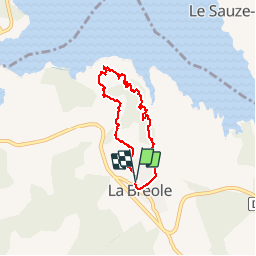
15.6 km | 23 km-effort
L'Escoubaye
FERAUD
User
Length
6 km
Max alt
1003 m
Uphill gradient
226 m
Km-Effort
9 km
Min alt
845 m
Downhill gradient
228 m
Boucle
Yes
Creation date :
2014-12-10 00:00:00.0
Updated on :
2014-12-10 00:00:00.0
1h22
Difficulty : Medium
FREE GPS app for hiking
About
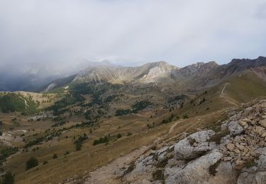
Trail Walking of 6 km to be discovered at Provence-Alpes-Côte d'Azur, Alpes-de-Haute-Provence, Ubaye-Serre-Ponçon. This trail is proposed by FERAUD.
Positioning
Country:
France
Region :
Provence-Alpes-Côte d'Azur
Department/Province :
Alpes-de-Haute-Provence
Municipality :
Ubaye-Serre-Ponçon
Location:
Unknown
Start:(Dec)
Start:(UTM)
284728 ; 4926248 (32T) N.
Comments
Trails nearby
MONTCLAR , les Rollands , canal de la Pisse , Pre Balou , fontaine du loup ,...
Walking
Medium
(1)
Ubaye-Serre-Ponçon,
Provence-Alpes-Côte d'Azur,
Alpes-de-Haute-Provence,
France
4h 22min
Yes
le clôt de la cime.
Walking
Easy
(1)
Ubaye-Serre-Ponçon,
Provence-Alpes-Côte d'Azur,
Alpes-de-Haute-Provence,
France
12.5 km | 19.8 km-effort
4h 0min
Yes
Circuit de l'Escoubaye 25 -12- 2014
Walking
Easy
(1)
Ubaye-Serre-Ponçon,
Provence-Alpes-Côte d'Azur,
Alpes-de-Haute-Provence,
France
6.9 km | 10.1 km-effort
2h 32min
Yes
PONTIS , le dolmen
Walking
Medium
(1)
Pontis,
Provence-Alpes-Côte d'Azur,
Alpes-de-Haute-Provence,
France
12.9 km | 21 km-effort
3h 50min
Yes
Morgon par les Traverses, retour par les Ortals
Walking
Very difficult
Pontis,
Provence-Alpes-Côte d'Azur,
Alpes-de-Haute-Provence,
France
17.1 km | 33 km-effort
5h 49min
No
Pic du Morgon par Serre-Chiret
Walking
Difficult
Pontis,
Provence-Alpes-Côte d'Azur,
Alpes-de-Haute-Provence,
France
14 km | 27 km-effort
4h 2min
Yes
L'Escoubaye
Walking
Easy
(1)
Ubaye-Serre-Ponçon,
Provence-Alpes-Côte d'Azur,
Alpes-de-Haute-Provence,
France
4.5 km | 7.4 km-effort
2h 0min
Yes
Circuit de Costebelle
Walking
Medium
(2)
Ubaye-Serre-Ponçon,
Provence-Alpes-Côte d'Azur,
Alpes-de-Haute-Provence,
France
8.2 km | 12.8 km-effort
2h 30min
Yes
Balcons du lac Taïga
Walking
Easy
Le Sauze-du-Lac,
Provence-Alpes-Côte d'Azur,
Hautes-Alpes,
France
7.5 km | 11.1 km-effort
3h 12min
Yes
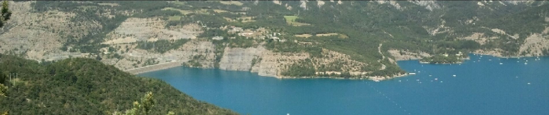
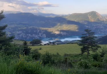
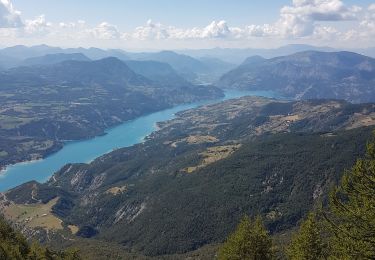
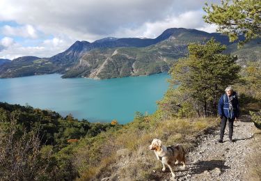
belle vue sur la rencontre entre l ubaye et la Durance