Trail Walking Longpont - en forêt de Retz_29_Longpont_la cave du Diable_A - Photo

en forêt de Retz_29_Longpont_la cave du Diable_A

forêts de France

© OpenStreetMap contributors
Length
Length
29 km
Max alt
Max alt
194 m
Uphill gradient
Uphill gradient
529 m
Km-Effort
Km-Effort  
36 km
Min alt
Min alt
86 m
Downhill gradient
Downhill gradient
493 m
Boucle
Boucle
No
Creation date :
2018-12-02 17:12:52.083
Updated on :
2020-11-08 11:09:25.0

(0 Reviews)

Walking
Walking
8h08
Difficulty : Very difficult

Scan this QR Code to open this trail in the SityTrail application

FREE GPS app for hiking

Logo SityTrail SityTrail

IGN / Geographical institutes

Download SityTrail from the App Store Download SityTrail from Google Play

Logo SityTrail SityTrail World

The world is yours!

Download SityTrail from the App Store Download SityTrail from Google Play Download SityTrail on Huawei AppGallery

About

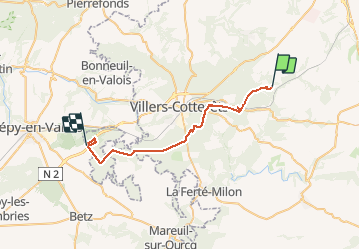
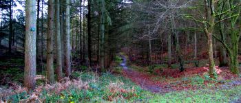
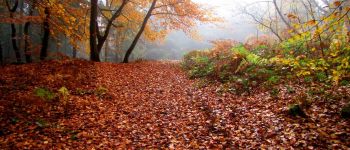
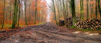
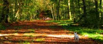
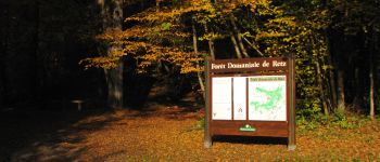
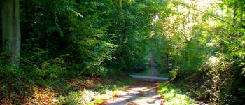
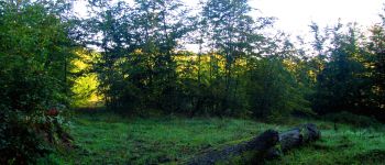
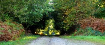
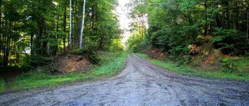
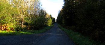
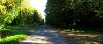
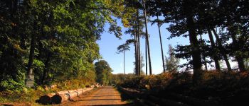
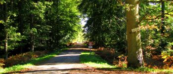
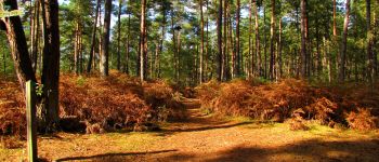
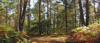
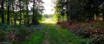
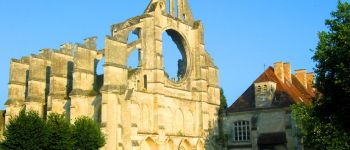
Trail Walking of 29 km to be discovered at Hauts-de-France, Aisne, Longpont. This trail is proposed by en forêt de Retz.

Description

voir aussi:
http://foret-de-retz.over-blog.com/

10/2014

Batterie pour iphone indispensable sinon impossible d'enregistrer dans sitytrail.
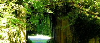
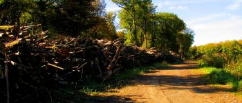
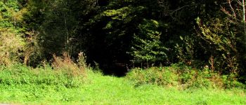
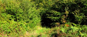
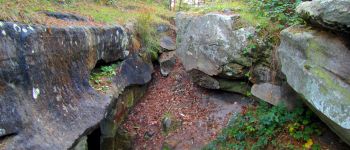
Prévoir une torche électrique pour la Cave du Diable (voir photos).

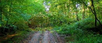
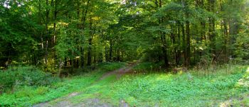
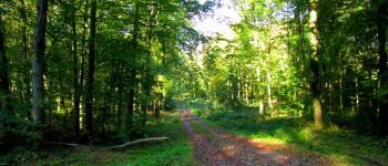
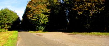
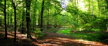
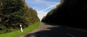
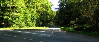
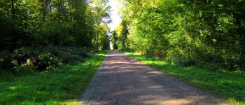
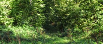
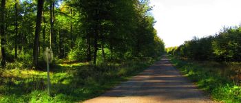
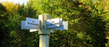
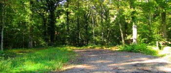
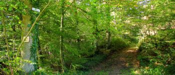
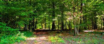
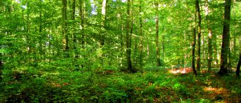
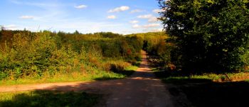
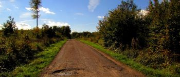
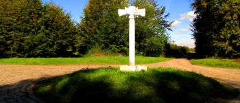
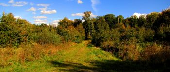
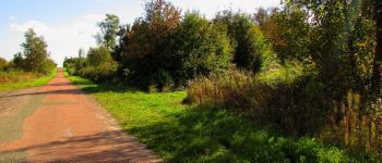
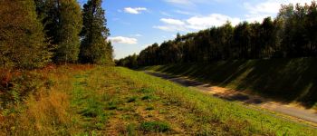
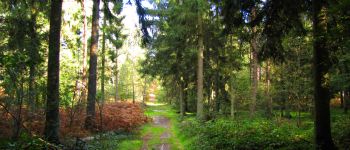
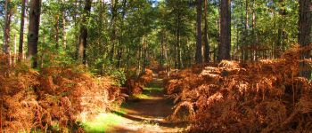
A partir de l'Abbaye de Longpont, rejoindre aux "trois maisons" le GR11A. Continuer jusqu'au vieux chemin de Longpont. Le suivre jusqu'au carrefour avec la laie de la Grosse Pierre. Prendre la laie de la Grosse Pierre à gauche. Passer le carrefour de château Fée et continuer sur la laie de la Route Droite. Passer la Fontaine du Prince, l'étang de la Petite Ramée, traverser la D80 et prendre la route de Hautwison au carrefour des Cornillards jusqu'au carrefour Maurice Loubet. Prendre à gauche la route de la Chr??tiennette jusqu'au carrefour du Pavé Neuf. Prendre la laie de la Queue d'Oigny jusqu'au carrefour du Poteau Caquetier. Suivre le GR11 (route tortue au lieu de l'ancienne route Tortue) jusqu'au carrefour de la Montagnette. Prendre la D936 à gauche puis au carrefour de la Fontaine des Boisseliers prendre à droite la Route Droite jusqu'au Rond Des Dames. Prendre à gauche la route du Château jusqu'au premier carrefour. Prendre à droite la laie Nicolay jusqu'au carrefour avec la route d'Ormoy. Prendre la route d'Ormoy à gauche, traverser le rond Capitaine, le rond Montebello pour arriver au carrefour du rond Capitaine. Prendre à droite la route des Quatorze Frères et suivre jusqu'au carrefour avant la maison des Quatorze Frères. Prendre à droite jusqu'au carrefour Philippe. Tourner à gauche dans la laie de la Tour du Grain jusqu'à la Cave du Diable (traverser le carrefour de la Cave du Diable). L'entrée est dans la faille rocheuse sur la droite.
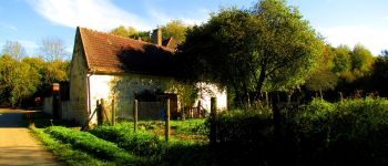
Reprendre la Route Droite jusqu'à la maison forestière des Quatorze Frères prés de la N2.
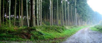
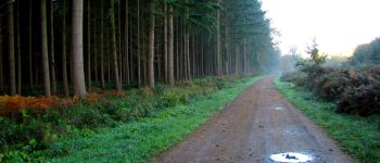
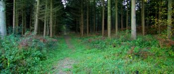
Elevation profile

Points of interest

Point of interest Montgobert - Point 1 - Photo
JeanLucA4
MONTGOBERT 
Point of interest Montgobert - Point 2 - Photo
JeanLucA4
MONTGOBERT 
Point of interest Montgobert - Point 3 - Photo
JeanLucA4
MONTGOBERT 
Point of interest Montgobert - Point 4 - Photo
JeanLucA4
MONTGOBERT 
Point of interest Montgobert - Point 5 - Photo
JeanLucA4
MONTGOBERT 
Point of interest Corcy - Point 6 - Photo
JeanLucA4
CORCY 
Point of interest Corcy - Point 7 - Photo
JeanLucA4
CORCY 
Point of interest Corcy - Point 8 - Photo
JeanLucA4
CORCY 
Point of interest Corcy - Point 9 - Photo
JeanLucA4
CORCY 
Point of interest Fleury - Point 10 - Photo
JeanLucA4
FLEURY 
Point of interest Dampleux - Point 11 - Photo
JeanLucA4
DAMPLEUX 
Point of interest Dampleux - Point 12 - Photo
JeanLucA4
DAMPLEUX 
Point of interest Dampleux - Point 13 - Photo
JeanLucA4
DAMPLEUX 
Point of interest Dampleux - Point 14 - Photo
JeanLucA4
DAMPLEUX 
Point of interest Dampleux - Point 15 - Photo
JeanLucA4
DAMPLEUX 
Point of interest Dampleux - Point 16 - Photo
JeanLucA4
DAMPLEUX 
Point of interest Dampleux - Point 17 - Photo
JeanLucA4
DAMPLEUX 
Point of interest Dampleux - Point 18 - Photo
JeanLucA4
DAMPLEUX 
Point of interest Fleury - Point 19 - Photo
JeanLucA4
FLEURY 
Point of interest Villers-Cotterêts - Point 20 - Photo
JeanLucA4
VILLERS-COTTERÊTS 
Point of interest Dampleux - Point 21 - Photo
JeanLucA4
DAMPLEUX 
Point of interest Dampleux - Point 22 - Photo
JeanLucA4
DAMPLEUX 
Point of interest Villers-Cotterêts - Point 23 - Photo
JeanLucA4
VILLERS-COTTERÊTS 
Point of interest Villers-Cotterêts - Point 24 - Photo
JeanLucA4
VILLERS-COTTERÊTS 
Point of interest Villers-Cotterêts - Point 25 - Photo
JeanLucA4
VILLERS-COTTERÊTS 
Point of interest Villers-Cotterêts - Point 26 - Photo
JeanLucA4
VILLERS-COTTERÊTS 
Point of interest Villers-Cotterêts - Point 27 - Photo
JeanLucA4
VILLERS-COTTERÊTS 
Point of interest Villers-Cotterêts - Point 28 - Photo
JeanLucA4
VILLERS-COTTERÊTS 
Point of interest Villers-Cotterêts - Point 29 - Photo
JeanLucA4
VILLERS-COTTERÊTS 
Point of interest Villers-Cotterêts - Point 30 - Photo
JeanLucA4
VILLERS-COTTERÊTS 
Point of interest Villers-Cotterêts - Point 31 - Photo
JeanLucA4
VILLERS-COTTERÊTS 
Point of interest Coyolles - Point 32 - Photo
JeanLucA4
COYOLLES 
Point of interest Coyolles - Point 33 - Photo
JeanLucA4
COYOLLES 
Point of interest Coyolles - Point 34 - Photo
JeanLucA4
COYOLLES 
Point of interest Coyolles - Point 35 - Photo
JeanLucA4
COYOLLES 
Point of interest Ivors - Point 36 - Photo
JeanLucA4
IVORS 
Point of interest Ivors - Point 37 - Photo
JeanLucA4
IVORS 
Point of interest Ivors - Point 38 - Photo
JeanLucA4
IVORS 
Point of interest Ivors - Point 39 - Photo
JeanLucA4
IVORS 
Point of interest Coyolles - Point 40 - Photo
JeanLucA4
COYOLLES 
Point of interest Coyolles - Point 41 - Photo
JeanLucA4
COYOLLES 
Point of interest Coyolles - Point 42 - Photo
JeanLucA4
COYOLLES 
Point of interest Coyolles - Point 43 - Photo
JeanLucA4
COYOLLES 
Point of interest Coyolles - Point 44 - Photo
JeanLucA4
COYOLLES 
Point of interest Coyolles - Point 45 - Photo
JeanLucA4
COYOLLES 
Point of interest Coyolles - Point 46 - Photo
JeanLucA4
COYOLLES 
Point of interest Coyolles - Point 47 - Photo
JeanLucA4
COYOLLES 
Point of interest Coyolles - Point 48 - Photo
JeanLucA4
COYOLLES 
Point of interest Coyolles - Point 49 - Photo
JeanLucA4
COYOLLES 
Point of interest Coyolles - Point 50 - Photo
JeanLucA4
COYOLLES 
Point of interest Coyolles - Point 52 - Photo
JeanLucA4
COYOLLES 
Point of interest Coyolles - Unnamed POI - Photo
JeanLucA4
COYOLLES 
Point of interest Coyolles - Point 54 - Photo
JeanLucA4
COYOLLES 
Point of interest Coyolles - Point 55 - Photo
JeanLucA4
COYOLLES 
Point of interest Longpont - Départ - Photo
JeanLucA4
LONGPONT 
Point of interest Coyolles - Point 51 - Photo
JeanLucA4
COYOLLES 
Point of interest Coyolles - Point 56 - Photo
JeanLucA4
COYOLLES 

Positioning

Country:
France
Region :
Hauts-de-France
Department/Province :
Aisne
Municipality :
Longpont
Location:
Unknown
Start:(UTM)
515994 ; 5457835 (31U) N.

Trails nearby

Trail Walking Longpont - en forêt de Retz_19_Longpont_carrefour de Vauvaudran_AR - Photo
Walking

Walking

Medium
(1)
Longpont, Hauts-de-France, Aisne, France
17.5 km | 21 km-effort
4h 10min
Yes
Trail Walking Corcy - FLEURY .AISNE  - Photo
Walking
TURLUPIN2010

Walking

Medium
Corcy, Hauts-de-France, Aisne, France
5.7 km | 7.9 km-effort
1h 25min
Yes
Trail Walking Corcy - en forêt de Retz_91_04_2022_la Laie de la Belle Epine - Photo
Walking

Walking

Difficult
Corcy, Hauts-de-France, Aisne, France
10.6 km | 13.3 km-effort
3h 32min
Yes
Trail On foot Puiseux-en-Retz - Route du Faîte - Photo
On foot
PRO

On foot

Easy
Puiseux-en-Retz, Hauts-de-France, Aisne, France
5.8 km | 7.1 km-effort
1h 37min
No
Trail On foot Longpont - en forêt de Retz_22_Longpont_Rond d'Orléans_AR - Photo
On foot

On foot

Medium
Longpont, Hauts-de-France, Aisne, France
14.6 km | 17.5 km-effort
Unknown
Yes
Trail Walking Montgobert - en forêt de Retz_83_les Champs Mentard_le Fond d'Argent - Photo
Walking

Walking

Medium
Montgobert, Hauts-de-France, Aisne, France
13.6 km | 16.2 km-effort
3h 46min
Yes
Trail Walking Longpont - en forêt de Retz_77_Longpont_Puiseux en Retz_AR - Photo
Walking

Walking

Difficult
Longpont, Hauts-de-France, Aisne, France
22 km | 27 km-effort
6h 4min
Yes
Trail Walking Montgobert - en forêt de Retz_75_promenade familiale tout temps - Photo
Walking

Walking

Very easy
Montgobert, Hauts-de-France, Aisne, France
3.9 km | 4.7 km-effort
1h 25min
Yes
Trail Walking Longpont - en forêt de Retz_73_ballade (5) en toute saison - Photo
Walking

Walking

Easy
Longpont, Hauts-de-France, Aisne, France
9.1 km | 10.8 km-effort
2h 6min
Yes


Close
My subscriptions