Trail Walking Montreuil-l'Argillé - Montreuil l'argillé - Photo

Montreuil l'argillé

© OpenStreetMap contributors
Length
Length
10.3 km
Max alt
Max alt
214 m
Uphill gradient
Uphill gradient
124 m
Km-Effort
Km-Effort  
11.9 km
Min alt
Min alt
166 m
Downhill gradient
Downhill gradient
125 m
Boucle
Boucle
Yes
Creation date :
2014-12-10 00:00:00.0
Updated on :
2014-12-10 00:00:00.0

(0 Reviews)

Walking
Walking
2h18
Difficulty : Easy

Scan this QR Code to open this trail in the SityTrail application

FREE GPS app for hiking

Logo SityTrail SityTrail

IGN / Geographical institutes

Download SityTrail from the App Store Download SityTrail from Google Play

Logo SityTrail SityTrail World

The world is yours!

Download SityTrail from the App Store Download SityTrail from Google Play Download SityTrail on Huawei AppGallery

About

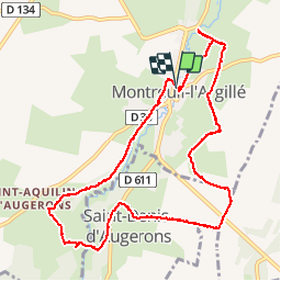
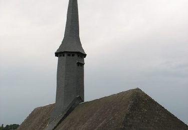
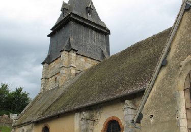
Trail Walking of 10.3 km to be discovered at Normandy, Eure, Montreuil-l'Argillé. This trail is proposed by FROIDMONT.

Description

Départ Mairie

Elevation profile

Positioning

Country:
France
Region :
Normandy
Department/Province :
Eure
Municipality :
Montreuil-l'Argillé
Location:
Unknown
Start:(UTM)
315538 ; 5423754 (31U) N.

Trails nearby

Trail Walking Montreuil-l'Argillé - autour de Montreuil l argilleé - Photo
Walking
ymarvin

Walking

Very easy
Montreuil-l'Argillé, Normandy, Eure, France
5.3 km | 6.2 km-effort
1h 11min
Yes
Trail Walking La Trinité-de-Réville - la trinite de Reville  - Photo
Walking
ymarvin

Walking

Medium
La Trinité-de-Réville, Normandy, Eure, France
9.8 km | 12 km-effort
2h 3min
Yes
Trail Walking La Goulafrière - Circuit de la Grande Vallée  -  La Goulafrière  - Photo
Walking
tracegps

Walking

Medium
La Goulafrière, Normandy, Eure, France
11.2 km | 13.1 km-effort
2h 45min
Yes
Trail Walking Saint-Agnan-de-Cernières - Boucle des Cernières  -  Saint-Agnan de Cernières - Photo
Walking
tracegps

Walking

Easy
Saint-Agnan-de-Cernières, Normandy, Eure, France
14.3 km | 15.8 km-effort
1h 0min
Yes
Trail Cycle Montreuil-l'Argillé - Boucle des mottes féodales  -  Montreuil-l'Argillé - Photo
Cycle
tracegps

Cycle

Difficult
Montreuil-l'Argillé, Normandy, Eure, France
24 km | 27 km-effort
1h 30min
Yes
Trail Walking Saint-Agnan-de-Cernières - Saint Agnan de Cernières 27 - Photo
Walking
DranoelNiala

Walking

Medium
Saint-Agnan-de-Cernières, Normandy, Eure, France
8.1 km | 10.2 km-effort
2h 18min
Yes
Trail Walking La Trinité-de-Réville - la trinité de réville - Photo
Walking
werth

Walking

Medium
La Trinité-de-Réville, Normandy, Eure, France
9.7 km | 11.7 km-effort
2h 50min
Yes
Trail Walking Montreuil-l'Argillé - Montreuil L'Argillė - Photo
Walking
DranoelNiala

Walking

Medium
Montreuil-l'Argillé, Normandy, Eure, France
9.2 km | 10.8 km-effort
2h 20min
Yes
Trail On foot La Folletière-Abenon - Les Sources de l'Orbiquet - Photo
On foot
PRO

On foot

Easy
La Folletière-Abenon, Normandy, Calvados, France
3.7 km | 4.4 km-effort
59min
No


Close
My subscriptions