


Devoluy Chamousset

c.gourme
User
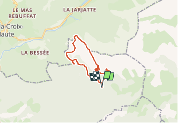

Length
12.7 km

Max alt
2081 m

Uphill gradient
849 m
Km-Effort
24 km

Min alt
1321 m

Downhill gradient
846 m
Boucle
Yes
Creation date :
2023-05-23 06:53:25.0
Updated on :
2023-05-23 19:26:13.543
5h10
Difficulty : Medium

FREE GPS app for hiking
 SityTrail
IGN / Geographical institutes
SityTrail Plus
The world is yours!
About
Trail Walking of 12.7 km to be discovered at Provence-Alpes-Côte d'Azur, Hautes-Alpes, Saint-Julien-en-Beauchêne. This trail is proposed by c.gourme.
Description
Essayer en prenant dans l’autre sens de découvrir le chemin qui mène directement à la Serre Sambue
Positioning
Country:
France
Region :
Provence-Alpes-Côte d'Azur
Department/Province :
Hautes-Alpes
Municipality :
Saint-Julien-en-Beauchêne
Location:
Unknown
Start:(Dec)
Start:(UTM)
719985 ; 4946409 (31T) N.
Comments