


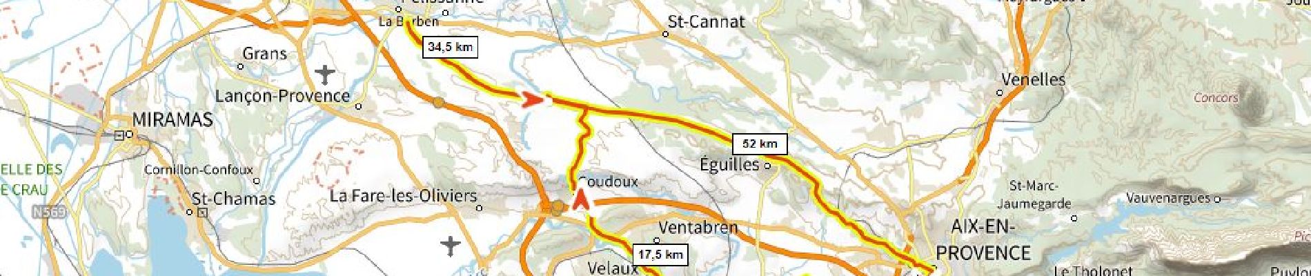
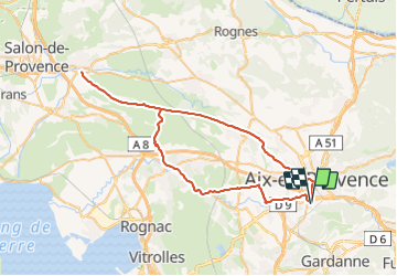
Aix Pelissanne 700m+

ericberlin
User

Length
66 km

Max alt
306 m

Uphill gradient
696 m
Km-Effort
75 km

Min alt
59 m

Downhill gradient
697 m
Boucle
Yes
Creation date :
2023-07-31 13:31:33.754
Updated on :
2023-07-31 13:39:29.165
4h33
Difficulty : Very difficult

FREE GPS app for hiking
 SityTrail
IGN / Geographical institutes
SityTrail Plus
The world is yours!
About
Trail Road bike of 66 km to be discovered at Provence-Alpes-Côte d'Azur, Bouches-du-Rhône, Aix-en-Provence. This trail is proposed by ericberlin.
Description
2023-07-30 avec Hélène.
Tres roulant, calme, cote au dessus de Coudoux
Photos

Positioning
Country:
France
Region :
Provence-Alpes-Côte d'Azur
Department/Province :
Bouches-du-Rhône
Municipality :
Aix-en-Provence
Location:
Unknown
Start:(Dec)
Start:(UTM)
697327 ; 4820009 (31T) N.
Comments