Trail Walking Rochefort - Mont-Gauthier adeps - Photo

Mont-Gauthier adeps

© OpenStreetMap contributors
Length
Length
13 km
Max alt
Max alt
309 m
Uphill gradient
Uphill gradient
273 m
Km-Effort
Km-Effort  
16.6 km
Min alt
Min alt
169 m
Downhill gradient
Downhill gradient
273 m
Boucle
Boucle
Yes
Creation date :
2015-02-08 00:00:00.0
Updated on :
2015-02-08 00:00:00.0

(3 Reviews)

Walking
Walking
3h32
Difficulty : Medium

Scan this QR Code to open this trail in the SityTrail application

FREE GPS app for hiking

Logo SityTrail SityTrail

IGN / Geographical institutes

Download SityTrail from the App Store Download SityTrail from Google Play

Logo SityTrail SityTrail World

The world is yours!

Download SityTrail from the App Store Download SityTrail from Google Play Download SityTrail on Huawei AppGallery

About

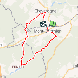
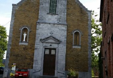
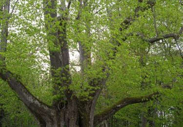
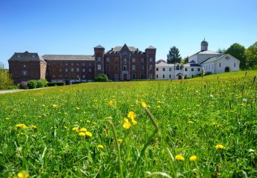
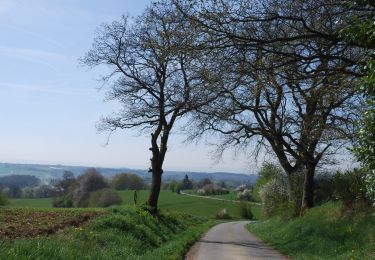
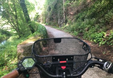
Trail Walking of 13 km to be discovered at Wallonia, Namur, Rochefort. This trail is proposed by lorenzonerol.

Elevation profile

Positioning

Country:
Belgium
Region :
Wallonia
Department/Province :
Namur
Municipality :
Rochefort
Location:
Mont-Gauthier
Start:(UTM)
651440 ; 5564061 (31U) N.

Comments

Please log in to post a review or rate the element


Attention promenade hors sentiers et passage difficile sur une poutre et ensuite passage difficile dû au fil de fer barbelé.


super belle ballade ! je l'ai faite le 15 octobre par une magnifique matinée ensoleillée. Attention, à cette saison, il vaut mieux avoir des bottes ou, au moins, de tres bonnes chaussures ... C'est très boueux et il y a une rivière à traverser sans pont ni gué ?? .


Il me semble que lorsqu'on propose un itinéraire qui comporte des passages hors piste et des franchissements de rivière à gué, la moindre des choses est de nous en avertir. Cela permettra d'éviter de nombreuses minutes à chercher un chemin qui n'existe pas et de se retrouver devant une Iwoigne inguéable à cause des pluies torrentielles de la semaine passée.


Trails nearby

Trail Walking Ciney - CINEY- Chevetogne- Promenade de l'Ywoigne - Photo
Walking
PRO

Walking

Very easy
(9)
Ciney, Wallonia, Namur, Belgium
5 km | 6.5 km-effort
1h 22min
Yes
Trail Walking Ciney - CINEY- Chevetogne- Promenade du Tige de Ronvaux - Photo
Walking
PRO

Walking

Medium
(6)
Ciney, Wallonia, Namur, Belgium
10.5 km | 13.2 km-effort
2h 50min
Yes
Trail Walking Houyet - Balade à Ciergnon. - Photo
Walking
GUIDE
Desrumaux

Walking

Very easy
(3)
Houyet, Wallonia, Namur, Belgium
10.8 km | 14 km-effort
4h 44min
Yes
Trail Walking Ciney - chevetogne ac 2 - Photo
Walking
colsonandre

Walking

Easy
(1)
Ciney, Wallonia, Namur, Belgium
9.7 km | 12.2 km-effort
3h 19min
Yes
Trail Walking Ciney - CHEVETOGNE (village) - Photo
Walking
GerardBouche

Walking

Easy
(3)
Ciney, Wallonia, Namur, Belgium
10.4 km | 12.5 km-effort
2h 43min
Yes
Trail Walking Ciney - CINEY- Conjoux- Promenade du Tilleul de Conjoux - Photo
Walking
PRO

Walking

Very easy
(5)
Ciney, Wallonia, Namur, Belgium
8.5 km | 10.8 km-effort
2h 22min
Yes
Trail On foot Ciney - Promenade de l'Ywoigne - Photo
On foot
GUIDE+

On foot

Easy
Ciney, Wallonia, Namur, Belgium
5 km | 6.5 km-effort
1h 28min
Yes
Trail On foot Ciney - Promenade du Tige de Ronvaux - Photo
On foot
GUIDE+

On foot

Easy
(1)
Ciney, Wallonia, Namur, Belgium
9.9 km | 12.4 km-effort
2h 49min
Yes
Trail On foot Houyet - Collyre - Photo
On foot
GUIDE+

On foot

Easy
Houyet, Wallonia, Namur, Belgium
9.2 km | 10.9 km-effort
2h 28min
Yes


Close
My subscriptions