Trail Mountain bike Ciron - St.Antoine-St.Paterne-St.Antoine- 45,3 KM -Le 17 Février 2015 - Auteur tintin37 - Photo

St.Antoine-St.Paterne-St.Antoine- 45,3 KM -Le 17 Février 2015 - Auteur tintin37

© OpenStreetMap contributors
Length
Length
154 km
Max alt
Max alt
156 m
Uphill gradient
Uphill gradient
1310 m
Km-Effort
Km-Effort  
171 km
Min alt
Min alt
41 m
Downhill gradient
Downhill gradient
1312 m
Boucle
Boucle
No
Creation date :
2015-02-17 00:00:00.0
Updated on :
2015-02-17 00:00:00.0

(0 Reviews)

Mountain bike
Mountain bike
2h12
Difficulty : Medium

Scan this QR Code to open this trail in the SityTrail application

FREE GPS app for hiking

Logo SityTrail SityTrail

IGN / Geographical institutes

Download SityTrail from the App Store Download SityTrail from Google Play

Logo SityTrail SityTrail World

The world is yours!

Download SityTrail from the App Store Download SityTrail from Google Play Download SityTrail on Huawei AppGallery

About

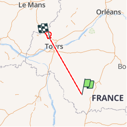
Trail Mountain bike of 154 km to be discovered at Centre-Loire Valley, Indre, Ciron. This trail is proposed by Martinjeanclaude.

Description

St.Antoine du Rocher-Semblancay-Neuillé Pont Pierre-La Roche Racan-Neuvy le Roi-Lencloitre-St.Antoine , Boucle fait uniquement par la route

Elevation profile

Positioning

Country:
France
Region :
Centre-Loire Valley
Department/Province :
Indre
Municipality :
Ciron
Location:
Unknown
Start:(UTM)
371853 ; 5168255 (31T) N.

Trails nearby

Trail Road bike Rivarennes - dondon rivarenne - Photo
Road bike
mib65

Road bike

Very difficult
Rivarennes, Centre-Loire Valley, Indre, France
68 km | 80 km-effort
4h 12min
Yes


Close
My subscriptions