


SGR KUST

Ronalddef
User
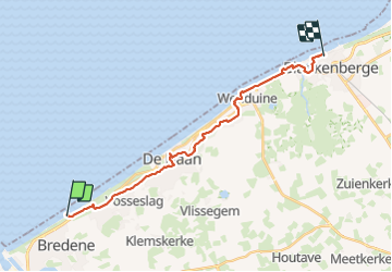

Length
18.4 km

Max alt
20 m

Uphill gradient
123 m
Km-Effort
20 km

Min alt
-2 m

Downhill gradient
111 m
Boucle
No
Creation date :
2023-12-12 09:54:14.134
Updated on :
2023-12-12 15:18:48.705
3h50
Difficulty : Very difficult

FREE GPS app for hiking
 SityTrail
IGN / Geographical institutes
SityTrail Plus
The world is yours!
About
Trail Walking of 18.4 km to be discovered at Flanders, West Flanders, Bredene. This trail is proposed by Ronalddef.
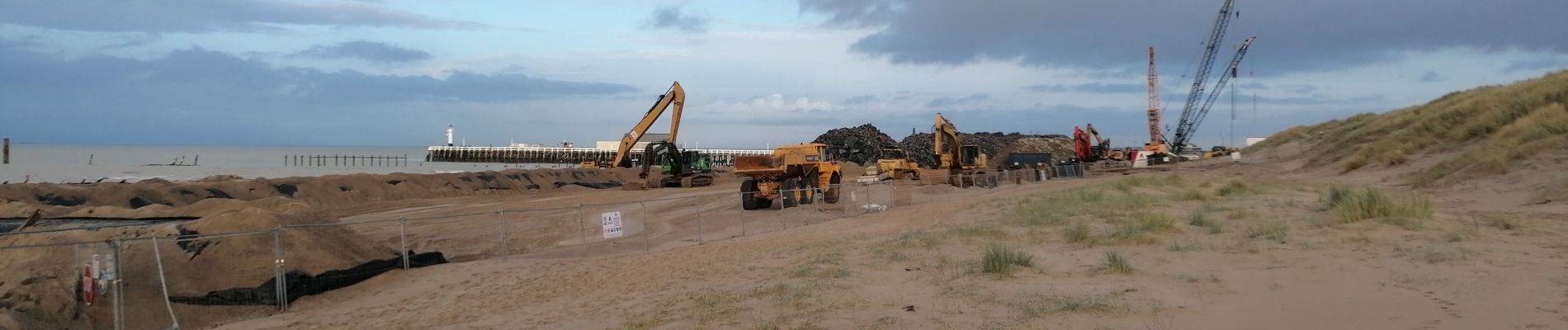
Photos


Positioning
Country:
Belgium
Region :
Flanders
Department/Province :
West Flanders
Municipality :
Bredene
Location:
Unknown
Start:(Dec)
Start:(UTM)
497609 ; 5677934 (31U) N.
Comments