


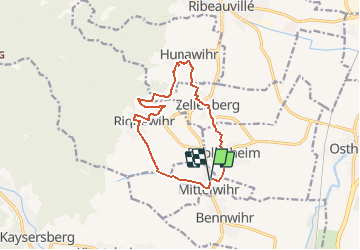

17.1 km | 25 km-effort


User


FREE GPS app for hiking
 SityTrail
IGN / Geographical institutes
SityTrail World
The world is yours!
Trail Walking of 11.5 km to be discovered at Grand Est, Haut-Rhin, Mittelwihr. This trail is proposed by MIFE68.
Départ Parking de l'hôtel "MandelBerg".
Prendre le chemin du Mandelberg.
A Beblenheim descendre vers la poste et rejoindre le sentier des grands crus vers le Sonnenglantz.
A Zellenberg, juste avant l'auberge du Frohn, monter les escaliers et passer derriere l'église. Descendre vers la route des vinspar la route d'Ostheim. A laroute des vins prendre à gauche le chemin qui mène au etablissement Fuchs (fut au croisement). Au bout de la rue prendre à gauche le chemin de Kronenbourg ensuite à gauche puis à droite, entrer dans le vignoble...
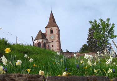
A Hunawihr, admirer la fontaine de Sainte Hune et le lavoir (pause possible), monter à l'église fortifiée.
Après la sortie de l'église St-Jacques le majeur, immédiatement à gauche emprunter un passage entre le presbytere et le numéro 14 de la rue de l'Eglise et monter dans le vignoble par le Hartweg. A l'intersection aller tout droit jusqu'au réservoir.

Walking

Mountain bike
Walking
Horseback riding

Walking
Horseback riding

Walking

Walking
Walking