


jo et Joëlle

bernir
User
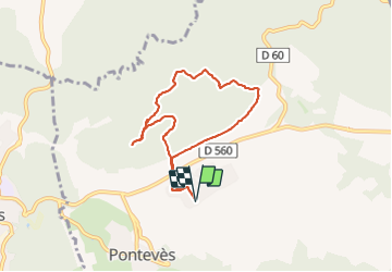

Length
7.3 km

Max alt
429 m

Uphill gradient
126 m
Km-Effort
9 km

Min alt
333 m

Downhill gradient
125 m
Boucle
Yes
Creation date :
2023-12-29 13:45:57.862
Updated on :
2024-01-03 10:47:46.995
2h02
Difficulty : Medium

FREE GPS app for hiking
 SityTrail
IGN / Geographical institutes
SityTrail Plus
The world is yours!
About
Trail Walking of 7.3 km to be discovered at Provence-Alpes-Côte d'Azur, Var, Pontevès. This trail is proposed by bernir.
Positioning
Country:
France
Region :
Provence-Alpes-Côte d'Azur
Department/Province :
Var
Municipality :
Pontevès
Location:
Unknown
Start:(Dec)
Start:(UTM)
260918 ; 4827238 (32T) N.
Comments