Trail Other activity Finhaut - bdx005_0627 - Photo

Optez pour le retour à la nature GUIDE+

© OpenStreetMap contributors
Length
Length
3.7 km
Max alt
Max alt
2021 m
Uphill gradient
Uphill gradient
11 m
Km-Effort
Km-Effort  
6.8 km
Min alt
Min alt
1132 m
Downhill gradient
Downhill gradient
888 m
Boucle
Boucle
No
Creation date :
2016-03-09 00:00:00.0
Updated on :
2016-03-09 00:00:00.0

(0 Reviews)

Other activity
Other activity
1h01
Difficulty : Unknown

Scan this QR Code to open this trail in the SityTrail application

FREE GPS app for hiking

Logo SityTrail SityTrail

IGN / Geographical institutes

Download SityTrail from the App Store Download SityTrail from Google Play

Logo SityTrail SityTrail World

The world is yours!

Download SityTrail from the App Store Download SityTrail from Google Play Download SityTrail on Huawei AppGallery

About

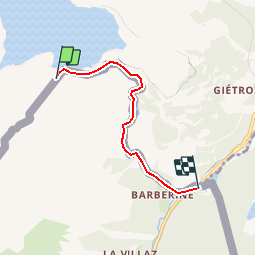
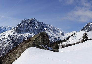
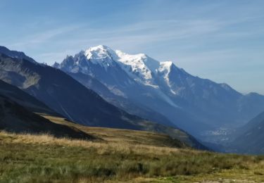
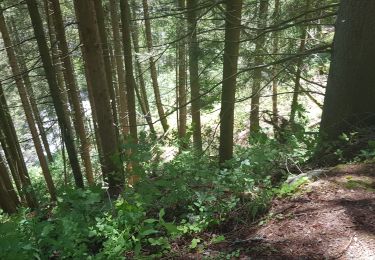
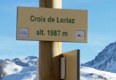
Trail Other activity of 3.7 km to be discovered at Valais/Wallis, Saint-Maurice, Finhaut. This trail is proposed by My Switzerland.

Elevation profile

Positioning

Country:
Switzerland
Region :
Valais/Wallis
Department/Province :
Saint-Maurice
Municipality :
Finhaut
Location:
Unknown
Start:(UTM)
339393 ; 5103279 (32T) N.

Trails nearby

Trail Walking Vallorcine - Le Buet - Vallorcine - Photo
Walking
tracegps

Walking

Difficult
(1)
Vallorcine, Auvergne-Rhône-Alpes, Upper Savoy, France
9 km | 27 km-effort
7h 0min
No
Trail Winter sports Vallorcine - vers Finhaut - Photo
Winter sports
fpitance

Winter sports

Medium
(1)
Vallorcine, Auvergne-Rhône-Alpes, Upper Savoy, France
22 km | 40 km-effort
5h 0min
No
Trail Touring skiing Finhaut - pointe de la terrasse  - Photo
Touring skiing
carton-fils@orange.fr

Touring skiing

Very easy
Finhaut, Valais/Wallis, Saint-Maurice, Switzerland
8.7 km | 19 km-effort
3h 14min
No
Trail Walking Vallorcine - téléphérique Vallorcine,col de Balme,aiguillettes des Posettes Montroc - Photo
Walking
marianne guichoux

Walking

Easy
Vallorcine, Auvergne-Rhône-Alpes, Upper Savoy, France
11.2 km | 19.4 km-effort
3h 28min
No
Trail On foot Vallorcine - Chemin des Diligences - Photo
On foot
PRO

On foot

Easy
Vallorcine, Auvergne-Rhône-Alpes, Upper Savoy, France
8.1 km | 11.1 km-effort
2h 32min
Yes
Trail On foot Vallorcine - Chalet de Loriaz - Photo
On foot
PRO

On foot

Medium
Vallorcine, Auvergne-Rhône-Alpes, Upper Savoy, France
13.6 km | 26 km-effort
5h 55min
Yes
Trail Walking Chamonix-Mont-Blanc - CHAMONIX ... Col de Balme & Aiguillettes des Posettes. - Photo
Walking
GerardBouche

Walking

Difficult
Chamonix-Mont-Blanc, Auvergne-Rhône-Alpes, Upper Savoy, France
10.3 km | 17.2 km-effort
3h 26min
No
Trail Walking Vallorcine - Vallorcine a la cascade de Barberine - Photo
Walking
Marie-Claire-mcp

Walking

Very easy
Vallorcine, Auvergne-Rhône-Alpes, Upper Savoy, France
6.6 km | 9.4 km-effort
2h 8min
Yes
Trail Walking Vallorcine - CHAMONIX (Chalet de Loriaz)  - Photo
Walking
GerardBouche

Walking

Medium
Vallorcine, Auvergne-Rhône-Alpes, Upper Savoy, France
10.6 km | 19.8 km-effort
4h 1min
Yes


Close
My subscriptions