


Ginoles incomplet

elexine23
User

Length
61 km

Max alt
868 m

Uphill gradient
3508 m
Km-Effort
109 km

Min alt
75 m

Downhill gradient
3880 m
Boucle
No
Creation date :
2024-04-07 07:19:53.422
Updated on :
2024-04-10 10:21:23.68
5h27
Difficulty : Difficult

FREE GPS app for hiking
 SityTrail
IGN / Geographical institutes
SityTrail Plus
The world is yours!
About
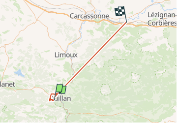
Trail Walking of 61 km to be discovered at Occitania, Aude, Ginoles. This trail is proposed by elexine23.
Description
Manque la fin depuis le belvédère du nez de l'homme jusqu'au retour au village de Ginoles
Positioning
Country:
France
Region :
Occitania
Department/Province :
Aude
Municipality :
Ginoles
Location:
Unknown
Start:(Dec)
Start:(UTM)
430734 ; 4746437 (31T) N.
Comments