Trail Walking Sion - Bisse de Lentine 04.2015 - Photo

Bisse de Lentine 04.2015

 duamerg
duamerg

User

© OpenStreetMap contributors
Length
Length
9.3 km
Max alt
Max alt
807 m
Uphill gradient
Uphill gradient
246 m
Km-Effort
Km-Effort  
12.6 km
Min alt
Min alt
646 m
Downhill gradient
Downhill gradient
246 m
Boucle
Boucle
Yes
Creation date :
2015-04-08 00:00:00.0
Updated on :
2020-01-30 13:56:59.336

(0 Reviews)

Walking
Walking
2h51
Difficulty : Easy

Scan this QR Code to open this trail in the SityTrail application

FREE GPS app for hiking

Logo SityTrail SityTrail

IGN / Geographical institutes

Download SityTrail from the App Store Download SityTrail from Google Play

Logo SityTrail SityTrail World

The world is yours!

Download SityTrail from the App Store Download SityTrail from Google Play Download SityTrail on Huawei AppGallery

About

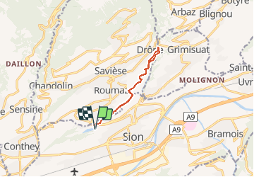
Trail Walking of 9.3 km to be discovered at Valais/Wallis, Sion, Sion. This trail is proposed by duamerg.

Description

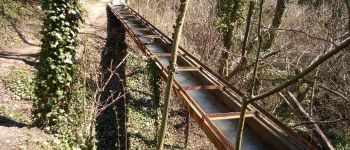
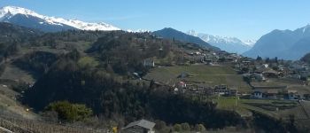
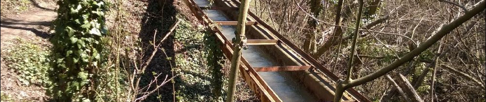
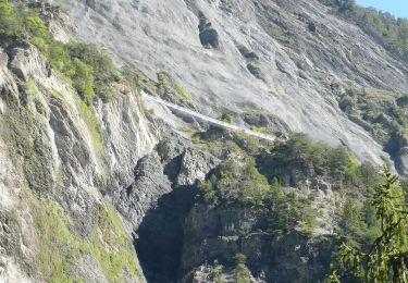
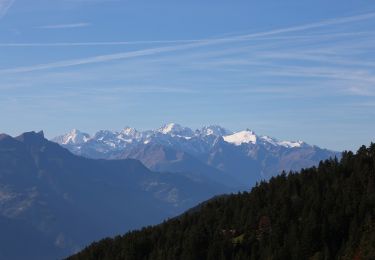
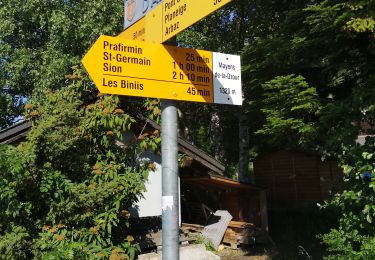
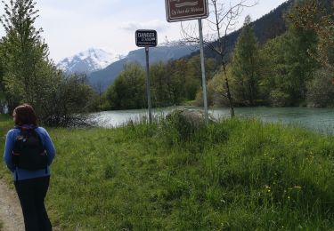
Places de parc au lac du Mont d'Orge. Suivre les panneaux indicateurs. Le bisse est en partie dans des tuyaux. La ballade nous mène jusqu'à la prise d'eau. Jolie ballade à faire au printemps. Vue magnifique sur les alpes. Panneaux informatifs sur les travaux de la vigne. Profitez de faire encore le tour du lac (15min.)

Elevation profile

Photos

Points of interest

Point of interest Savièse - chenaux en métal - Photo
duamerg
Point of interest Savièse - vue magnifique - Photo
duamerg
SAVIÈSE 

Positioning

Country:
Switzerland
Region :
Valais/Wallis
Department/Province :
Sion
Municipality :
Sion
Location:
Sion
Start:(UTM)
372033 ; 5121339 (32T) N.

Comments

Please log in to post a review or rate the element


sion 12 qvrol2015


Trails nearby

Trail On foot Savièse - Bisse de Savièse (Torrent-Neuf) - Photo
On foot
PRO

On foot

Easy
Savièse, Valais/Wallis, Sion, Switzerland
4.5 km | 7.4 km-effort
1h 41min
No
Trail Walking Sion -  - Photo
Walking
npannatier

Walking

Very easy
(1)
Sion, Valais/Wallis, Sion, Switzerland
7.4 km | 9.6 km-effort
Unknown
No
Trail Walking Savièse - Mayen de la Zour-Prabé - Photo
Walking
lroux

Walking

Very easy
(1)
Savièse, Valais/Wallis, Sion, Switzerland
3.8 km | 10.3 km-effort
Unknown
No
Trail On foot Conthey - Bisse de la Tsandra - Photo
On foot
PRO

On foot

Easy
Conthey, Valais/Wallis, Conthey, Switzerland
7.4 km | 10.5 km-effort
2h 23min
No
Trail Nordic walking Arbaz - Grimisuat  - Photo
Nordic walking
suzanne.bron

Nordic walking

Very easy
Arbaz, Valais/Wallis, Sion, Switzerland
3.6 km | 4.8 km-effort
1h 1min
No
Trail Walking Sion - Tour du Massif des Muverans - Photo
Walking
illustre

Walking

Very easy
Sion, Valais/Wallis, Sion, Switzerland
6.2 km | 14.1 km-effort
22h 11min
No
Trail Nordic walking Arbaz - mayens de la Zour  - Photo
Nordic walking
suzanne.bron

Nordic walking

Very easy
Arbaz, Valais/Wallis, Sion, Switzerland
7.9 km | 12.2 km-effort
2h 36min
Yes
Trail Nordic walking Savièse - bini  - Photo
Nordic walking
suzanne.bron

Nordic walking

Very easy
Savièse, Valais/Wallis, Sion, Switzerland
8.9 km | 12.2 km-effort
2h 59min
No
Trail Nordic walking Arbaz - bisse d'Ayen  - Photo
Nordic walking
suzanne.bron

Nordic walking

Very easy
Arbaz, Valais/Wallis, Sion, Switzerland
6.7 km | 9.6 km-effort
2h 14min
Yes


Close
My subscriptions