


lobbes Zoning Randonnée lapin de nordique

jackcox
User
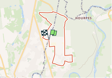

Length
7 km

Max alt
198 m

Uphill gradient
78 m
Km-Effort
8 km

Min alt
149 m

Downhill gradient
78 m
Boucle
Yes
Creation date :
2024-05-19 14:36:48.749
Updated on :
2024-05-19 14:38:53.865
0m
Difficulty : Very easy

FREE GPS app for hiking
 SityTrail
IGN / Geographical institutes
SityTrail Plus
The world is yours!
About
Trail Nordic walking of 7 km to be discovered at Wallonia, Hainaut, Thuin. This trail is proposed by jackcox.
Positioning
Country:
Belgium
Region :
Wallonia
Department/Province :
Hainaut
Municipality :
Thuin
Location:
Unknown
Start:(Dec)
Start:(UTM)
591301 ; 5579440 (31U) N.
Comments