


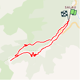


6.3 km | 13.6 km-effort

User


FREE GPS app for hiking
 SityTrail
IGN / Geographical institutes
SityTrail World
The world is yours!
Trail Walking of 8.4 km to be discovered at Occitania, Ariège, Couflens. This trail is proposed by patricklecetre.
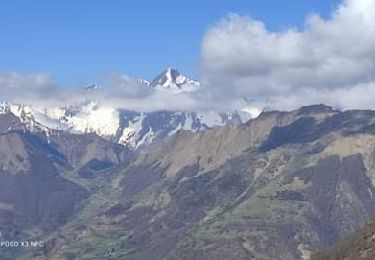
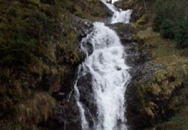
Grand comme trois fois la ville de Paris, le Haut-Couserans se situe au coeur des Pyrénées Ariègeoises à 1h30 de Toulouse. Son environnement naturel et bâtit exceptionnellement préservé, variant de 463m à 2865m, est à découvrir. La Lanette. Vue sur la haute vallée du Salat. Vestiges d'une exploitation forestière du début du XXieme siècle qui transportait le bois de la forêt de Bonnabé en Espagne jusqu'à Salau. . De Seix, prendre la direction Salau/ Guzet Neige. Rentrer dans Salau et franchir le torrent des Cougnets. Arrêt en face du café des Myrtilles.


Walking

Walking
Walking

Walking

Mountain bike

Walking

Walking