


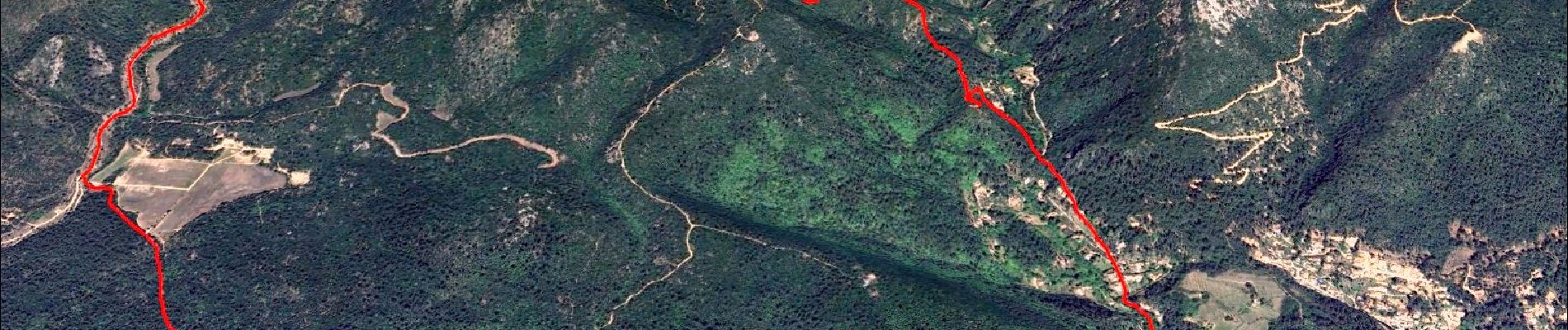
Pont du diable, la cascade du Latay et la chapelle Châteauvieux

affinetataille
User GUIDE
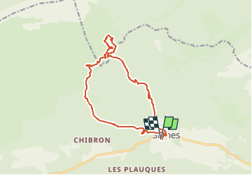

Length
15.8 km

Max alt
712 m

Uphill gradient
552 m
Km-Effort
23 km

Min alt
336 m

Downhill gradient
552 m
Boucle
Yes
Creation date :
2024-10-05 08:54:27.254
Updated on :
2025-06-06 17:53:54.406
6h00
Difficulty : Medium

FREE GPS app for hiking
 SityTrail
IGN / Geographical institutes
SityTrail Plus
The world is yours!
About
Trail Walking of 15.8 km to be discovered at Provence-Alpes-Côte d'Azur, Var, Signes. This trail is proposed by affinetataille.
Photos


28 photos in total. Please click on a photo to see them all in the gallery.
Positioning
Country:
France
Region :
Provence-Alpes-Côte d'Azur
Department/Province :
Var
Municipality :
Signes
Location:
Unknown
Start:(Dec)
Start:(UTM)
732123 ; 4796929 (31T) N.
Comments