


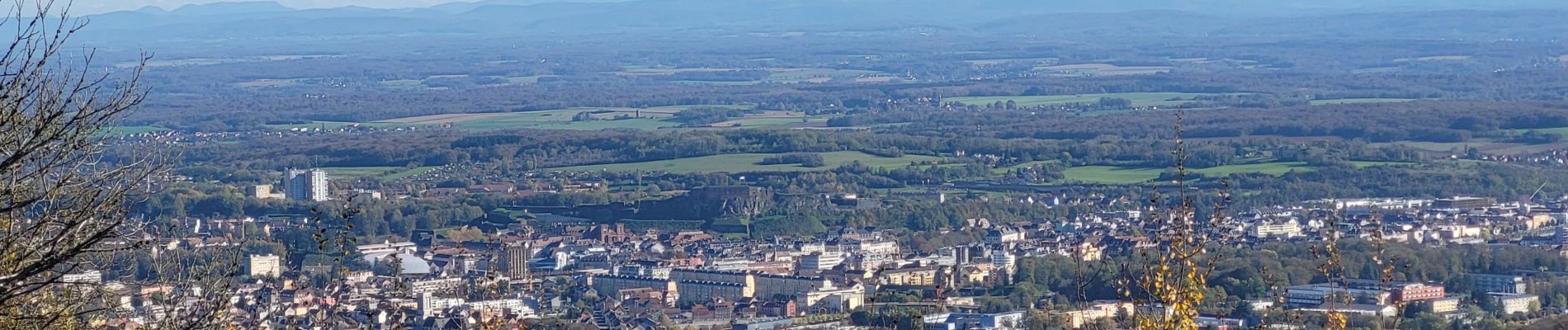
VTT - Châlonvillars - Salbert - Etang des Forges - Fort de Giromagny - Malsaucy

Bart2015
User
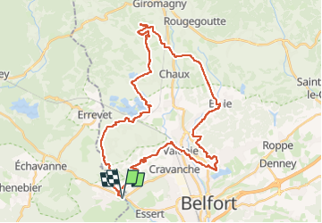

Length
41 km

Max alt
641 m

Uphill gradient
783 m
Km-Effort
52 km

Min alt
363 m

Downhill gradient
783 m
Boucle
Yes
Creation date :
2024-10-28 12:50:45.897
Updated on :
2024-10-31 10:20:43.193
3h26
Difficulty : Medium

FREE GPS app for hiking
 SityTrail
IGN / Geographical institutes
SityTrail Plus
The world is yours!
About
Trail Electric bike of 41 km to be discovered at Bourgogne-Franche-Comté, Haute-Saône, Châlonvillars. This trail is proposed by Bart2015.
Photos


Positioning
Country:
France
Region :
Bourgogne-Franche-Comté
Department/Province :
Haute-Saône
Municipality :
Châlonvillars
Location:
Unknown
Start:(Dec)
Start:(UTM)
334527 ; 5278698 (32T) N.
Comments