Trail Other activity Fribourg - Freiburg - 101/Bourguillon/Ameismühle/Schönberg/R - Photo

101/Bourguillon/Ameismühle/Schönberg/R

© OpenStreetMap contributors
Length
Length
9.6 km
Max alt
Max alt
707 m
Uphill gradient
Uphill gradient
248 m
Km-Effort
Km-Effort  
12.9 km
Min alt
Min alt
570 m
Downhill gradient
Downhill gradient
250 m
Boucle
Boucle
Yes
Creation date :
2014-12-10 00:00:00.0
Updated on :
2014-12-10 00:00:00.0

(0 Reviews)

Other activity
Other activity
--
Difficulty : Unknown

Scan this QR Code to open this trail in the SityTrail application

FREE GPS app for hiking

Logo SityTrail SityTrail

IGN / Geographical institutes

Download SityTrail from the App Store Download SityTrail from Google Play

Logo SityTrail SityTrail World

The world is yours!

Download SityTrail from the App Store Download SityTrail from Google Play Download SityTrail on Huawei AppGallery

About

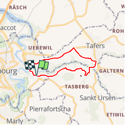
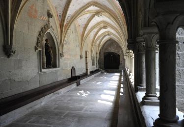
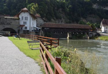
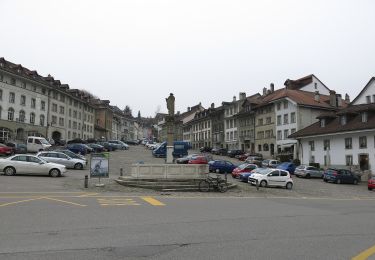
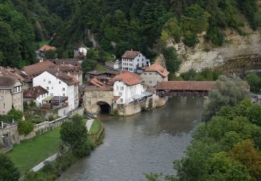
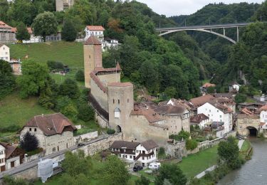
Trail Other activity of 9.6 km to be discovered at Fribourg, Sarine District, Fribourg - Freiburg. This trail is proposed by nordicmarly.

Description

Bourguillon
Bürglenholz
Hattenberg
Schürmatt
Ameismühle
Chrüz
Maggenberg
Rejoindre la route au point 662
Schönberg
Chemin des Maggenberg
Route Mgr Besson
Route Joseph Chaley
Ch. de la Tour Rouge
Route de Bourguillon Pont
Pour moyens   si le temps
Sentiers des Falaises et
Chemin du Breitfeld
Bourguillon


Bourgillon

Elevation profile

Positioning

Country:
Switzerland
Region :
Fribourg
Department/Province :
Sarine District
Municipality :
Fribourg - Freiburg
Location:
Unknown
Start:(UTM)
360776 ; 5184597 (32T) N.

Trails nearby

Trail On foot Villars-sur-Glâne - Tour des trois rivières - Photo
On foot
PRO

On foot

Easy
Villars-sur-Glâne, Fribourg, Sarine District, Switzerland
5.1 km | 7.1 km-effort
1h 36min
No
Trail On foot Hauterive (FR) - Circuit Hauterive - Photo
On foot
PRO

On foot

Easy
Hauterive (FR), Fribourg, Sarine District, Switzerland
5 km | 6.7 km-effort
1h 31min
No
Trail On foot Hauterive (FR) - Hauterive - La Tuffière - Photo
On foot
PRO

On foot

Easy
Hauterive (FR), Fribourg, Sarine District, Switzerland
5 km | 6.6 km-effort
1h 30min
No
Trail On foot Hauterive (FR) - Circuit de La Tuffière - Photo
On foot
PRO

On foot

Easy
Hauterive (FR), Fribourg, Sarine District, Switzerland
6.2 km | 8.2 km-effort
1h 52min
No
Trail On foot Hauterive (FR) - Grangeneuve - La Tuffière - Photo
On foot
PRO

On foot

Easy
Hauterive (FR), Fribourg, Sarine District, Switzerland
5 km | 6.6 km-effort
1h 29min
No
Trail On foot Fribourg - Freiburg - Bourguillon - Schürmatt - Photo
On foot
PRO

On foot

Easy
Fribourg - Freiburg, Fribourg, Sarine District, Switzerland
3.9 km | 5.5 km-effort
1h 14min
No
Trail On foot Fribourg - Freiburg - Freiburg - Fribourg (Jura) - Photo
On foot
PRO

On foot

Easy
Fribourg - Freiburg, Fribourg, Sarine District, Switzerland
3.8 km | 5.5 km-effort
1h 15min
No
Trail On foot Fribourg - Freiburg - Freiburg / Fribourg Balm / La Palme - Maggenberg - Photo
On foot
PRO

On foot

Easy
Fribourg - Freiburg, Fribourg, Sarine District, Switzerland
4.5 km | 7 km-effort
1h 35min
No
Trail On foot Fribourg - Freiburg - Schönberg - Maggenberg - Photo
On foot
PRO

On foot

Easy
Fribourg - Freiburg, Fribourg, Sarine District, Switzerland
3.8 km | 5.1 km-effort
1h 8min
No


Close
My subscriptions