


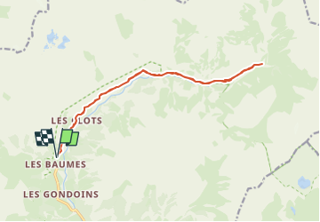
Pré de la Chaumette au départ des Baumes

frizou83
User

Length
16.2 km

Max alt
1828 m

Uphill gradient
596 m
Km-Effort
24 km

Min alt
1340 m

Downhill gradient
596 m
Boucle
Yes
Creation date :
2025-04-29 06:45:22.151
Updated on :
2025-04-29 19:10:10.632
5h29
Difficulty : Very difficult

FREE GPS app for hiking
 SityTrail
IGN / Geographical institutes
SityTrail Plus
The world is yours!
About
Trail Walking of 16.2 km to be discovered at Provence-Alpes-Côte d'Azur, Hautes-Alpes, Champoléon. This trail is proposed by frizou83.
Positioning
Country:
France
Region :
Provence-Alpes-Côte d'Azur
Department/Province :
Hautes-Alpes
Municipality :
Champoléon
Location:
Unknown
Start:(Dec)
Start:(UTM)
282147 ; 4957704 (32T) N.
Comments