


chameleux

dragonchef
User
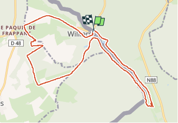

Length
11.7 km

Max alt
340 m

Uphill gradient
201 m
Km-Effort
14.4 km

Min alt
233 m

Downhill gradient
193 m
Boucle
Yes
Creation date :
2025-04-27 15:27:34.36
Updated on :
2025-05-05 19:07:35.676
2h12
Difficulty : Medium

FREE GPS app for hiking
 SityTrail
IGN / Geographical institutes
SityTrail Plus
The world is yours!
About
Trail Walking of 11.7 km to be discovered at Grand Est, Ardennes, Williers. This trail is proposed by dragonchef.
Photos


Positioning
Country:
France
Region :
Grand Est
Department/Province :
Ardennes
Municipality :
Williers
Location:
Unknown
Start:(Dec)
Start:(UTM)
666976 ; 5504286 (31U) N.
Comments