


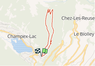


4.3 km | 6.4 km-effort


User


FREE GPS app for hiking
 SityTrail
IGN / Geographical institutes
SityTrail World
The world is yours!
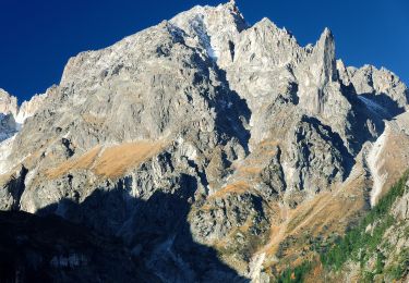
Trail Snowshoes of 3.1 km to be discovered at Valais/Wallis, Entremont, Orsières. This trail is proposed by verbier.
Parquer votre voiture vers l''hôtel Alpina d''en haut de la patinoire et suivre le sentier qui s''enfonce dans la forêt. Le parcours effecue une boucle par l''ancienne route que prenaient les diligences du 20e siècle. L''intinéraire est agrémenté de panneaux traitant de la géologie ainsi que de la faune et la folre alpine.
Ce parcours se réfère aux panneaux N°4.
On foot
On foot

On foot
On foot
On foot
Walking
Snowshoes

Walking

Walking