Trail Walking Lambesc - Chaine des Côtes - Photo
 bryss
bryss

User

© OpenStreetMap contributors
Length
Length
13.2 km
Max alt
Max alt
478 m
Uphill gradient
Uphill gradient
355 m
Km-Effort
Km-Effort  
17.9 km
Min alt
Min alt
306 m
Downhill gradient
Downhill gradient
348 m
Boucle
Boucle
Yes
Creation date :
2015-09-01 00:00:00.0
Updated on :
2015-09-01 00:00:00.0

(1 Reviews)

Walking
Walking
3h48
Difficulty : Medium

Scan this QR Code to open this trail in the SityTrail application

FREE GPS app for hiking

Logo SityTrail SityTrail

IGN / Geographical institutes

Download SityTrail from the App Store Download SityTrail from Google Play

Logo SityTrail SityTrail World

The world is yours!

Download SityTrail from the App Store Download SityTrail from Google Play Download SityTrail on Huawei AppGallery

About

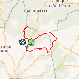
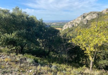
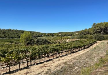
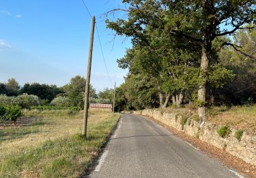
Trail Walking of 13.2 km to be discovered at Provence-Alpes-Côte d'Azur, Bouches-du-Rhône, Lambesc. This trail is proposed by bryss.

Description

Lambesc - Ste Anne de Goiron - Chaine des Côtes - hameau de Janet

Elevation profile

Positioning

Country:
France
Region :
Provence-Alpes-Côte d'Azur
Department/Province :
Bouches-du-Rhône
Municipality :
Lambesc
Location:
Unknown
Start:(UTM)
683454 ; 4838582 (31T) N.

Comments

Please log in to post a review or rate the element


Trails nearby

Trail Walking Lambesc - GB LES JARDINS  - Photo
Walking
Ghislaine Blanchet

Walking

Medium
(3)
Lambesc, Provence-Alpes-Côte d'Azur, Bouches-du-Rhône, France
5.7 km | 6.6 km-effort
1h 30min
Yes
Trail Walking Lambesc - Garachon-Beauchamp - Photo
Walking
Berpav

Walking

Medium
(1)
Lambesc, Provence-Alpes-Côte d'Azur, Bouches-du-Rhône, France
7.8 km | 9.9 km-effort
2h 8min
Yes
Trail Walking Charleval - CHAINE DES COTES CHARLEVAL - Photo
Walking
ARPF

Walking

Medium
(1)
Charleval, Provence-Alpes-Côte d'Azur, Bouches-du-Rhône, France
12.6 km | 17.9 km-effort
3h 46min
Yes
Trail Walking Charleval - Gambadous - Charleval - Photo
Walking
Taricot

Walking

Easy
(2)
Charleval, Provence-Alpes-Côte d'Azur, Bouches-du-Rhône, France
7.5 km | 10.5 km-effort
2h 13min
Yes
Trail Walking La Roque-d'Anthéron - Gambadous - La Roque d'Antheron - Photo
Walking
Taricot

Walking

Easy
(2)
La Roque-d'Anthéron, Provence-Alpes-Côte d'Azur, Bouches-du-Rhône, France
7.3 km | 10 km-effort
2h 30min
Yes
Trail Walking Rognes - Caire Val- les Costes -St Marcellin - Photo
Walking
Berpav

Walking

Medium
(1)
Rognes, Provence-Alpes-Côte d'Azur, Bouches-du-Rhône, France
8.6 km | 10.7 km-effort
2h 26min
Yes
Trail Walking Charleval - Les hauts de Charleval 13 - Photo
Walking
Dadou 1

Walking

Very easy
Charleval, Provence-Alpes-Côte d'Azur, Bouches-du-Rhône, France
9.3 km | 12.3 km-effort
3h 17min
Yes
Trail Walking Lambesc - PF-Lambesc - Garachon - Beauchamp - Chaffard - Photo
Walking
MicDul

Walking

Medium
Lambesc, Provence-Alpes-Côte d'Azur, Bouches-du-Rhône, France
8.4 km | 10.9 km-effort
2h 29min
Yes
Trail Walking Lambesc - Nord de LAMBESC - Photo
Walking
didierc13

Walking

Medium
Lambesc, Provence-Alpes-Côte d'Azur, Bouches-du-Rhône, France
10.3 km | 12.9 km-effort
1h 57min
No


Close
My subscriptions