


14.3 km | 0 m-effort


User


FREE GPS app for hiking
 SityTrail
IGN / Geographical institutes
SityTrail World
The world is yours!
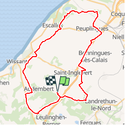
Trail Mountain bike of 36 km to be discovered at Hauts-de-France, Pas-de-Calais, Leubringhen. This trail is proposed by Baltykatt.
Départ Leubringhen.
Walking
Walking

Walking

Walking
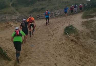
Running
Walking
On foot
On foot
Walking
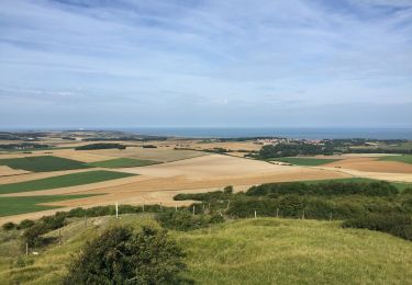
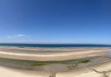
Vue magnifique sur le site des deux caps et les côtes anglaises.Difficile pour le dénivelé.