


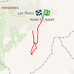

16.8 km | 30 km-effort


User


FREE GPS app for hiking
 SityTrail
IGN / Geographical institutes
SityTrail World
The world is yours!
Trail Walking of 10 km to be discovered at Vaud, District d'Aigle, Bex. This trail is proposed by rpf.
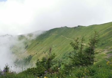
Sous les parois rocheuses des Muverans et de la Dent de Morcles... Une réserve naturelle... un jardin alpin, la Thomasia... Des ruisseaux, des pierriers, des forêts, une riche végétation... Tous les ingrédients pour une journée réussie !
Une balade de " www.toprando.ch "
Walking

Walking
Walking

Mountain bike

Running
Running
Walking
Walking
Walking