Trail Walking Longpont - en foret de Retz_ 41_Longpont_Vertes Feuilles_AR - Photo

en foret de Retz_ 41_Longpont_Vertes Feuilles_AR

forêts de France

© OpenStreetMap contributors
Length
Length
26 km
Max alt
Max alt
203 m
Uphill gradient
Uphill gradient
387 m
Km-Effort
Km-Effort  
31 km
Min alt
Min alt
82 m
Downhill gradient
Downhill gradient
389 m
Boucle
Boucle
Yes
Creation date :
2017-03-06 00:00:00.0
Updated on :
2020-11-08 11:57:11.063

(0 Reviews)

Walking
Walking
8h31
Difficulty : Very difficult

Scan this QR Code to open this trail in the SityTrail application

FREE GPS app for hiking

Logo SityTrail SityTrail

IGN / Geographical institutes

Download SityTrail from the App Store Download SityTrail from Google Play

Logo SityTrail SityTrail World

The world is yours!

Download SityTrail from the App Store Download SityTrail from Google Play Download SityTrail on Huawei AppGallery

About

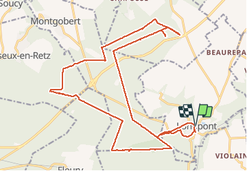
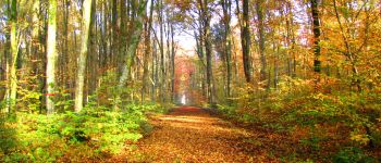
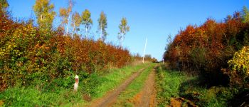
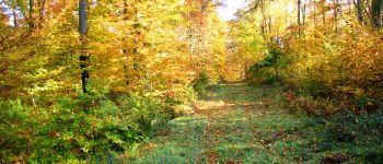
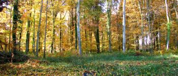
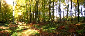
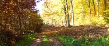
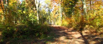
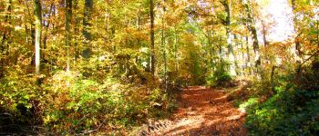
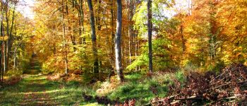
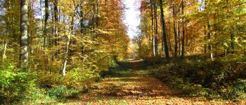
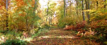
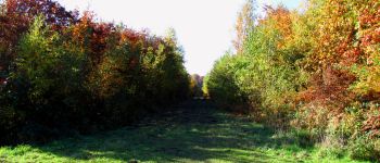
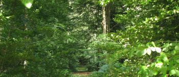
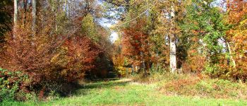
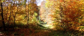
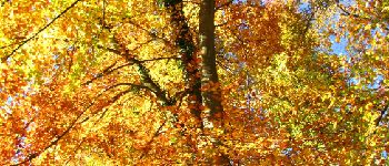
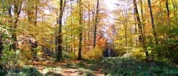
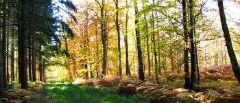
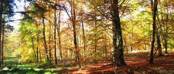
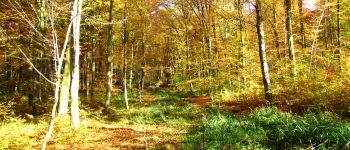
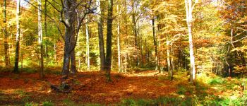
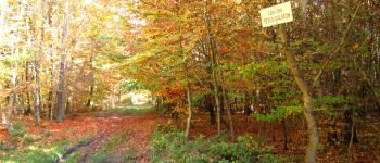
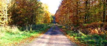
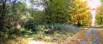
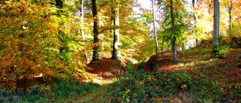
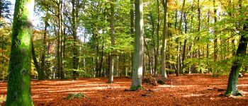
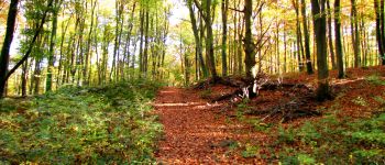
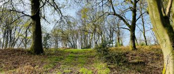
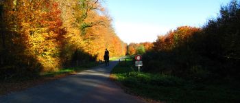
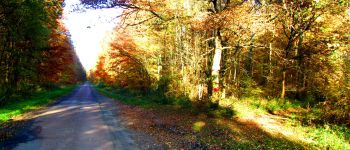
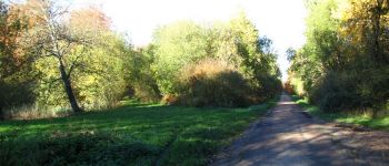
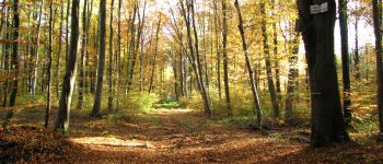
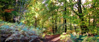
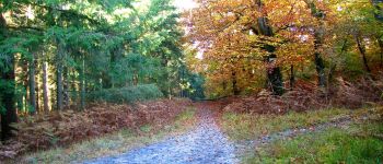
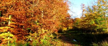
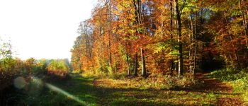
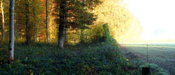
Trail Walking of 26 km to be discovered at Hauts-de-France, Aisne, Longpont. This trail is proposed by en forêt de Retz.

Description

voir aussi:
http://foret-de-retz.over-blog.com/

10/2015

batterie pour iphone indispensable.
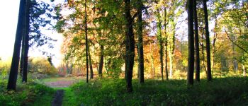
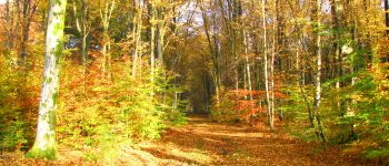
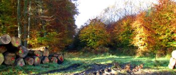
Rando très difficile car forêt détrempée par endroit. La route Chrétiennette et la laie  du Translon sur Vertes Feuilles sont en partie retournées par les sangliers. Du labour!

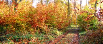
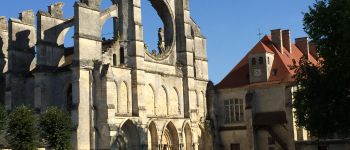
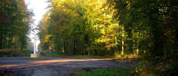
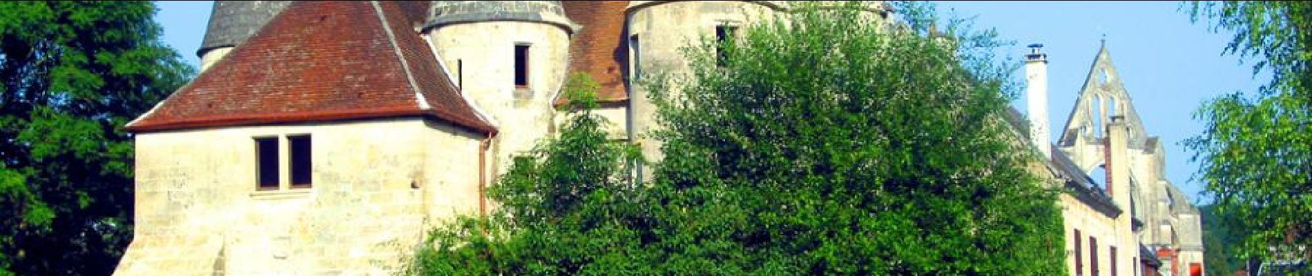
Au départ de l'abbaye de Longpont, suivre le GR11A aux "trois maisons" (photos du château). Rejoindre le vieux  chemin de Longpont et prendre à droite au carrefour Gaudrillard la laie de la Croix Pain Tendre jusqu'au carrefour du Hibou. Prendre la route de Vauvaudran, traverser la N2 et au carrefour d'Aumale, prendre à droite la laie du Translon jusqu'au carrefour du Fond d'Argent. Prendre à droite jusqu'à la N2 et revenir au carrefour d'Aumale. Reprendre à droite la laie du Translon. Au carrefour suivant, prendre à droite la "laie des Vertes Feuilles à Saint Pierre" jusqu'à la N2. Revenir sur ses pas et suivre la "laie des Vertes Feuilles à Saint Pierre" jusqu'au carrefour avec la route Chrétiennette. La suivre jusqu'au carrefour du Grand Veneur. Prendre à gauche la Route Droite jusqu'aux carrefour des Tombes. Prendre à droite la laie Amélie jusqu'au carrefour de la Beauve. Suivre à gauche la laie de la Mare Pavée jusqu'au carrefour des Cailloutis. Prendre à droite la Route du Mur du Parc jusqu'au carrefour des Têtes Salmon. Prendre le chemin à gauche en montant, traverser le carrefour de la Mare puis le bio-pont sur la N2. Continuer la laie des Monthieux jusqu'au carrefour de Chavigny. Prendre à droite la route des Chamarts jusqu'au carrefour de la Croix Bacquet. Suivre le vieux chemin de Longpont jusqu'au carrefour avec la route du Pendu. Suivre la route du Pendu jusqu'au carrefour du Pendu. Prendre à gauche la laie de la Croix Pain Tendre jusqu'au carrefour Gaudrillard. Suivre à droite le vieux chemin de Longpont jusqu'à la D2 et revenir à Longpont.

Elevation profile

Points of interest

Point of interest Montgobert - Point 3 - Photo
JeanLucA4
MONTGOBERT 
Point of interest Montgobert - Point 4 - Photo
JeanLucA4
MONTGOBERT 
Point of interest Montgobert - Point 5 - Photo
JeanLucA4
MONTGOBERT 
Point of interest Montgobert - Point 6 - Photo
JeanLucA4
MONTGOBERT 
Point of interest Montgobert - Point 7 - Photo
JeanLucA4
MONTGOBERT 
Point of interest Montgobert - Point 8 - Photo
JeanLucA4
MONTGOBERT 
Point of interest Montgobert - Point 9 - Photo
JeanLucA4
MONTGOBERT 
Point of interest Montgobert - Point 10 - Photo
JeanLucA4
MONTGOBERT 
Point of interest Montgobert - Point 11 - Photo
JeanLucA4
MONTGOBERT 
Point of interest Montgobert - Point 12 - Photo
JeanLucA4
MONTGOBERT 
Point of interest Montgobert - Point 13 - Photo
JeanLucA4
MONTGOBERT 
Point of interest Montgobert - Point 14 - Photo
JeanLucA4
MONTGOBERT 
Point of interest Montgobert - Point 15 - Photo
JeanLucA4
MONTGOBERT 
Point of interest Saint-Pierre-Aigle - Point 16 - Photo
JeanLucA4
SAINT-PIERRE-AIGLE 
Point of interest Saint-Pierre-Aigle - Point 17 - Photo
JeanLucA4
SAINT-PIERRE-AIGLE 
Point of interest Saint-Pierre-Aigle - Point 18 - Photo
JeanLucA4
SAINT-PIERRE-AIGLE 
Point of interest Saint-Pierre-Aigle - Unnamed POI - Photo
JeanLucA4
SAINT-PIERRE-AIGLE 
Point of interest Saint-Pierre-Aigle - Point 20 - Photo
JeanLucA4
SAINT-PIERRE-AIGLE 
Point of interest Saint-Pierre-Aigle - Point 21 - Photo
JeanLucA4
SAINT-PIERRE-AIGLE 
Point of interest Saint-Pierre-Aigle - Point 22 - Photo
JeanLucA4
SAINT-PIERRE-AIGLE 
Point of interest Saint-Pierre-Aigle - Point 23 - Photo
JeanLucA4
SAINT-PIERRE-AIGLE 
Point of interest Saint-Pierre-Aigle - Point 24 - Photo
JeanLucA4
SAINT-PIERRE-AIGLE 
Point of interest Saint-Pierre-Aigle - Unnamed POI - Photo
JeanLucA4
SAINT-PIERRE-AIGLE 
Point of interest Saint-Pierre-Aigle - Point 26 - Photo
JeanLucA4
SAINT-PIERRE-AIGLE 
Point of interest Saint-Pierre-Aigle - Unnamed POI - Photo
JeanLucA4
SAINT-PIERRE-AIGLE 
Point of interest Saint-Pierre-Aigle - Point 28 - Photo
JeanLucA4
SAINT-PIERRE-AIGLE 
Point of interest Saint-Pierre-Aigle - Point 29 - Photo
JeanLucA4
SAINT-PIERRE-AIGLE 
Point of interest Saint-Pierre-Aigle - Point 30 - Photo
JeanLucA4
SAINT-PIERRE-AIGLE 
Point of interest Saint-Pierre-Aigle - Point 31 - Photo
JeanLucA4
SAINT-PIERRE-AIGLE 
Point of interest Montgobert - Unnamed POI - Photo
JeanLucA4
MONTGOBERT 
Point of interest Montgobert - Point 33 - Photo
JeanLucA4
MONTGOBERT 
Point of interest Montgobert - Unnamed POI - Photo
JeanLucA4
MONTGOBERT 
Point of interest Montgobert - Point 35 - Photo
JeanLucA4
MONTGOBERT 
Point of interest Montgobert - Point 36 - Photo
JeanLucA4
MONTGOBERT 
Point of interest Montgobert - Point 37 - Photo
JeanLucA4
MONTGOBERT 
Point of interest Montgobert - Point 38 - Photo
JeanLucA4
MONTGOBERT 
Point of interest Puiseux-en-Retz - Point 39 - Photo
JeanLucA4
PUISEUX-EN-RETZ 
Point of interest Puiseux-en-Retz - Point 40 - Photo
JeanLucA4
PUISEUX-EN-RETZ 
Point of interest Puiseux-en-Retz - Point 41 - Photo
JeanLucA4
PUISEUX-EN-RETZ 
Point of interest Puiseux-en-Retz - Point 42 - Photo
JeanLucA4
PUISEUX-EN-RETZ 
Point of interest Puiseux-en-Retz - Point 43 - Photo
JeanLucA4
PUISEUX-EN-RETZ 
Point of interest Puiseux-en-Retz - Point 44 - Photo
JeanLucA4
PUISEUX-EN-RETZ 
Point of interest Puiseux-en-Retz - Point 45 - Photo
JeanLucA4
PUISEUX-EN-RETZ 
Point of interest Puiseux-en-Retz - Point 46 - Photo
JeanLucA4
PUISEUX-EN-RETZ 
Point of interest Puiseux-en-Retz - Point 47 - Photo
JeanLucA4
PUISEUX-EN-RETZ 
Point of interest Puiseux-en-Retz - Point 48 - Photo
JeanLucA4
PUISEUX-EN-RETZ 
Point of interest Fleury - Point 49 - Photo
JeanLucA4
FLEURY 
Point of interest Fleury - Unnamed POI - Photo
JeanLucA4
FLEURY 
Point of interest Fleury - Point 51 - Photo
JeanLucA4
FLEURY 
Point of interest Montgobert - Point 52 - Photo
JeanLucA4
MONTGOBERT 
Point of interest Montgobert - Point 53 - Photo
JeanLucA4
MONTGOBERT 
Point of interest Montgobert - Point 54 - Photo
JeanLucA4
MONTGOBERT 
Point of interest Montgobert - Point 56 - Photo
JeanLucA4
MONTGOBERT 
Point of interest Montgobert - Point 57 - Photo
JeanLucA4
MONTGOBERT 
Point of interest Montgobert - Point 58 - Photo
JeanLucA4
MONTGOBERT 
Point of interest Corcy - Point 59 - Photo
JeanLucA4
CORCY 
Point of interest Montgobert - Unnamed POI - Photo
JeanLucA4
MONTGOBERT 
Point of interest Montgobert - Point 61 - Photo
JeanLucA4
MONTGOBERT 
Point of interest Montgobert - Point 62 - Photo
JeanLucA4
MONTGOBERT 
Point of interest Montgobert - Point 63 - Photo
JeanLucA4
MONTGOBERT 
Point of interest Longpont - Point 1 - Photo
JeanLucA4
LONGPONT 
Point of interest Longpont - Point 2 - Photo
JeanLucA4
LONGPONT 
Point of interest Montgobert - Point 55 - Photo
JeanLucA4
MONTGOBERT 
Point of interest Longpont - Point 64 - Photo
JeanLucA4
LONGPONT 
Point of interest Longpont - Point 65 - Photo
JeanLucA4
LONGPONT 

Positioning

Country:
France
Region :
Hauts-de-France
Department/Province :
Aisne
Municipality :
Longpont
Location:
Unknown
Start:(UTM)
515986 ; 5457842 (31U) N.

Trails nearby

Trail Walking Longpont - en forêt de Retz_19_Longpont_carrefour de Vauvaudran_AR - Photo
Walking

Walking

Medium
(1)
Longpont, Hauts-de-France, Aisne, France
17.5 km | 21 km-effort
4h 10min
Yes
Trail Walking Corcy - FLEURY .AISNE  - Photo
Walking
TURLUPIN2010

Walking

Medium
Corcy, Hauts-de-France, Aisne, France
5.7 km | 7.9 km-effort
1h 25min
Yes
Trail Walking Corcy - en forêt de Retz_91_04_2022_la Laie de la Belle Epine - Photo
Walking

Walking

Difficult
Corcy, Hauts-de-France, Aisne, France
10.6 km | 13.3 km-effort
3h 32min
Yes
Trail On foot Puiseux-en-Retz - Route du Faîte - Photo
On foot
PRO

On foot

Easy
Puiseux-en-Retz, Hauts-de-France, Aisne, France
5.8 km | 7.1 km-effort
1h 37min
No
Trail On foot Longpont - en forêt de Retz_22_Longpont_Rond d'Orléans_AR - Photo
On foot

On foot

Medium
Longpont, Hauts-de-France, Aisne, France
14.6 km | 17.5 km-effort
Unknown
Yes
Trail Walking Montgobert - en forêt de Retz_83_les Champs Mentard_le Fond d'Argent - Photo
Walking

Walking

Medium
Montgobert, Hauts-de-France, Aisne, France
13.6 km | 16.2 km-effort
3h 46min
Yes
Trail Walking Longpont - en forêt de Retz_77_Longpont_Puiseux en Retz_AR - Photo
Walking

Walking

Difficult
Longpont, Hauts-de-France, Aisne, France
22 km | 27 km-effort
6h 4min
Yes
Trail Walking Montgobert - en forêt de Retz_75_promenade familiale tout temps - Photo
Walking

Walking

Very easy
Montgobert, Hauts-de-France, Aisne, France
3.9 km | 4.7 km-effort
1h 25min
Yes
Trail Walking Longpont - en forêt de Retz_73_ballade (5) en toute saison - Photo
Walking

Walking

Easy
Longpont, Hauts-de-France, Aisne, France
9.1 km | 10.8 km-effort
2h 6min
Yes


Close
My subscriptions