


8 km | 15.4 km-effort


User


FREE GPS app for hiking
 SityTrail
IGN / Geographical institutes
SityTrail World
The world is yours!
Trail Winter sports of 15.1 km to be discovered at Auvergne-Rhône-Alpes, Ain, Mijoux. This trail is proposed by otgex.
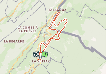
Principe de balisage à La Vattay : chaque panneau indique le nom de la piste avec sa couleur (ici rouge), le kilométrage total (ici 15,5km) et sur chaque panneau la distance déjà parcourue.Sur l''aire de départ, passer la cabane de contrôle puis suivre sur la gauche les panneaux "Germine" balisés en rouge. D''abord parcours commun avec les pistes du Plateau, de la Girantette, de la Pillarde et de Sonnailley.
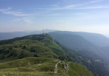
Après la bifurcation de la Girantette qui part sur la gauche, le parcours se fait face au sommet de la Dôle hérissé d''antennes de télécommunications.
Après le croisement de La Pillarde qui part sur la gauche la piste est en territoire Suisse et le reste jusqu''au moment de retrouver la Pillarde.
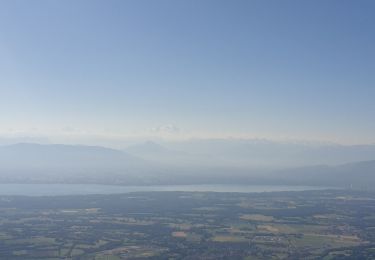
Le sommet de la piste à 1370 m est juste sous la Dôle, beau panorama vers le sud sur les plateaux de La Vattay, la vallée de la Valserine et les sommets de la Haute Chaîne du Jura.
Après une longue descente la piste se dirige sur la droite vers la vallée des Dappes pour arriver à proximité des pistes de ski alpin du massif de La Dôle.
retour par les pistes bien dégagées du plateau de La Vattay.
On foot

Running

Walking
Bicycle tourism
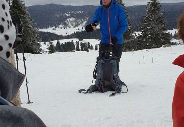
Snowshoes
Walking
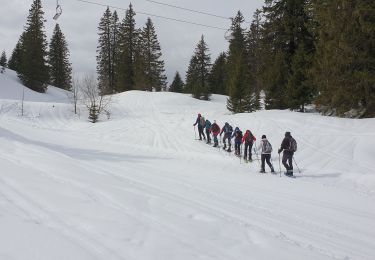
Snowshoes

Snowshoes
Walking