Trail Walking Soorts-Hossegor - 40 SEIGNOSSE, entre océan dunes et forêts de pins, Landes - Photo

40 SEIGNOSSE, entre océan dunes et forêts de pins, Landes

 jeff66
jeff66

User

© OpenStreetMap contributors
Length
Length
19.7 km
Max alt
Max alt
61 m
Uphill gradient
Uphill gradient
242 m
Km-Effort
Km-Effort  
23 km
Min alt
Min alt
0 m
Downhill gradient
Downhill gradient
241 m
Boucle
Boucle
Yes
Creation date :
2016-01-13 00:00:00.0
Updated on :
2016-01-13 00:00:00.0

(0 Reviews)

Walking
Walking
3h48
Difficulty : Medium

Scan this QR Code to open this trail in the SityTrail application

FREE GPS app for hiking

Logo SityTrail SityTrail

IGN / Geographical institutes

Download SityTrail from the App Store Download SityTrail from Google Play

Logo SityTrail SityTrail World

The world is yours!

Download SityTrail from the App Store Download SityTrail from Google Play Download SityTrail on Huawei AppGallery

About

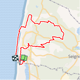
Trail Walking of 19.7 km to be discovered at New Aquitaine, Landes, Soorts-Hossegor. This trail is proposed by jeff66.

Description

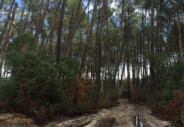
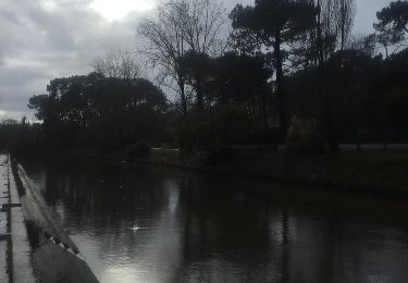
40 SEIGNOSSE, côte sauvage, av. du Gardian, av. de l'orée, du rayon vert, des Gurbettes, océan Plages des Estagnots, des Bourdaines et du Penon, sentier pédestre bleu, DFCI piste 104, Les Mougnes, RP circuit vert, piste DFCI 206, borne IGN 1942, Saurines, RP circuit violet, Bergeron, RP  Circuit Rouge puis à nouveau Bleu vers Tutelaux, traverser la RD89 suivre de l'autre côté la piste DFCI 303, chemin RP Orange, chemin par les crêtes puis chemin des Tucs, citerne DFCI près golf club, traverser la RD79 en direction de le Pley, impasse et avenue D es baïnes, av. de l'entrade,du Pley, de la paloumère, RD152 av. du Pénon, Belambra clubs, rue du 8 Mai 1945, av. de l'orée, des chênes verts, de la forêt, des Corciers,

Elevation profile

Photos

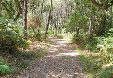
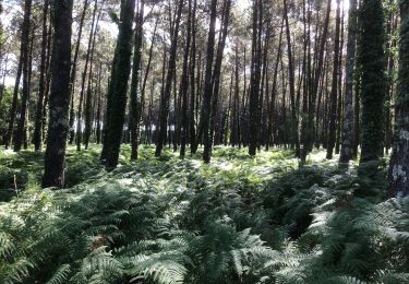
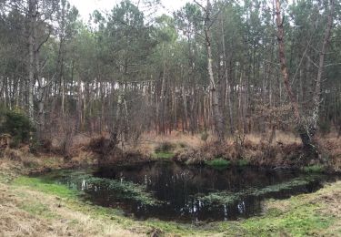
32 photos in total. Please click on a photo to see them all in the gallery.

Positioning

Country:
France
Region :
New Aquitaine
Department/Province :
Landes
Municipality :
Soorts-Hossegor
Location:
Unknown
Start:(UTM)
625973 ; 4837726 (30T) N.

Trails nearby

Trail Walking Seignosse - Dunes et forêts à Seignosse le Penon - Photo
Walking
tracegps

Walking

Medium
(2)
Seignosse, New Aquitaine, Landes, France
6.7 km | 7.9 km-effort
1h 30min
Yes
Trail Walking Seignosse - seignosse  - Photo
Walking
Titome

Walking

Medium
Seignosse, New Aquitaine, Landes, France
10.1 km | 12.5 km-effort
3h 0min
No
Trail Mountain bike Soorts-Hossegor - Boucle Seignosse - Souston - Photo
Mountain bike
phibos

Mountain bike

Easy
Soorts-Hossegor, New Aquitaine, Landes, France
35 km | 40 km-effort
3h 20min
Yes
Trail Mountain bike Soorts-Hossegor - SoortsPlageCasernes - Photo
Mountain bike
ChristopheLefauconnier

Mountain bike

Medium
(1)
Soorts-Hossegor, New Aquitaine, Landes, France
23 km | 27 km-effort
1h 52min
Yes
Trail Walking Seignosse - 40 SEIGNOSSE-BOURG, réservé naturelle de l'Etang Noir, l'étang blanc et l'étang D'Hardy, forêts de Soustons et SEIGNOSSE  - Photo
Walking
jeff66

Walking

Medium
Seignosse, New Aquitaine, Landes, France
11.5 km | 14 km-effort
2h 8min
Yes
Trail Walking Soorts-Hossegor - 40 HOSSEGOR, parcours pédestres de la forêt d'Hossegor maison Hargous - Photo
Walking
jeff66

Walking

Easy
Soorts-Hossegor, New Aquitaine, Landes, France
5.3 km | 6.4 km-effort
1h 9min
Yes
Trail Walking Soorts-Hossegor - 40 SOORTS-HOSSEGOR promenade entre lac, dunes, plages et Océan - Photo
Walking
jeff66

Walking

Medium
Soorts-Hossegor, New Aquitaine, Landes, France
9 km | 9.9 km-effort
2h 4min
Yes
Trail Walking Soorts-Hossegor - 40 SOORTS-HOSSEGOR, SEIGNOSSE. CAPBRETON, grand tour du Lac D'Hossegor - Photo
Walking
jeff66

Walking

Medium
(1)
Soorts-Hossegor, New Aquitaine, Landes, France
13 km | 14.3 km-effort
3h 6min
Yes
Trail Walking Capbreton - 40 CAPBRETON, promenade entre canaux, ports, plages et centre ville - Photo
Walking
jeff66

Walking

Easy
Capbreton, New Aquitaine, Landes, France
7.4 km | 7.9 km-effort
1h 41min
No


Close
My subscriptions