Trail Walking Pennes-le-Sec - Pennes le Sec - Photo
 ajd26
ajd26

User

© OpenStreetMap contributors
Length
Length
17.5 km
Max alt
Max alt
1312 m
Uphill gradient
Uphill gradient
824 m
Km-Effort
Km-Effort  
28 km
Min alt
Min alt
779 m
Downhill gradient
Downhill gradient
826 m
Boucle
Boucle
Yes
Creation date :
2019-05-19 18:04:29.851
Updated on :
2019-05-19 18:04:31.249

(0 Reviews)

Walking
Walking
5h25
Difficulty : Very easy

Scan this QR Code to open this trail in the SityTrail application

FREE GPS app for hiking

Logo SityTrail SityTrail

IGN / Geographical institutes

Download SityTrail from the App Store Download SityTrail from Google Play

Logo SityTrail SityTrail World

The world is yours!

Download SityTrail from the App Store Download SityTrail from Google Play Download SityTrail on Huawei AppGallery

About

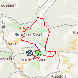
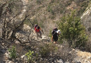
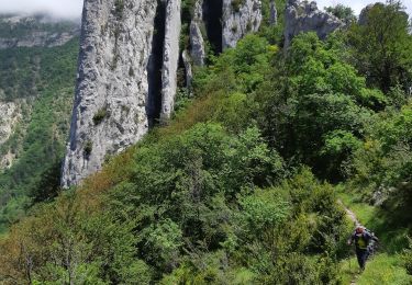
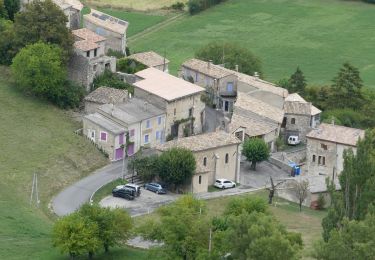
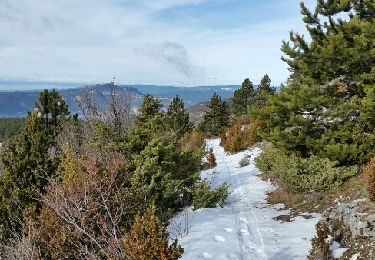
Trail Walking of 17.5 km to be discovered at Auvergne-Rhône-Alpes, Drôme, Pennes-le-Sec. This trail is proposed by ajd26.

Description

Départ de Pennes le Sec (parking mairie) vers St BENOIT en Diois  circuit par Rimon, col du Royer, crêtes de Barnave, et retour par le col de Pennes.    Dénivelé 900m

Elevation profile

Photos

Positioning

Country:
France
Region :
Auvergne-Rhône-Alpes
Department/Province :
Drôme
Municipality :
Pennes-le-Sec
Location:
Unknown
Start:(UTM)
683825 ; 4945303 (31T) N.

Comments

Please log in to post a review or rate the element


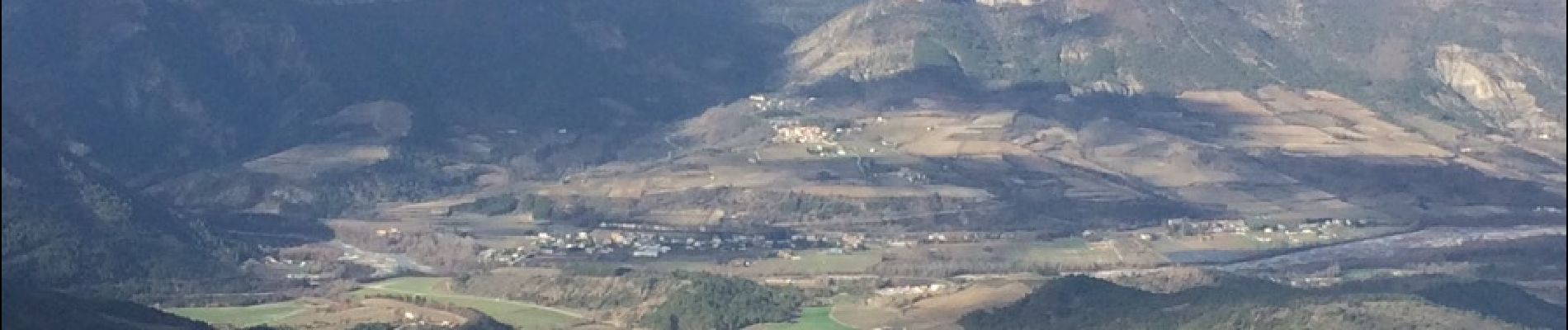
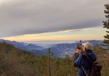
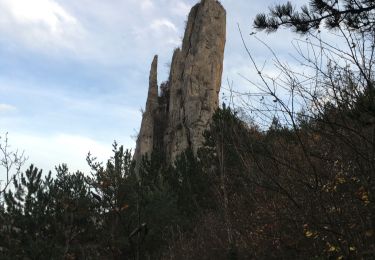
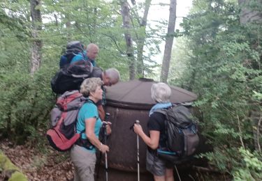
belle randonnée dans cette partie méconnue de la Drôme. deux passages un peu plus relevés pour faire oublier les longueurs de pistes ou routes ! panorama sublime. merci pour le topo


Trails nearby

Trail Walking Rimon-et-Savel - rimon 2/1/2022 - Photo
Walking
odileterrasse26

Walking

Medium
Rimon-et-Savel, Auvergne-Rhône-Alpes, Drôme, France
5.4 km | 6.9 km-effort
1h 48min
No
Trail Walking Saint-Benoit-en-Diois - montagne de Faraud - Photo
Walking
ajd26

Walking

Difficult
Saint-Benoit-en-Diois, Auvergne-Rhône-Alpes, Drôme, France
16.4 km | 31 km-effort
5h 15min
Yes
Trail Walking Aucelon - la montagne d Aucelon  - Photo
Walking
jphugon

Walking

Difficult
Aucelon, Auvergne-Rhône-Alpes, Drôme, France
97 km | 119 km-effort
6h 0min
No
Trail Walking Rimon-et-Savel - Savel - La Pale - Photo
Walking
ajd26

Walking

Difficult
Rimon-et-Savel, Auvergne-Rhône-Alpes, Drôme, France
17.4 km | 30 km-effort
6h 0min
Yes
Trail Walking Rimon-et-Savel - 26 lames de pennes savel jp - Photo
Walking
himba26100

Walking

Medium
Rimon-et-Savel, Auvergne-Rhône-Alpes, Drôme, France
10.8 km | 0 m-effort
7h 56min
Yes
Trail Walking Pradelle - Pradelle - Vallée de la Roanne - Photo
Walking
Philindy26

Walking

Medium
Pradelle, Auvergne-Rhône-Alpes, Drôme, France
14.7 km | 24 km-effort
4h 0min
Yes
Trail Walking Barnave - barnave - Photo
Walking
jphugon

Walking

Medium
(2)
Barnave, Auvergne-Rhône-Alpes, Drôme, France
12.4 km | 23 km-effort
6h 56min
Yes
Trail Nordic walking Montmaur-en-Diois - 23/01/2016 Montmaur-Col du Royet - Photo
Nordic walking
fiorano

Nordic walking

Medium
Montmaur-en-Diois, Auvergne-Rhône-Alpes, Drôme, France
17.2 km | 26 km-effort
4h 0min
Yes
Trail Walking Rimon-et-Savel - Sur les Pas des Huguenots  -   Rimon-et-Savel - Die - Photo
Walking
tracegps

Walking

Very difficult
Rimon-et-Savel, Auvergne-Rhône-Alpes, Drôme, France
18 km | 25 km-effort
5h 0min
No


Close
My subscriptions