Trail Walking Lampaul-Guimiliau - Les enclos du Léon - Photo
© OpenStreetMap contributors
Length
Length
26 km
Max alt
Max alt
131 m
Uphill gradient
Uphill gradient
379 m
Km-Effort
Km-Effort  
31 km
Min alt
Min alt
62 m
Downhill gradient
Downhill gradient
381 m
Boucle
Boucle
Yes
Creation date :
2018-04-02 00:00:00.0
Updated on :
2018-04-02 00:00:00.0

(0 Reviews)

Walking
Walking
7h00
Difficulty : Medium

Scan this QR Code to open this trail in the SityTrail application

FREE GPS app for hiking

Logo SityTrail SityTrail

IGN / Geographical institutes

Download SityTrail from the App Store Download SityTrail from Google Play

Logo SityTrail SityTrail World

The world is yours!

Download SityTrail from the App Store Download SityTrail from Google Play Download SityTrail on Huawei AppGallery

About

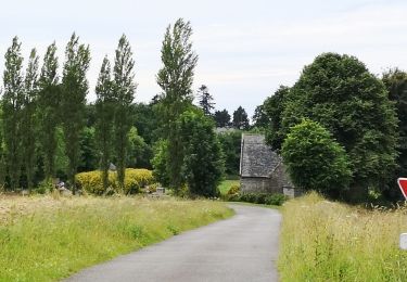
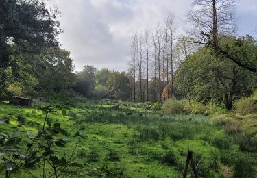
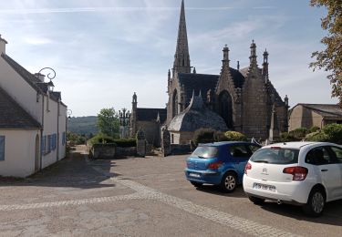
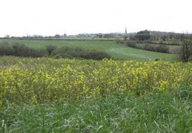
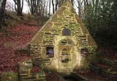
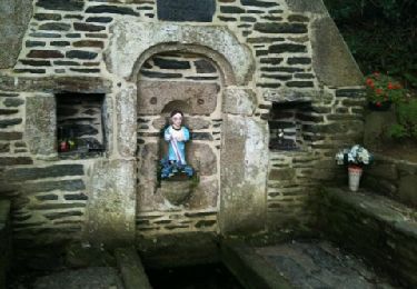
Trail Walking of 26 km to be discovered at Brittany, Finistère, Lampaul-Guimiliau. This trail is proposed by neoroll44.

Description

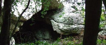
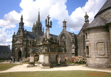
De Lampaul Guimiliau, le long du Quilivarron, la grotte de Roch'Toull, St-Thégonnec et Guimiliau.

Elevation profile

Photos

Points of interest

Point of interest Saint-Thégonnec Loc-Eguiner - enclos-paroissial-de-saint-thegonnec - Photo
neoroll44
SAINT-THÉGONNEC LOC-EGUINER 
Point of interest Guiclan - Roch Toull - Photo
neoroll44
GUICLAN 
Point of interest Lampaul-Guimiliau - Enclos Lampaul Guimiliau - Photo
neoroll44
LAMPAUL-GUIMILIAU 

Positioning

Country:
France
Region :
Brittany
Department/Province :
Finistère
Municipality :
Lampaul-Guimiliau
Location:
Unknown
Start:(UTM)
423118 ; 5371607 (30U) N.

Trails nearby

Trail Walking Guimiliau - Guimiliau et Lampaul-Guimiliau - Photo
Walking
RonanDAGORN

Walking

Very difficult
(1)
Guimiliau, Brittany, Finistère, France
20 km | 24 km-effort
5h 23min
Yes
Trail On foot Lampaul-Guimiliau - Circuit de Sainte-Anasthasie - Photo
On foot
PRO

On foot

Easy
Lampaul-Guimiliau, Brittany, Finistère, France
9.7 km | 11.8 km-effort
2h 40min
Yes
Trail On foot Landivisiau - Circuit de la rivière Penguilly - Photo
On foot
PRO

On foot

Medium
Landivisiau, Brittany, Finistère, France
19.2 km | 23 km-effort
5h 9min
Yes
Trail Walking Lampaul-Guimiliau - petite st anne - Photo
Walking
siboutchou

Walking

Easy
Lampaul-Guimiliau, Brittany, Finistère, France
7.2 km | 8.5 km-effort
1h 35min
Yes
Trail Walking Loc-Eguiner - loc-eguiner - Photo
Walking
miguelmillepattes

Walking

Medium
Loc-Eguiner, Brittany, Finistère, France
7.6 km | 9.4 km-effort
2h 1min
Yes
Trail Nordic walking Locmélar - locmelar - Photo
Nordic walking
elianette

Nordic walking

Very easy
Locmélar, Brittany, Finistère, France
11.2 km | 13.9 km-effort
1h 13min
Yes
Trail Walking Loc-Eguiner - Loc Eguiner et le circuit de la Vallée Perdue - Photo
Walking
tracegps

Walking

Medium
Loc-Eguiner, Brittany, Finistère, France
13.2 km | 16.1 km-effort
3h 0min
Yes
Trail Walking Lampaul-Guimiliau - Autour de Lampaul - Guimiliau - Photo
Walking
tracegps

Walking

Medium
Lampaul-Guimiliau, Brittany, Finistère, France
9.7 km | 11.8 km-effort
2h 0min
Yes
Trail Walking Landivisiau - bois de coat mœur - Photo
Walking
siboutchou

Walking

Very easy
Landivisiau, Brittany, Finistère, France
8.9 km | 11.2 km-effort
Unknown
No


Close
My subscriptions