Trail Walking Saint-Jean-aux-Bois - en forêt de Compiègne_2_ruines gallo-romaines de Champlieu_les Petits Monts - Photo

en forêt de Compiègne_2_ruines gallo-romaines de Champlieu_les Petits Monts

mes randos en forêt

© OpenStreetMap contributors
Length
Length
27 km
Max alt
Max alt
153 m
Uphill gradient
Uphill gradient
304 m
Km-Effort
Km-Effort  
31 km
Min alt
Min alt
43 m
Downhill gradient
Downhill gradient
304 m
Boucle
Boucle
Yes
Creation date :
2018-12-14 18:14:43.658
Updated on :
2022-09-13 05:03:44.847

(0 Reviews)

Walking
Walking
7h51
Difficulty : Difficult

Scan this QR Code to open this trail in the SityTrail application

FREE GPS app for hiking

Logo SityTrail SityTrail

IGN / Geographical institutes

Download SityTrail from the App Store Download SityTrail from Google Play

Logo SityTrail SityTrail World

The world is yours!

Download SityTrail from the App Store Download SityTrail from Google Play Download SityTrail on Huawei AppGallery

About

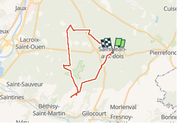
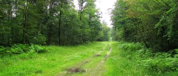
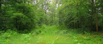
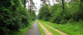
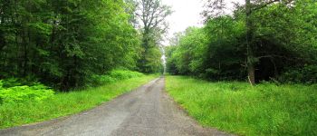
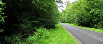
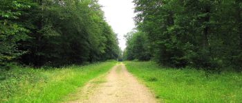
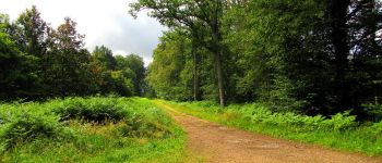
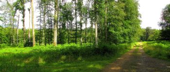
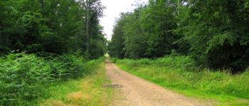
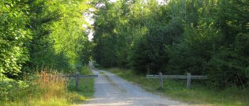
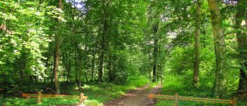
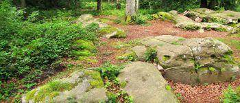
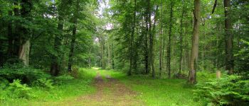
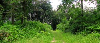
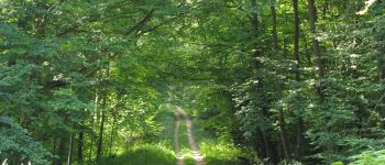
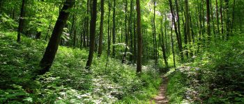
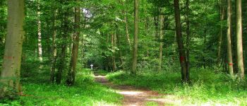
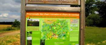
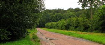
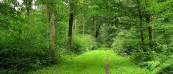
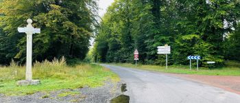
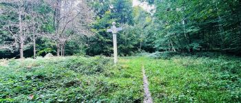
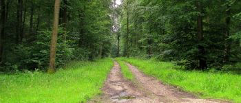
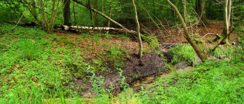
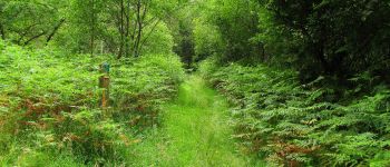
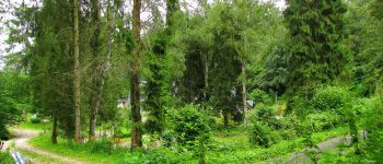
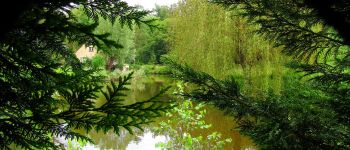
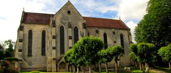
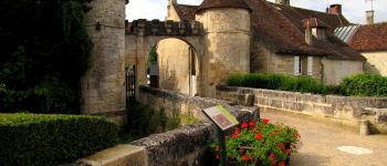
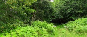
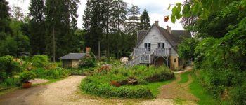
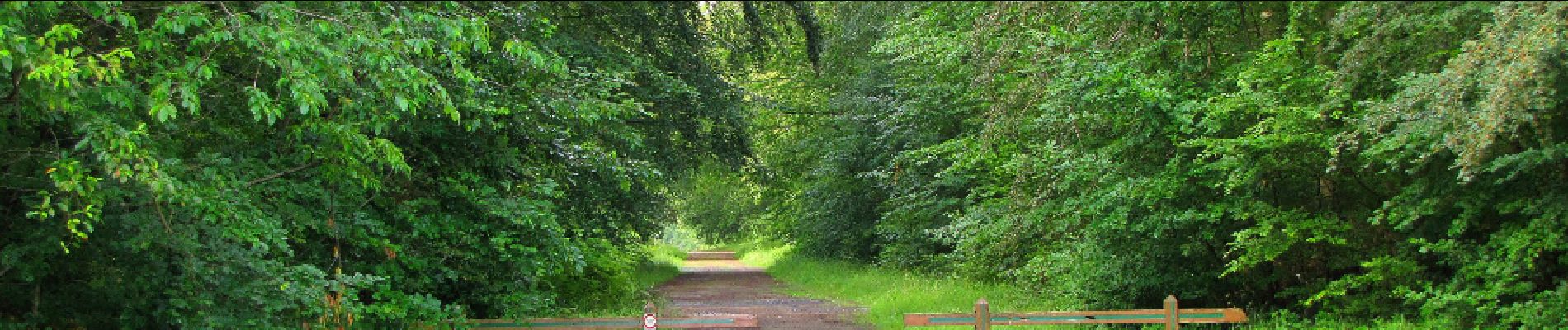
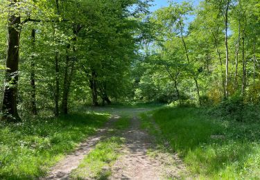
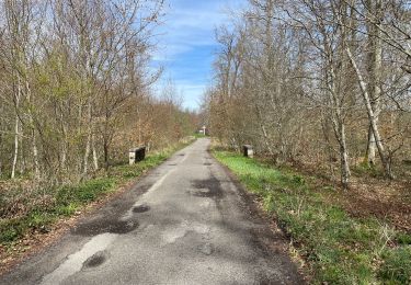
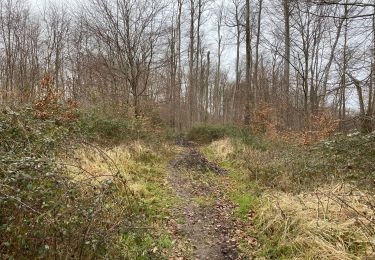
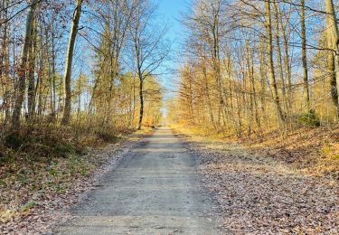
Trail Walking of 27 km to be discovered at Hauts-de-France, Oise, Saint-Jean-aux-Bois. This trail is proposed by en forêt de Compiègne.

Description

07/ 2016
voir aussi:

http://foret-de-compiegne.over-blog.com/

Batterie pour iphone indispensable. Attention aux moustiques (veste, chapeau, pantalon ...).

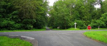
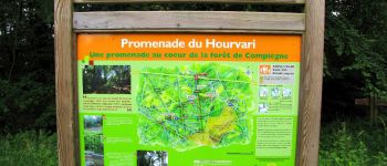
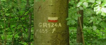
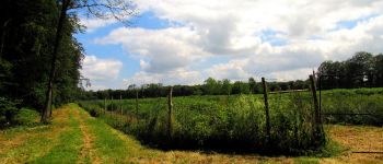
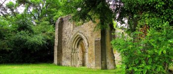
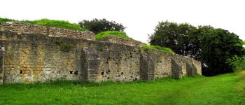
A partir de Saint-Jean-aux-Bois, suivre le chemin qui mène au chêne Saint Jean. Puis continuer à gauche jusqu'au carrefour du Boquet Colin. Continuer jusqu'au carrefour de la Route du Pont Palesne avec la Route tournante des Près Saint-Jean. Prendre à gauche pour rejoindre le chemin des Meuniers (piste cyclable) et le suivre jusqu'au carrefour avec la Route des Près de la Brévière. Prendre à droite sur cette Route et continuer jusqu'au carrefour Murat. Prendre à gauche la Route de la Mariolle jusqu'au carrefour de Jupiter. Suivre à droite la Route de l'Octogonet jusqu'au carrefour de l'Atalante. Prendre à gauche le GR655 (Route du Pont de la Reine) jusqu'au carrefour du Puits du Roi. Suivre à gauche le GR655 (Route de Champlieu) jusqu'au carrefour du Maupas. Prendre à droite la Route du Maupas jusqu'au carrefour avec la Route des Grueries. Suivre à gauche la Route des Grueries jusqu'au carrefour avec la Route du Grand Octogone. Continuer à gauche sur la Route du Grand Octogone jusqu'au carrefour des Princesses. Retrouver à droite le GR655 (Route de Champlieu) jusqu'au carrefour de Champlieu. Prendre à gauche la Route Tournante sur les Grands Monts jusqu'au carrefour d'Acaste. Continuer sur le GR de liason jusqu'au carrefour avec la chaussée Brunehaut. Suivre à droite cette chaussée jusqu'à la Chapelle Romane puis revenir (arrêt aux ruines Gallo-Romaines de Champlieu) jusqu'au carrefour des Grands Monts sur la Route des Tournelles. Prendre à droite la Route des Grands Monts jusqu'au carrefour Galaté puis à gauche le chemin Eloise jusqu'au carrefour des Muses. Suivre la Route Tournante sur les Petits Monts jusqu'à la maison forestière de Vaudrampont. Traverser la D332 et suivre le chemin jusqu'à la Route du Parquet. La continuer sur la droite jusqu'à Saint-Jean-aux-Bois.
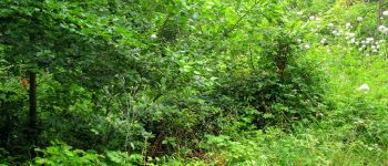
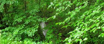
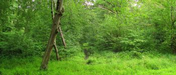
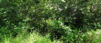
Elevation profile

Points of interest

Point of interest Saint-Jean-aux-Bois - Point 1 - Photo
JeanLucA4
SAINT-JEAN-AUX-BOIS 
Point of interest Saint-Jean-aux-Bois - Point 2 - Photo
JeanLucA4
SAINT-JEAN-AUX-BOIS 
Point of interest Saint-Jean-aux-Bois - Point 3 - Photo
JeanLucA4
SAINT-JEAN-AUX-BOIS 
Point of interest Saint-Jean-aux-Bois - Point 4 - Photo
JeanLucA4
SAINT-JEAN-AUX-BOIS 
Point of interest Saint-Jean-aux-Bois - Point 5 - Photo
JeanLucA4
SAINT-JEAN-AUX-BOIS 
Point of interest Saint-Jean-aux-Bois - Point 6 - Photo
JeanLucA4
SAINT-JEAN-AUX-BOIS 
Point of interest Saint-Jean-aux-Bois - Point 7 - Photo
JeanLucA4
SAINT-JEAN-AUX-BOIS 
Point of interest Saint-Jean-aux-Bois - Point 8 - Photo
JeanLucA4
SAINT-JEAN-AUX-BOIS 
Point of interest Saint-Jean-aux-Bois - Point 9 - Photo
JeanLucA4
SAINT-JEAN-AUX-BOIS 
Point of interest Saint-Jean-aux-Bois - Point 10 - Photo
JeanLucA4
SAINT-JEAN-AUX-BOIS 
Point of interest Saint-Jean-aux-Bois - Point 11 - Photo
JeanLucA4
SAINT-JEAN-AUX-BOIS 
Point of interest Saint-Jean-aux-Bois - Point 12 - Photo
JeanLucA4
SAINT-JEAN-AUX-BOIS 
Point of interest Saint-Jean-aux-Bois - Point 13 - Photo
JeanLucA4
SAINT-JEAN-AUX-BOIS 
Point of interest Saint-Jean-aux-Bois - Point 14 - Photo
JeanLucA4
SAINT-JEAN-AUX-BOIS 
Point of interest Compiègne - Point 15 - Photo
JeanLucA4
COMPIÈGNE 
Point of interest Compiègne - Point 16 - Photo
JeanLucA4
COMPIÈGNE 
Point of interest Saint-Jean-aux-Bois - Point 17 - Photo
JeanLucA4
SAINT-JEAN-AUX-BOIS 
Point of interest Saint-Jean-aux-Bois - Point 18 - Photo
JeanLucA4
SAINT-JEAN-AUX-BOIS 
Point of interest Saint-Jean-aux-Bois - Unnamed POI - Photo
JeanLucA4
SAINT-JEAN-AUX-BOIS 
Point of interest Saint-Jean-aux-Bois - Point 20 - Photo
JeanLucA4
SAINT-JEAN-AUX-BOIS 
Point of interest Saint-Jean-aux-Bois - Point 21 - Photo
JeanLucA4
SAINT-JEAN-AUX-BOIS 
Point of interest Saint-Jean-aux-Bois - Point 22 - Photo
JeanLucA4
SAINT-JEAN-AUX-BOIS 
Point of interest Saint-Jean-aux-Bois - Unnamed POI - Photo
JeanLucA4
SAINT-JEAN-AUX-BOIS 
Point of interest Saint-Sauveur - Point 24 - Photo
JeanLucA4
SAINT-SAUVEUR 
Point of interest Saint-Sauveur - Point 25 - Photo
JeanLucA4
SAINT-SAUVEUR 
Point of interest Saint-Jean-aux-Bois - Point 26 - Photo
JeanLucA4
SAINT-JEAN-AUX-BOIS 
Point of interest Saint-Jean-aux-Bois - Unnamed POI - Photo
JeanLucA4
SAINT-JEAN-AUX-BOIS 
Point of interest Saint-Sauveur - Point 28 - Photo
JeanLucA4
SAINT-SAUVEUR 
Point of interest Saint-Sauveur - Point 29 - Photo
JeanLucA4
SAINT-SAUVEUR 
Point of interest Saint-Sauveur - Point 30 - Photo
JeanLucA4
SAINT-SAUVEUR 
Point of interest Saint-Sauveur - Point 31 - Photo
JeanLucA4
SAINT-SAUVEUR 
Point of interest Saint-Sauveur - Point 32 - Photo
JeanLucA4
SAINT-SAUVEUR 
Point of interest Saint-Jean-aux-Bois - Unnamed POI - Photo
JeanLucA4
SAINT-JEAN-AUX-BOIS 
Point of interest Orrouy - Point 34 - Photo
JeanLucA4
ORROUY 
Point of interest Orrouy - Unnamed POI - Photo
JeanLucA4
ORROUY 
Point of interest Orrouy - Point 36 - Photo
JeanLucA4
ORROUY 
Point of interest Orrouy - Point 37 - Photo
JeanLucA4
ORROUY 
Point of interest Orrouy - Point 38 - Photo
JeanLucA4
ORROUY 
Point of interest Orrouy - Point 39 - Photo
JeanLucA4
ORROUY 
Point of interest Orrouy - Point 40 - Photo
JeanLucA4
ORROUY 
Point of interest Orrouy - Point 41 - Photo
JeanLucA4
ORROUY 
Point of interest Orrouy - Point 42 - Photo
JeanLucA4
ORROUY 
Point of interest Orrouy - Point 43 - Photo
JeanLucA4
ORROUY 
Point of interest Orrouy - Unnamed POI - Photo
JeanLucA4
ORROUY 
Point of interest Orrouy - Unnamed POI - Photo
JeanLucA4
ORROUY 
Point of interest Orrouy - Point 46 - Photo
JeanLucA4
ORROUY 
Point of interest Morienval - Point 47 - Photo
JeanLucA4
MORIENVAL 
Point of interest Morienval - Point 48 - Photo
JeanLucA4
MORIENVAL 
Point of interest Saint-Jean-aux-Bois - Point 49 - Photo
JeanLucA4
SAINT-JEAN-AUX-BOIS 
Point of interest Saint-Jean-aux-Bois - Point 51 - Photo
JeanLucA4
SAINT-JEAN-AUX-BOIS 
Point of interest Saint-Jean-aux-Bois - Point 52 - Photo
JeanLucA4
SAINT-JEAN-AUX-BOIS 
Point of interest Saint-Jean-aux-Bois - Point 53 - Photo
JeanLucA4
SAINT-JEAN-AUX-BOIS 
Point of interest Saint-Jean-aux-Bois - Point 55 - Photo
JeanLucA4
SAINT-JEAN-AUX-BOIS 
Point of interest Saint-Jean-aux-Bois - Départ - Photo
JeanLucA4
SAINT-JEAN-AUX-BOIS 
Point of interest Saint-Jean-aux-Bois - Arrivée - Photo
JeanLucA4
SAINT-JEAN-AUX-BOIS 
Point of interest Saint-Jean-aux-Bois - Point 50 - Photo
JeanLucA4
SAINT-JEAN-AUX-BOIS 
Point of interest Saint-Jean-aux-Bois - point 54 - Photo
JeanLucA4
SAINT-JEAN-AUX-BOIS 

Positioning

Country:
France
Region :
Hauts-de-France
Department/Province :
Oise
Municipality :
Saint-Jean-aux-Bois
Location:
Unknown
Start:(UTM)
493141 ; 5465964 (31U) N.

Trails nearby

Trail On foot Pierrefonds - Le Voliard - Photo
On foot
PRO

On foot

Easy
(1)
Pierrefonds, Hauts-de-France, Oise, France
5.2 km | 6.4 km-effort
1h 27min
No
Trail On foot Saint-Jean-aux-Bois - Promenade du Chêne de Saint-Jean - Photo
On foot
PRO

On foot

Easy
Saint-Jean-aux-Bois, Hauts-de-France, Oise, France
5.7 km | 6.5 km-effort
1h 28min
No
Trail Walking Saint-Jean-aux-Bois - SAINT JEAN AUX BOIS, le village et les bois - Photo
Walking
jeannine grandjean

Walking

Easy
Saint-Jean-aux-Bois, Hauts-de-France, Oise, France
4.6 km | 5.2 km-effort
1h 11min
Yes
Trail Walking Vieux-Moulin - Rando douce Vieux moulin 14/8/2022 - Photo
Walking
pascha

Walking

Medium
(1)
Vieux-Moulin, Hauts-de-France, Oise, France
8.7 km | 10.1 km-effort
2h 14min
Yes
Trail Walking Vieux-Moulin - Gorges du Han - ATPC ARVAL - Photo
Walking
pascha

Walking

Very easy
(1)
Vieux-Moulin, Hauts-de-France, Oise, France
13.2 km | 16 km-effort
2h 42min
Yes
Trail Walking Compiègne - en Forêt de Compiègne_50_les Routes des Beaux Monts, de Morpigny et des Nymphes - Photo
Walking

Walking

Very difficult
Compiègne, Hauts-de-France, Oise, France
17 km | 20 km-effort
5h 2min
Yes
Trail Walking Compiègne - en forêt de Compiègne_48_sur les Routes de la Mariolle et du Grand Veneur - Photo
Walking

Walking

Very difficult
Compiègne, Hauts-de-France, Oise, France
17 km | 19.9 km-effort
5h 21min
Yes
Trail Walking Saint-Jean-aux-Bois - Saint Jean au Bois 13,4 km - Photo
Walking
GUIDE
rvapeldo

Walking

Easy
Saint-Jean-aux-Bois, Hauts-de-France, Oise, France
13.4 km | 16.3 km-effort
3h 51min
Yes
Trail Walking Lacroix-Saint-Ouen - en forêt de Compiègne_45_sur les Routes de Morienval et de Champlieu - Photo
Walking

Walking

Medium
Lacroix-Saint-Ouen, Hauts-de-France, Oise, France
15 km | 17.4 km-effort
4h 29min
Yes


Close
My subscriptions