Trail Walking Omblèze - ambel - Photo
 guyzinz
guyzinz

User

© OpenStreetMap contributors
Length
Length
15.6 km
Max alt
Max alt
1497 m
Uphill gradient
Uphill gradient
542 m
Km-Effort
Km-Effort  
23 km
Min alt
Min alt
1134 m
Downhill gradient
Downhill gradient
544 m
Boucle
Boucle
Yes
Creation date :
2019-06-07 09:39:39.517
Updated on :
2019-06-07 09:39:39.596

(0 Reviews)

Walking
Walking
4h40
Difficulty : Unknown

Scan this QR Code to open this trail in the SityTrail application

FREE GPS app for hiking

Logo SityTrail SityTrail

IGN / Geographical institutes

Download SityTrail from the App Store Download SityTrail from Google Play

Logo SityTrail SityTrail World

The world is yours!

Download SityTrail from the App Store Download SityTrail from Google Play Download SityTrail on Huawei AppGallery

About

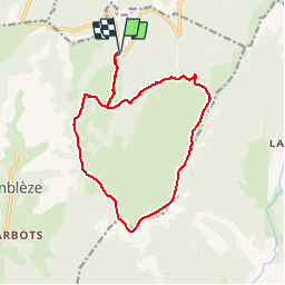
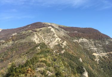
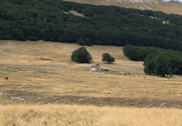
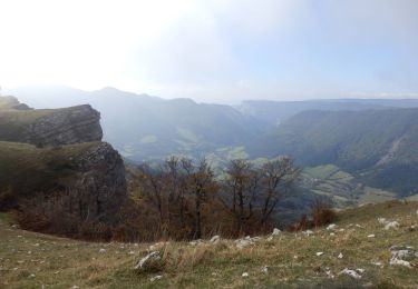
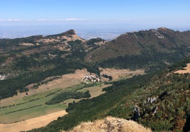
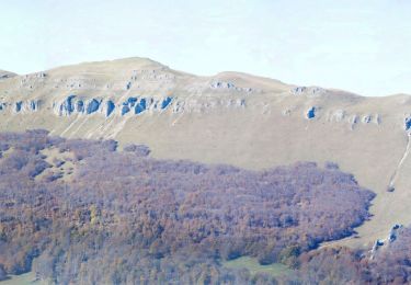
Trail Walking of 15.6 km to be discovered at Auvergne-Rhône-Alpes, Drôme, Omblèze. This trail is proposed by guyzinz.

Description

depart parking de gardiol la veratre refuge d'ambel pas du gouillat tete de la dame les moutons refuge du tubanet la verratre gardiol

Elevation profile

Positioning

Country:
France
Region :
Auvergne-Rhône-Alpes
Department/Province :
Drôme
Municipality :
Omblèze
Location:
Unknown
Start:(UTM)
677974 ; 4973459 (31T) N.

Trails nearby

Trail Walking Omblèze - 2021-07-26_17h20m33_1627312809705_Plateau d_Ambel 15km.gpx.xml - Photo
Walking
chancha

Walking

Very difficult
(1)
Omblèze, Auvergne-Rhône-Alpes, Drôme, France
14.9 km | 22 km-effort
4h 56min
Yes
Trail Walking Bouvante - 01 - Photo
Walking
Noiraude

Walking

Medium
(1)
Bouvante, Auvergne-Rhône-Alpes, Drôme, France
12.5 km | 19.5 km-effort
5h 7min
Yes
Trail Walking Omblèze - Bec pointu Tête Dame - Photo
Walking
fabal

Walking

Difficult
(1)
Omblèze, Auvergne-Rhône-Alpes, Drôme, France
12.7 km | 26 km-effort
5h 12min
Yes
Trail Mountain bike Léoncel - Tête de la Dame - Photo
Mountain bike
Thierryb26

Mountain bike

Medium
(1)
Léoncel, Auvergne-Rhône-Alpes, Drôme, France
27 km | 39 km-effort
2h 35min
Yes
Trail Walking Omblèze - Bec Pointu - Photo
Walking
ajd26

Walking

Medium
Omblèze, Auvergne-Rhône-Alpes, Drôme, France
14.5 km | 27 km-effort
5h 10min
Yes
Trail Walking Bouvante - Tour du Plateau d’Ambel - Photo
Walking
alinetpierre

Walking

Medium
Bouvante, Auvergne-Rhône-Alpes, Drôme, France
18.5 km | 27 km-effort
4h 11min
Yes
Trail Walking Omblèze - Plateau d_Ambel 15km - Photo
Walking
GUIDE
thonyc

Walking

Medium
Omblèze, Auvergne-Rhône-Alpes, Drôme, France
14.8 km | 22 km-effort
4h 20min
Yes
Trail Walking Léoncel - Pas de Sausse pas De Chovet, arche de Rucla - Photo
Walking
alinetpierre

Walking

Medium
Léoncel, Auvergne-Rhône-Alpes, Drôme, France
9.9 km | 14.6 km-effort
2h 43min
Yes
Trail Walking Omblèze - Le tour du Roc de Toulau - Photo
Walking
Philindy26

Walking

Medium
Omblèze, Auvergne-Rhône-Alpes, Drôme, France
9.1 km | 14.8 km-effort
3h 20min
Yes


Close
My subscriptions