Trail Walking Mittlach - Mittlach 3 sommets-3 lacs - Photo

Mittlach 3 sommets-3 lacs

© OpenStreetMap contributors
Length
Length
18.9 km
Max alt
Max alt
1349 m
Uphill gradient
Uphill gradient
1172 m
Km-Effort
Km-Effort  
34 km
Min alt
Min alt
554 m
Downhill gradient
Downhill gradient
1162 m
Boucle
Boucle
Yes
Creation date :
2019-01-20 20:50:27.505
Updated on :
2019-01-20 20:50:27.536

(0 Reviews)

Walking
Walking
7h01
Difficulty : Very difficult

Scan this QR Code to open this trail in the SityTrail application

FREE GPS app for hiking

Logo SityTrail SityTrail

IGN / Geographical institutes

Download SityTrail from the App Store Download SityTrail from Google Play

Logo SityTrail SityTrail World

The world is yours!

Download SityTrail from the App Store Download SityTrail from Google Play Download SityTrail on Huawei AppGallery

About

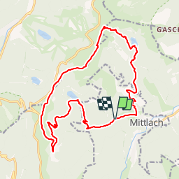
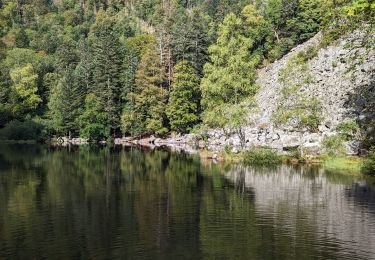
Trail Walking of 18.9 km to be discovered at Grand Est, Haut-Rhin, Mittlach. This trail is proposed by LaurentGILG.

Description

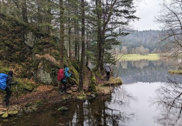
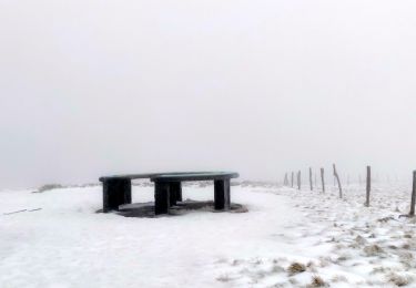
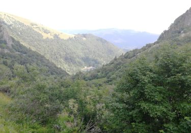
Mittlach, Lac du Fischboedle, Lac du Schiessrothried, Le Kastelberg, Le Rainkopf; Rotenbacchkopf, Lac d'Altenweiher, Mittlach

Elevation profile

Points of interest

Point of interest Mittlach - Suivre Triangle Bleu - Photo
LaurentGILG
Point of interest Mittlach - suivre + Bleu Lac de Fischboedle - Photo
LaurentGILG
Point of interest Metzeral - Suivre Rectangle Rouge - Photo
LaurentGILG
Point of interest Metzeral - Suivre Triangle Bleu - Photo
LaurentGILG
Point of interest La Bresse - Suivre la Crête à gauche puis droite - Photo
LaurentGILG
Point of interest Metzeral - Suivre Disque Rouge - Photo
LaurentGILG
Point of interest Metzeral - Disque Jaune - Photo
LaurentGILG
METZERAL 
Point of interest Metzeral - Suivre + Jaune - Photo
LaurentGILG
METZERAL 

Positioning

Country:
France
Region :
Grand Est
Department/Province :
Haut-Rhin
Municipality :
Mittlach
Location:
Unknown
Start:(Dec)
Start:(UTM)
352035 ; 5318731 (32U) N.

Comments

Please log in to post a review or rate the element


Trails nearby

Trail Walking La Bresse - 2023-04-16 Marche Abri Lac de Blanchemer vers Lac de Lispach - Photo
Walking
GUIDE
holtzv

Walking

Very difficult
(1)
La Bresse, Grand Est, Vosges, France
23 km | 36 km-effort
8h 4min
No
Trail Walking Wildenstein - 2022-02-20 Marche Kruth Grand Ventron - Photo
Walking
GUIDE
holtzv

Walking

Very difficult
(1)
Wildenstein, Grand Est, Haut-Rhin, France
16.8 km | 27 km-effort
4h 52min
Yes
Trail Walking La Bresse - Kastelberg des pierres, des lacs, des panoramas magnifiques  - Photo
Walking
Alfredy

Walking

Difficult
(1)
La Bresse, Grand Est, Vosges, France
15.1 km | 26 km-effort
6h 11min
Yes
Trail Walking La Bresse - Les 5 lacs autour du Hohneck - Photo
Walking
tiene

Walking

Very difficult
(1)
La Bresse, Grand Est, Vosges, France
21 km | 36 km-effort
7h 21min
Yes
Trail Walking La Bresse - Du Hohneck au Kastelberg par les Spietzkoepfe et le Sentier des Névées - Photo
Walking
tracegps

Walking

Very difficult
(3)
La Bresse, Grand Est, Vosges, France
7.6 km | 13.7 km-effort
3h 30min
Yes
Trail Walking La Bresse - Rainkopf - Mittlach - Hohneck - Photo
Walking
tracegps

Walking

Difficult
(1)
La Bresse, Grand Est, Vosges, France
22 km | 41 km-effort
8h 0min
Yes
Trail Mountain bike Metzeral - Sentier des Névés - Photo
Mountain bike
tracegps

Mountain bike

Very difficult
(1)
Metzeral, Grand Est, Haut-Rhin, France
33 km | 52 km-effort
6h 0min
Yes
Trail Walking Mittlach - 2023-09-24 Marche Mittlach 5 Lacs - Photo
Walking
GUIDE
holtzv

Walking

Medium
Mittlach, Grand Est, Haut-Rhin, France
25 km | 41 km-effort
9h 19min
Yes
Trail Walking Sondernach - 2023-05-19 WE Marche Bivouac Massif du Hohneck - Photo
Walking
GUIDE
holtzv

Walking

Medium
Sondernach, Grand Est, Haut-Rhin, France
46 km | 73 km-effort
16h 41min
Yes


Close
My subscriptions