


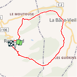

14.2 km | 23 km-effort


User GUIDE


FREE GPS app for hiking
 SityTrail
IGN / Geographical institutes
SityTrail World
The world is yours!
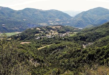
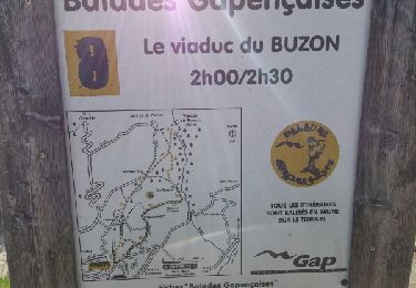
Trail Walking of 8.5 km to be discovered at Provence-Alpes-Côte d'Azur, Hautes-Alpes, Rambaud. This trail is proposed by R@ph.
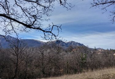
Petite balade dominicale sans beaucoup de dénivelé qui vous permettra de profiter de magnifiques paysages et vues sur les montagnes environnantes.

Walking
Walking
Walking
Road bike
Walking
Walking
Walking

Mountain bike
Running