


orléans st denis prés martel

alain46
User

Length
243 km

Max alt
427 m

Uphill gradient
2558 m
Km-Effort
276 km

Min alt
88 m

Downhill gradient
2279 m
Boucle
No
Creation date :
2017-03-15 00:00:00.0
Updated on :
2017-03-15 00:00:00.0
2h10
Difficulty : Unknown

FREE GPS app for hiking
 SityTrail
IGN / Geographical institutes
SityTrail Plus
The world is yours!
About
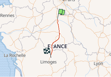
Trail Other activity of 243 km to be discovered at Centre-Loire Valley, Loiret, Fleury-les-Aubrais. This trail is proposed by alain46.
Description
train
Positioning
Country:
France
Region :
Centre-Loire Valley
Department/Province :
Loiret
Municipality :
Fleury-les-Aubrais
Location:
Unknown
Start:(Dec)
Start:(UTM)
418272 ; 5308825 (31T) N.
Comments