Trail Walking Torsac - Torsac. Sentier des croix - Photo

Torsac. Sentier des croix

 dorcier
dorcier

User

© OpenStreetMap contributors
Length
Length
10.1 km
Max alt
Max alt
157 m
Uphill gradient
Uphill gradient
138 m
Km-Effort
Km-Effort  
11.9 km
Min alt
Min alt
101 m
Downhill gradient
Downhill gradient
133 m
Boucle
Boucle
Yes
Creation date :
2017-03-28 00:00:00.0
Updated on :
2017-03-28 00:00:00.0

(0 Reviews)

Walking
Walking
2h37
Difficulty : Easy

Scan this QR Code to open this trail in the SityTrail application

FREE GPS app for hiking

Logo SityTrail SityTrail

IGN / Geographical institutes

Download SityTrail from the App Store Download SityTrail from Google Play

Logo SityTrail SityTrail World

The world is yours!

Download SityTrail from the App Store Download SityTrail from Google Play Download SityTrail on Huawei AppGallery

About

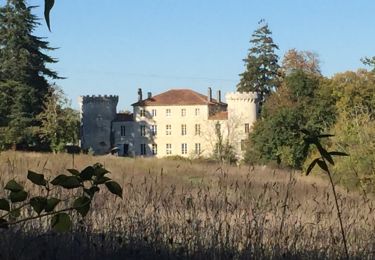
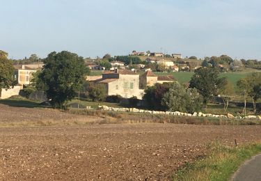
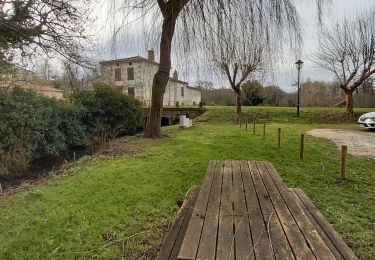
Trail Walking of 10.1 km to be discovered at New Aquitaine, Charente, Torsac. This trail is proposed by dorcier.

Description

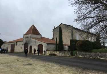
Départ parking face au cimetière sur la D41.
Le nom du cimetière est dû aux cinq croix qui le jalonnent. Elles évoquent la chrétienté mais servaient aussi de repères pour les différentes propriétés ou limites de communes.

Elevation profile

Photos

Points of interest

Point of interest Torsac - Point 1 - Photo
dorcier
TORSAC 
Point of interest Torsac - Point 2 - Photo
dorcier
TORSAC 
Point of interest Torsac - Point 3 - Photo
dorcier
TORSAC 
Point of interest Torsac - Point 4 - Photo
dorcier
TORSAC 
Point of interest Torsac - Point 5 - Photo
dorcier
TORSAC 
Point of interest Torsac - Point 6 - Photo
dorcier
TORSAC 

Positioning

Country:
France
Region :
New Aquitaine
Department/Province :
Charente
Municipality :
Torsac
Location:
Unknown
Start:(UTM)
282633 ; 5049364 (31T) N.

Trails nearby

Trail Walking Dirac - Les lavoirs de Dirac - Photo
Walking
dorcier

Walking

Easy
Dirac, New Aquitaine, Charente, France
7.4 km | 9 km-effort
2h 5min
Yes
Trail Walking Fouquebrune - Fouquebrune (rando de la Motte) - Photo
Walking
dorcier

Walking

Easy
Fouquebrune, New Aquitaine, Charente, France
9.9 km | 11.5 km-effort
2h 5min
Yes
Trail Walking Fouquebrune - fouquebrune - Photo
Walking
dorcier

Walking

Very easy
Fouquebrune, New Aquitaine, Charente, France
8.7 km | 9.9 km-effort
2h 14min
Yes
Trail Walking Puymoyen - La vallée des Eaux claires  - Photo
Walking
alainjoseph6

Walking

Easy
Puymoyen, New Aquitaine, Charente, France
9.2 km | 11.1 km-effort
2h 36min
Yes
Trail Walking Dignac - dignac_ouest G-16417318 - Photo
Walking
Gege Lolo

Walking

Difficult
Dignac, New Aquitaine, Charente, France
11.3 km | 13.4 km-effort
3h 2min
Yes
Trail Walking Dirac - Dirac - Photo
Walking
Gege Lolo

Walking

Medium
Dirac, New Aquitaine, Charente, France
9.9 km | 11.8 km-effort
2h 41min
Yes
Trail Trail Torsac - torsac - Photo
Trail
thierry16

Trail

Medium
Torsac, New Aquitaine, Charente, France
8.5 km | 10.8 km-effort
1h 0min
Yes
Trail Mountain bike Dirac - VTT DIRAC 16 - Photo
Mountain bike
topolino

Mountain bike

Difficult
Dirac, New Aquitaine, Charente, France
48 km | 60 km-effort
Unknown
Yes
Trail Walking Fouquebrune - fouquebrune - Photo
Walking
sy!

Walking

Very easy
Fouquebrune, New Aquitaine, Charente, France
17.4 km | 20 km-effort
4h 15min
Yes


Close
My subscriptions