Trail Walking Urrugne - RP64 SOCOA - HENDAYE - par la corniche Basque  - Photo

RP64 SOCOA - HENDAYE - par la corniche Basque

 jeff66
jeff66

User

© OpenStreetMap contributors
Length
Length
13.9 km
Max alt
Max alt
85 m
Uphill gradient
Uphill gradient
303 m
Km-Effort
Km-Effort  
17.9 km
Min alt
Min alt
0 m
Downhill gradient
Downhill gradient
303 m
Boucle
Boucle
Yes
Creation date :
2017-04-27 00:00:00.0
Updated on :
2017-04-27 00:00:00.0

(0 Reviews)

Walking
Walking
4h29
Difficulty : Medium

Scan this QR Code to open this trail in the SityTrail application

FREE GPS app for hiking

Logo SityTrail SityTrail

IGN / Geographical institutes

Download SityTrail from the App Store Download SityTrail from Google Play

Logo SityTrail SityTrail World

The world is yours!

Download SityTrail from the App Store Download SityTrail from Google Play Download SityTrail on Huawei AppGallery

About

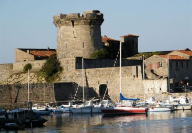
Trail Walking of 13.9 km to be discovered at New Aquitaine, Pyrénées-Atlantiques, Urrugne. This trail is proposed by jeff66.

Description

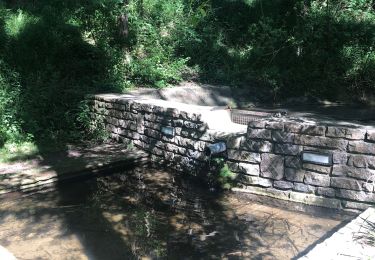
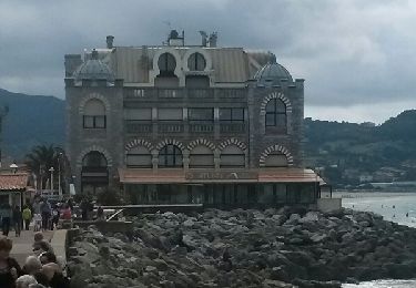
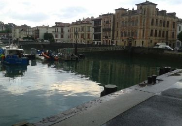
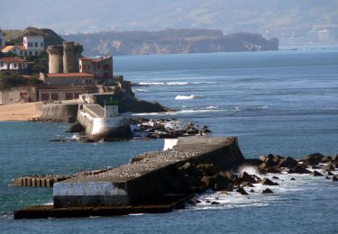
RP64 SOCOA - HENDAYE - par la corniche Basque - les viviers Basques - Haizabea - domaine d'Abbadia - Asporotza - baie de Loya - Kapelu - les jumeaux - pointe sainte Anne - Nekatoenea - Larretxea - maison de la lande - HENDAYE - route de la Corniche - rues Gasconenia, Armatonde - château d'Abbadia -  chemins d'Ascoube-Fagady et d'Etxail-Bordaberri - Antxiola - point de vue - Kauteren borda - la corniche - le 27.04.2017

Elevation profile

Positioning

Country:
France
Region :
New Aquitaine
Department/Province :
Pyrénées-Atlantiques
Municipality :
Urrugne
Location:
Unknown
Start:(UTM)
604067 ; 4804557 (30T) N.

Trails nearby

Trail Walking Saint-Jean-de-Luz - 64 SAINT-JEAN-DE-LUZ, front de mer, pointe ste Barbe, sentier littoral - Photo
Walking
jeff66

Walking

Medium
(1)
Saint-Jean-de-Luz, New Aquitaine, Pyrénées-Atlantiques, France
6.9 km | 8.4 km-effort
1h 57min
Yes
Trail Mountain bike Urrugne - la rhune - Photo
Mountain bike
PierreBellevaux

Mountain bike

Very difficult
(2)
Urrugne, New Aquitaine, Pyrénées-Atlantiques, France
32 km | 45 km-effort
3h 42min
Yes
Trail Walking Urrugne - SOCOA HENDAYE par sentier du littoral - Photo
Walking
jaja64

Walking

Easy
Urrugne, New Aquitaine, Pyrénées-Atlantiques, France
17 km | 22 km-effort
4h 24min
Yes
Trail Walking Hendaye - Hendaye - Photo
Walking
Isabelle07

Walking

Easy
(1)
Hendaye, New Aquitaine, Pyrénées-Atlantiques, France
8.4 km | 10.1 km-effort
2h 16min
Yes
Trail Walking Ciboure - SENTIER DU LITTORAL BASQUE  - Photo
Walking
PVERTICAL

Walking

Easy
Ciboure, New Aquitaine, Pyrénées-Atlantiques, France
14.6 km | 18.5 km-effort
4h 2min
No
Trail Walking Saint-Jean-de-Luz - JFT YB ETAPE 23 21-5-2014 - Photo
Walking
jeff2

Walking

Easy
Saint-Jean-de-Luz, New Aquitaine, Pyrénées-Atlantiques, France
17.3 km | 22 km-effort
5h 10min
No
Trail Walking Hendaye - corniche pointe st Anne - Photo
Walking
balooales

Walking

Very easy
Hendaye, New Aquitaine, Pyrénées-Atlantiques, France
3.2 km | 4.3 km-effort
58min
No
Trail Walking Saint-Jean-de-Luz - Sentier du Littoral - De St Jean de Luz à Hendaye - Photo
Walking
tracegps

Walking

Medium
(1)
Saint-Jean-de-Luz, New Aquitaine, Pyrénées-Atlantiques, France
15.1 km | 19.2 km-effort
3h 0min
No
Trail Mountain bike Ciboure - La virée de Joël - Ciboure - Photo
Mountain bike
tracegps

Mountain bike

Medium
Ciboure, New Aquitaine, Pyrénées-Atlantiques, France
36 km | 44 km-effort
3h 0min
Yes


Close
My subscriptions