Trail Walking Sarzeau - Pointes de Bernon et de l'Ours - Photo

Pointes de Bernon et de l'Ours

© OpenStreetMap contributors
Length
Length
9.6 km
Max alt
Max alt
19 m
Uphill gradient
Uphill gradient
83 m
Km-Effort
Km-Effort  
10.8 km
Min alt
Min alt
0 m
Downhill gradient
Downhill gradient
84 m
Boucle
Boucle
Yes
Creation date :
2017-06-12 00:00:00.0
Updated on :
2017-06-12 00:00:00.0

(2 Reviews)

Walking
Walking
2h22
Difficulty : Medium

Scan this QR Code to open this trail in the SityTrail application

FREE GPS app for hiking

Logo SityTrail SityTrail

IGN / Geographical institutes

Download SityTrail from the App Store Download SityTrail from Google Play

Logo SityTrail SityTrail World

The world is yours!

Download SityTrail from the App Store Download SityTrail from Google Play Download SityTrail on Huawei AppGallery

About

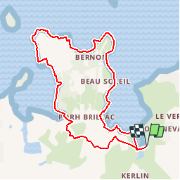
Trail Walking of 9.6 km to be discovered at Brittany, Morbihan, Sarzeau. This trail is proposed by neoroll44.

Description

Se garer sur l'aire de repos située en bordure de mer au Nord de Sarzeau.
Au départ de la randonnée, tout de suite après le petit pont, prendre le chemin sur la droite pour suivre le trait de côte.
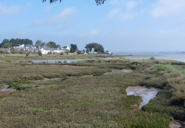
Au fond de l'Anse de Kerollet, rejoindre le GR34 que l'on suit en contournant Port Brillac par la Route du Golf sur quelques mètres puis l'Impasse de Kerollet à droite. Prendre le premier chemin à gauche, le suivre jusqu'au bout et virer à droite par le sentier qui rejoint le trait de côte. Dépasser le lieu-dit Beau-Soleil.
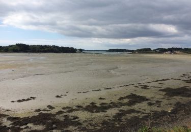
Quitter le GR et continuer à longer la côte pour faire le tour de la Pointe de Bernon.
Retrouver le GR 34, passer par la Pointe de l'Ours et rejoindre Brillac. Suivre le Chemin du Palud puis la Rue Saint Maur que l'on prendra à droite.
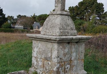
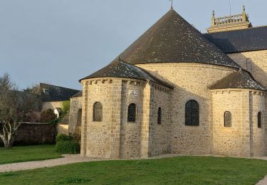
Tourner à gauche pour monter vers l'église par la Rue Abbé Drean et laisser le cimetière sur la gauche.
À la croix, prendre le chemin carrossable sur la gauche et le suivre jusqu'au lieu-dit Kerdéquinet. Prendre la rue principale sur la droite quelques mètres puis la première à gauche.
Dans le virage à l'équerre, prendre le petit chemin à droite entre deux maisons et le suivre orientation Sud-Est puis Nord- Ouest pour rejoindre le GR.
Virer à droite pour rejoindre le parking.

Elevation profile

Positioning

Country:
France
Region :
Brittany
Department/Province :
Morbihan
Municipality :
Sarzeau
Location:
Unknown
Start:(UTM)
515260 ; 5264932 (30T) N.

Comments

Please log in to post a review or rate the element


Belle boucle le long du golfe.


Trails nearby

Trail Walking Saint-Armel - Tour du Golfe du Morbihan - 04 - St Armel, Le Hézo - Photo
Walking
tracegps

Walking

Difficult
(1)
Saint-Armel, Brittany, Morbihan, France
16.6 km | 17.6 km-effort
4h 0min
No
Trail Walking Sarzeau - autour de Brillac - Photo
Walking
fredouille661

Walking

Very easy
(2)
Sarzeau, Brittany, Morbihan, France
9.5 km | 10.5 km-effort
2h 27min
Yes
Trail Walking Sarzeau - Circuit du Château de Truscat - Photo
Walking
corsinou

Walking

Easy
(1)
Sarzeau, Brittany, Morbihan, France
7.4 km | 8.2 km-effort
1h 50min
Yes
Trail Walking Sarzeau - PR_56_Sarzeau_HA_08_Circuit1b_Les-Parcs-Ostreicoles_20240407 - Photo
Walking
patrickdanilo

Walking

Very easy
Sarzeau, Brittany, Morbihan, France
8.2 km | 9.2 km-effort
2h 5min
Yes
Trail Walking Sarzeau - PR_56_Sarzeau_GA_07_Circuit1b_Regards-Sur-Le-Golfe_20240310 - Photo
Walking
patrickdanilo

Walking

Very easy
Sarzeau, Brittany, Morbihan, France
8.3 km | 9.2 km-effort
2h 6min
Yes
Trail Walking Sarzeau - PR_56_Sarzeau_FA_06_Circuit1b_Le-Port-Du-Logeo_20240217 - Photo
Walking
patrickdanilo

Walking

Very easy
Sarzeau, Brittany, Morbihan, France
4.1 km | 4.6 km-effort
1h 3min
Yes
Trail Walking Saint-Gildas-de-Rhuys - PR_56_St-Gildas-Rhuys_AA_01_Circuit1b_Du-Grand-Mont_20231111 - Photo
Walking
patrickdanilo

Walking

Medium
Saint-Gildas-de-Rhuys, Brittany, Morbihan, France
9 km | 10.1 km-effort
1h 49min
Yes
Trail Walking Saint-Gildas-de-Rhuys - Grand Mont - Photo
Walking
leho.yannick@orange.fr

Walking

Medium
Saint-Gildas-de-Rhuys, Brittany, Morbihan, France
6.6 km | 7.5 km-effort
2h 1min
No
Trail Walking Saint-Armel - 56-St-Colombier-Ludré-Duer-10km - Photo
Walking
SyMA

Walking

Easy
Saint-Armel, Brittany, Morbihan, France
9.6 km | 10.3 km-effort
2h 58min
Yes


Close
My subscriptions