Trail Walking Cervières - le lac des Cordes et le pic du vallon Crouzet - Photo

le lac des Cordes et le pic du vallon Crouzet

 amiral13
amiral13

User GUIDE

© OpenStreetMap contributors
Length
Length
11.8 km
Max alt
Max alt
2704 m
Uphill gradient
Uphill gradient
755 m
Km-Effort
Km-Effort  
22 km
Min alt
Min alt
1959 m
Downhill gradient
Downhill gradient
757 m
Boucle
Boucle
Yes
Creation date :
2017-07-11 00:00:00.0
Updated on :
2017-07-11 00:00:00.0

(0 Reviews)

Walking
Walking
4h26
Difficulty : Easy

Scan this QR Code to open this trail in the SityTrail application

FREE GPS app for hiking

Logo SityTrail SityTrail

IGN / Geographical institutes

Download SityTrail from the App Store Download SityTrail from Google Play

Logo SityTrail SityTrail World

The world is yours!

Download SityTrail from the App Store Download SityTrail from Google Play Download SityTrail on Huawei AppGallery

About

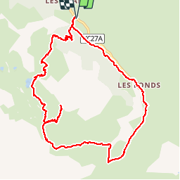
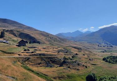
Trail Walking of 11.8 km to be discovered at Provence-Alpes-Côte d'Azur, Hautes-Alpes, Cervières. This trail is proposed by amiral13.

Description

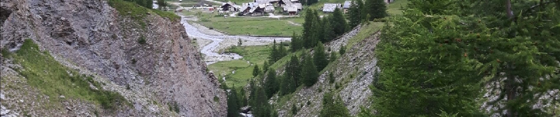
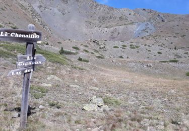
la montée s'effectue en sous-bois jusqu'au passage équipé d'un câble (utile uniquement pour les randonneurs non aguerris).
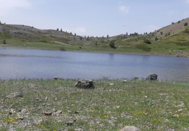
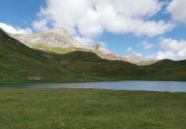
le sentier continu ensuite en alpage jusqu'au lac des cordes.
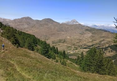
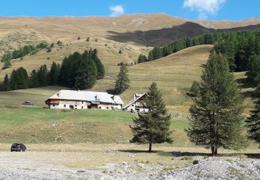
poursuivre en direction du col des marsailles en passant  à proximité du lac des Maits.
du col on partira en direction nord est vers un premier petit mamelon, puis vers un second plus important dont on contournera la crête rocheuses par l'ouest (pour les plus aguerris suivre la crête). revenir au col par le même itinéraire.

Elevation profile

Photos

Positioning

Country:
France
Region :
Provence-Alpes-Côte d'Azur
Department/Province :
Hautes-Alpes
Municipality :
Cervières
Location:
Unknown
Start:(UTM)
326235 ; 4969358 (32T) N.

Trails nearby

Trail Walking Cervières - Le Petit rochebrune par col de péas - Photo
Walking
GUIDE
amiral13

Walking

Difficult
Cervières, Provence-Alpes-Côte d'Azur, Hautes-Alpes, France
15.2 km | 31 km-effort
8h 8min
Yes
Trail Walking Cervières - le lasseron col de chaude maison  - Photo
Walking
Evenc

Walking

Difficult
Cervières, Provence-Alpes-Côte d'Azur, Hautes-Alpes, France
13.3 km | 28 km-effort
9h 54min
Yes
Trail Walking Cervières - Le Lac des cordes  - Photo
Walking
Sorriaux

Walking

Difficult
Cervières, Provence-Alpes-Côte d'Azur, Hautes-Alpes, France
10 km | 18.7 km-effort
3h 42min
No
Trail Walking Cervières - Le Grand Charvia - Photo
Walking
GuyVachet

Walking

Very difficult
Cervières, Provence-Alpes-Côte d'Azur, Hautes-Alpes, France
10.9 km | 21 km-effort
4h 43min
Yes
Trail Walking Cervières - Cervières - Photo
Walking
pensionisten71

Walking

Difficult
Cervières, Provence-Alpes-Côte d'Azur, Hautes-Alpes, France
7.7 km | 13.4 km-effort
3h 6min
Yes
Trail Walking Cervières - Arsem Les fonts de Cervieres - Photo
Walking
labarone

Walking

Medium
Cervières, Provence-Alpes-Côte d'Azur, Hautes-Alpes, France
13.4 km | 23 km-effort
5h 44min
No
Trail Winter toboggan Cervières - refuge Les Fonts à Chalp - Photo
Winter toboggan
jeff2

Winter toboggan

Difficult
Cervières, Provence-Alpes-Côte d'Azur, Hautes-Alpes, France
22 km | 35 km-effort
7h 1min
No
Trail Walking Cervières - cime saurel - Photo
Walking
gibello

Walking

Easy
Cervières, Provence-Alpes-Côte d'Azur, Hautes-Alpes, France
10.9 km | 18.1 km-effort
5h 5min
Yes
Trail Walking Cervières - Lac des Cordes - Photo
Walking
Jacques-WIRTH

Walking

Difficult
Cervières, Provence-Alpes-Côte d'Azur, Hautes-Alpes, France
3.2 km | 8.2 km-effort
1h 44min
No


Close
My subscriptions